Guestuser: Login or enrol?
- Home
- Main Display
- Main Display (Old)
- Find a Walk
- Display INTRODUCTION
- DONATE
- Click below for your
profile & contributions
guestuser- New
- Tracks, Walks
- Challenge
- Community
- Lists & Logs
- Popular Lists:
- County Highpoints
- Range & Area Highpoints
- Local 100
- Highest Hundred
- Vandeleur-Lynams
- Arderins
- Carns
- Best rated
- Irish 900 up
- Irish Island
- Munros
- All Lists
- Shorter Irish
- County Highpoints
- Range & Area Highpoints
- Highest Hundred
- Local 100
- Local 100 (pre2014)
- Local Historical Cultural
- Best rated
- Irish 900 up
- Larger Irish
- Arderins
- Arderin Begs
- Arderins + Arderin Begs
- Vandeleur-Lynams
- Vandeleur-Lynams + Arderins
- Carns
- Binnions
- Highest 50 per Province
- Island Features
- Irish Island
- Coastal Hills
- Irish 600 up
- Irish 500 up
- British
- Munros
- British 600 up
- British 500-600
- British Marilyns
- Comprehensive
- All Irish summits
- All Irish features
- All British summits
- All Britain+ Ireland
- Special
- Analysis List
- Simple Irish Listings
- Simple Irish & British Listings
-
- More
- Motley Views
Welcome to MountainViews
If you want to use the website often please enrol (quick and free) at top right.OverviewFor more map options click on any overview map area or any detail map feature.Detail Map FeaturesShowing 16 of a total of 29 items:
Galtymore 917.9m, Galtybeg 799.2m, Greenane West 787m, Cush 641.2m, Lough Curra Mound 600.4m, Knockastakeen 581.6m,Tracks:2796, 22km 2213, 20km 2070, 17km 2249, 17km 1978, 16km 3306, 15km 2076, 15km 2071, 15km 1530, 15km 1587, 14km Find Suggested Walks
Find hill, mountain, island, coastal feature.Videos
 Recent Contributions
 Get Notifications
Little Bin: Tough little climb
Meikle Bin: Long trek to summit
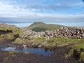
Letterettrin - a perspective on the N Connemara peaks
Cort-ma Law East Top: Do not climb in the rain !
Lecket Hill: Short trek to summit of around 2 Km from Crow road
Kilbrony Park Ramble
Great Knock: Short trek to summit
Brown Knowe: Straight forward track to the summit
Knocknakilton & Cummeen, Dingle Penninsula
Silvermines Hydro Project
Burren: Black Head Loop
Lamb Knowe: Short trek from Tods Knowe
Conditions and Info
Use of MountainViews is governed by conditions and a privacy policy.
Read general information about the site.
Opinions in material here are not necessarily endorsed by MountainViews.
Hillwalking is a risk sport. Information in comments, walks, shared GPS tracks or about starting places may not be accurate for example as regards safety or access permission. You are responsible for your safety and your permission to walk.
See the credits and list definitions.Video displayGalty Mountains Area Cen: Central Galtys SubareaPlace count in area: 24, OSI/LPS Maps: 66, 74, EW-G
Highest place: Galtymore, 917.9m
Maximum height for area: 917.9 metres, Maximum prominence for area: 820 metres,
Places in area Galty Mountains:
Cen: Central Galtys:Cush 641.2mGaltybeg 799.2mGaltymore 917.9mGreenane 801.3mGreenane West 787mKnockastakeen 581.6mKnockeenatoung 601.3mLough Curra Mound 600.4mSeefin 446.6mSeefin North Top 444.1m
E: East Galtys:Laghtshanaquilla 629.4mLaghtshanaquilla North-East Top 598mSlieveanard 437.8mSlieveanard NE Top 448.5mSturrakeen 541.7m
N: North Galtys:Slievenamuck 369m
W: West Galtys:Benard 479.5mCarrignabinnia 822.9mKnockaterriff 691.6mKnockaterriff Beg 679.3mLyracappul 824.9mMonabrack 630.1mSlievecushnabinnia 774.8mTemple Hill 783.1m
Note: this list of places includes island features such as summits, but not islands as such.
(Ir. Cois [OSI], 'side, flank') Tipperary County in Munster Province, in Arderin, Vandeleur-Lynam Lists, Conglomerate & purple sandstone Bedrock
Height: 641.2m OS 1:50k Mapsheet: 74 Grid Reference: R89435 26200
Place visited by 463 members. Recently by: Clionaodriscoll, maoris, Petecal423, Leatra, Josephineobrien, johnwaterford, Alatar78, patman1974, JoannaS, Aidan_Ennis, davidrenshaw, discovering_dann, MeabhTiernan, RosieMc, farmerjoe1I have visited this place: NO (You need to be a logged-in member to change this.)Longitude: -8.155897, Latitude: 52.387694 , Easting: 189436, Northing: 126200 Prominence: 176.16m, Isolation: 2.1km
ITM: 589387 626250 , GPS IDs, 6 char: Cush, 10 char: Cush
Bedrock type: Conglomerate & purple sandstone, (Slievenamuck Conglomerate Formation)
The name may well be a shortened form of Cois na Binne, which appears in several place-names in this area. This mountain is referred to as Binnia in 'The Mountains of Ireland' by Paddy Dillon. Cush is the 216th highest place in Ireland.
Linkback: https://mountainviews.ie/summit/215/COMMENTS for Cush (Cois) 1 2 3 Next page >>  Follow this place's comments
 Height layer: © MapTiler

MountainViews.ie, a Hill-walking Website for the island of Ireland. 2500 Summiteers, 1480 Contributors, maintainer of lists such as: Arderins, Vandeleur-Lynams, Highest Hundred, County Highpoints etc

 Fergalh
 Fergalh
 glencree
 Fergalh
 Fergalh
 Fergalh
 Fergalh
 Fergalh
 Visit our Facebook page.