This website uses cookies, which are small text files that the website puts on your device to facilitate operation. Cookies help us provide a better service to you. They are used to track general user traffic information and to help the website function properly.
Summits & other features in area North East Midlands: Cen: Ballyjamesduff: Aghalion Hill 249m Cen: Oldcastle: Mullaghmeen 258m, Slieve Na Calliagh 276m, Spire of Lloyd 131m, The Hill of Mael 241m E: Kingscourt: Carrickleck Hill 173m N Cen: Cavan Town: Shantemon 218m, Slieve Glah 320m, Tievenanass 261m NE: Ballybay: Bunnanimma 268m NE: Carrickmacross: Corduff 243m NE: Castleblaney: Mullyash Mountain 317m NE: Cen Bailieborough: Cornasaus 339m, Taghart South 290m NW Cen: Arva: Bruse Hill 260m NW: Aughavas: Lugganammer 190m S Cen: Crookedwood: Cruckboeltane 199m, Knockeyon 214m S: Westmeath South West: Knockastia 200m SE: Boyne Valley: Hill of Slane 160.4m, Mount Oriel 251m, Tara 155m W: Ardagh: Bawn Mountain 200m W: Drumlish: Corn Hill 278m
Note: this list of places may include island features such as summits, but not
islands as such.
Knockastia, 200mHill
Place Rating ..
, Westmeath County in Leinster province, in Binnion Lists, Knockastia is the 1400th highest place in Ireland. Knockastia is the most southerly summit in the North East Midlands area.
Grid Reference N24537 43380,
OS 1:50k mapsheet 48 Place visited by: 27members, recently by: Carolyn105, Bernieor, madfrankie, Johnnylayne, dregish, tonibm, abcd, finkey86, ceadeile, TommyMc, melohara, TommyV, moggy40, moggy40t, Lauranna
I visited this place: NO (You need to be a logged-in member for this.)
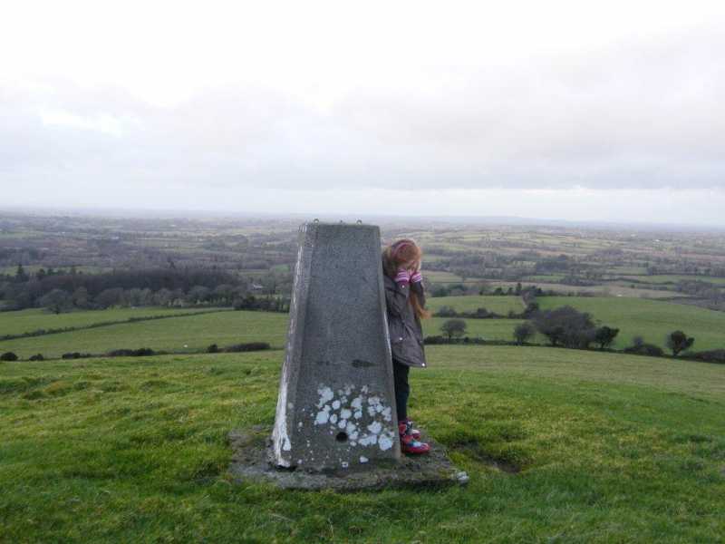
Followed Fergalh's excellent directions up to the top. Overgrown path may need trimming to get through in growing season. Took my 5yr old granddaughter along for the adventure but she got a little scared with the high winds at the top. Smiles afterwards however. Fine views all round. Linkback: mountainviews.ie/summit/1293/comment/15820/
Read Less
Read More
Behind quarry
by Fergalh
18 Feb 2019
At Moate take road to the pretty village of Rosemount. Drive through village and turn left around west side of mountain. At quarry there is a sign for site of old church (A (N24010 43352)) proceed up this overgrown path to the top cross through gap into field turn right and proceed to top than cross through gap in fence to field the promentary with trig pillar is clearly visible.
. Linkback: mountainviews.ie/summit/1293/comment/15809/
Read Less
Read More
Picture: Trig looking out on the Westmeath countyside.
Most central hill in Ireland??
by TommyV
5 Jul 2019
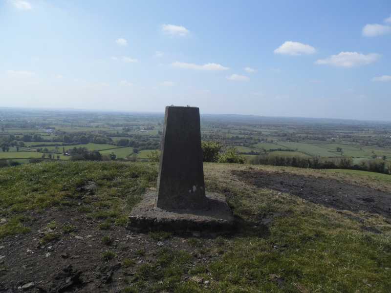
Heading North from the little village of Rosemount will bring you near this hill. I found parking beside an old abandoned house at B (N24222 42974) and proceeded to walk up a road which leads to a house where the owners of the land reside. They were out cutting the lawn and had no problems showing me the best way to access the hill through their land. 15 minutes later I was back at the car. It dawned on me that this must be the most central hill in Ireland and so possibly the best place to view the plains of the midlands. Linkback: mountainviews.ie/summit/1293/comment/20132/
Read Less
Read More
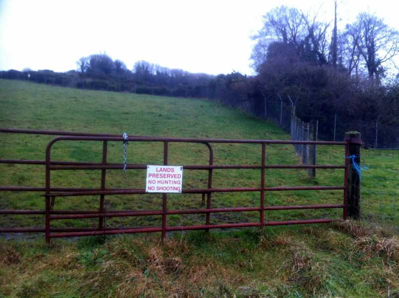
Picture: No hunting or shooting
Hunting and shooting forbidden
by ceadeile
17 Jan 2018
The path described by FergalH is now, January 2018, very overgrown. There are many thorn bushes in particular which make it a somewhat dangerous for your eyes. A simpler approach is to park at the disused quarry gate at C (N24035 43266) and walk 100m NW along the road to D (N23968 43330) where a double locked gate has a sign saying that hunting and shooting are forbidden. So, secure in the knowledge that you are unlikely to be hunted or shot, the well maintained field beyond the gate makes for pleasant underfoot conditions as you ascend to the top of the hill. If you keep close to the perimeter fence of the quarry and then follow the line of the stone wall uphill above the quarry you will come to another gate built into the stone wall. There are two strands of barbed wire to be negotiated then to access the field where the hilltop is located. Linkback: mountainviews.ie/summit/1293/comment/19843/
Use of MountainViews is governed by conditions and a privacy policy.
Read general information about the site. Opinions in material here are not necessarily endorsed by MountainViews.
Hillwalking is a risk sport. Information in comments, walks, shared GPS tracks or about starting places may
not be accurate for example as regards safety or access permission. You are responsible for your safety and your permission to walk.
See the credits and list definitions.


 Our Facebook page.