Overview

For more map options click on any overview map area or any detail map feature.
Detail Map Features
Find Suggested Walks
Find hill, mountain, island, coastal feature.
Videos
Recent Contributions
 Get Notifications
Get Notifications
Binbane: Steepish approach to relatively easy Carn.
 Collaborative entry
Walk on tracks above Glendalough
 ceadeile
Crucknaree: Magnificent views!
 paddyhillsbagger
Dunranhill: Sika deer and sitka spruce
 hibby
hibby
Circumnavigation of Tawny Rower
 glencree
Crocknasharragh: Impressive views on initial ascent.
 Colin Murphy
Near Church Mountain, Wicklow (Ireland)
Cunnigar: Short trek to summit
 Fergalh
Westtown Hill: Tramore's Highest Point
 DeirdreM
Keeloges-Aganny loop
 Colin Murphy
Knockbrinnea West Top: Eflanagan on the Knockbrinneas
 eflanaga
Great option for a day hike over Slieve Carr (inspired by Irish Peaks)
Conditions and Info
Use of MountainViews is governed by conditions and a privacy policy.
Read general information about the site.
Opinions in material here are not necessarily endorsed by MountainViews.
Hillwalking is a risk sport. Information in comments, walks, shared GPS tracks or about starting places may not be accurate for example as regards safety or access permission. You are responsible for your safety and your permission to walk.
See the credits and list definitions.
 Visit our Facebook page.
Video display
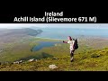
Achill & Corraun
Area N: Slievemore Subarea
Place count in area: 16,
OSI/LPS Maps: 22, 30, CBW, EW-ACC, EW-ACC
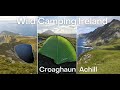
Highest place: Croaghaun, 688m
Maximum height for area: 688 metres,
Maximum prominence for area: 688 metres,
Places in area Achill & Corraun:
Cen: Minaun:Minaun (Achill Island) 466m
N: Slievemore:Krinnuck (Achill Island) 214mSlievemore (Achill Island) 671m
NW: Croaghaun:Benmore (Achill Island) 332mCornaclea Hill (Achill Island) 269mCroaghaun (Achill Island) 688mCroaghaun SW Top (Achill Island) 664m
S: Knockmore Achill:Achillbeg Island N Top (Achillbeg Island) 109.7mAchillbeg Island S Top (Achillbeg Island) 108.5mKnockmore (Achill Island) 337mTievereivagh (Achill Island) 286m
SE: Corraun:Knocklettragh 452mCorraun Hill 524mCorraun Hill Highpoint 541m
SW: Clare Island:Knockmore (Clare Island) 462mKnocknaveen (Clare Island) 223m
Note: this list of places includes island features such as summits, but not islands as such.
Highest place:
Croaghaun, 688mPlaces in area Achill & Corraun:
Cen: Minaun:
Minaun (Achill Island) 466mN: Slievemore:
Krinnuck (Achill Island) 214mSlievemore (Achill Island) 671mNW: Croaghaun:
Benmore (Achill Island) 332mCornaclea Hill (Achill Island) 269mCroaghaun (Achill Island) 688mCroaghaun SW Top (Achill Island) 664mS: Knockmore Achill:
Achillbeg Island N Top (Achillbeg Island) 109.7mAchillbeg Island S Top (Achillbeg Island) 108.5mKnockmore (Achill Island) 337mTievereivagh (Achill Island) 286mSE: Corraun:
Knocklettragh 452mCorraun Hill 524mCorraun Hill Highpoint 541mSW: Clare Island:
Knockmore (Clare Island) 462mKnocknaveen (Clare Island) 223mNote: this list of places includes island features such as summits, but not islands as such.

Reachable "On Foot " Y
Bedrock type: Banded psammitic and pelitic schists., (Ridge Point Psammitic Formation)
This hill is unnamed on OS maps but is mentioned in the Co. Mayo Development Plan as Doogort Hill. However, a local bi-lingual walking guide names as Cruinneoc (which has here been standardised to Cruinneog), a wonderfully descriptive name for this little round hill. The round shape is very evident from the pattern of concentric oval-shaped contours on the map. The anglicised form Krinnuck is found on William Bald's map of Mayo (1830). This is a good example of how easily local names can be lost and are sometimes unknown even to local authorities in whose area they are located. For a walk around the base of Krinnuck, see Siúlóidí Acla, walk F. Krinnuck is the 1376th highest place in Ireland. Krinnuck is the second most northerly summit in the Achill & Corraun area.
Linkback: https://mountainviews.ie/summit/1032/
COMMENTS for Krinnuck (Cruinneog) 1 2 Next page >>  Follow this place's comments

|
|
|
|
||
| MountainViews.ie, a Hill-walking Website for the island of Ireland. 2400 Summiteers, 1480 Contributors, maintainer of lists: Arderins, Vandeleur-Lynams, Highest Hundred, County Highpoints etc | |||