Members and Supporters, the MountainViews Committee requests your help to meet the costs of the website and of other activities such as insured events or publications.
glencree: Track/5069 in area near Sheeffry Hills (Ireland)
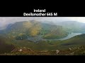
Circumnavigation of Tawny Rower
Ascent: 424m,
Length: 11.7km,
Creator time taken: 4h 5m
Descent: 425m,
Time predicted from Naismith's rule: 3h 3m + breaks
Click here to rate track
PlacesStart at Tawnycrower (TCrower) L91984 69718, end at Start
Track Rating ..
[RWD version 1 ]
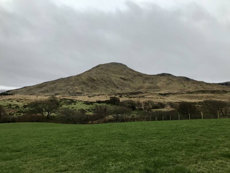
This is a walk on the Western Way that circumnavigates Tawny Rower. By the standards of the long distance walking routes, the going is steep and rough for the initial off-road section. The Western Way walking markers are excellent, with the next marker usually visible even without perfect visibility. The road slog back is enlivened with good views of the hills. A short diversion at the highest point would enable the summit to be bagged but on a foggy day we stuck with the marked trail.
Tawny Rower mountain
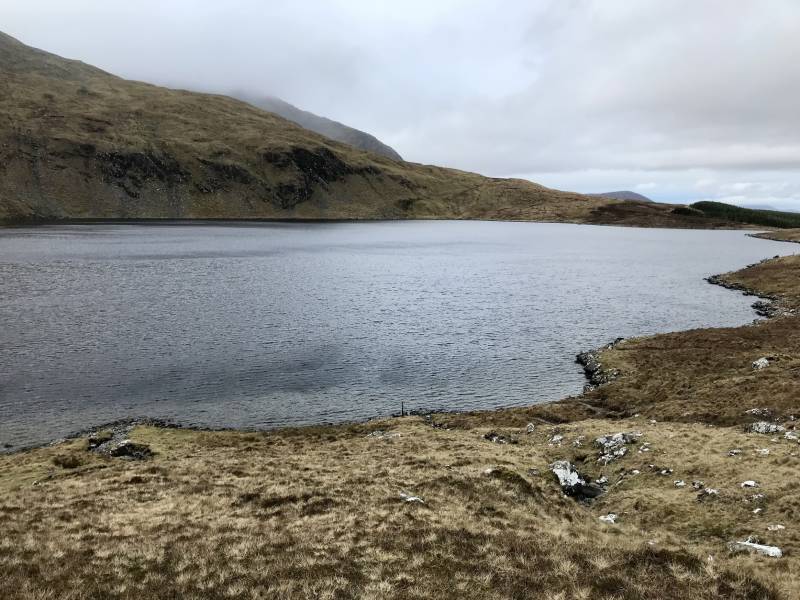
Lough Logachullaway/Shanvally Lake
Editing Details for track/5069
NOTE: ALL information such as Ascent, Length and Creator time taken etc should be regarded as approximate. The creator's comments are opinions and may not be accurate or still correct.
Your time to complete will depend on the speed of the slowest plus break time and your mode of transport.
NOTE: It is up to you to ensure that your route is appropriate for you and your party to follow bearing in mind all factors such as safety, weather conditions, experience and access permission.
Uploaded on: Sun, 14 Apr 2024 (08:07:28), Linkback: https://mountainviews.ie/track/5069/
* Note: A GPS Height in the elevation profile is sourced from the device that recorded the track. An "SRTM" height is derived from a model of elevations for parts of the earth. More detail
Use of MountainViews is governed by conditions and a privacy policy.
Read general information about the site. Opinions in material here are not necessarily endorsed by MountainViews.
Hillwalking is a risk sport. Information in comments, walks, shared GPS tracks or about starting places may
not be accurate for example as regards safety or access permission. You are responsible for your safety and your permission to walk.
See the credits and list definitions.


 Our Facebook page.