Members and Supporters, the MountainViews Committee requests your help to meet the costs of the website and of other activities such as insured events or publications.
Colin Murphy: Track/5064 in area near Keeloges, Dartry Mountains (Ireland)
Keeloges-Aganny loop
Ascent: 652m,
Length: 14.7km,
Creator time taken: 5h26m
Descent: 652m,
Time predicted from Naismith's rule: 4h 1m + breaks
Click here to rate track
PlacesStart at G80258 50164, Keeloges, Aganny Top, end at Start
Track Rating ..
[RWD version 1 ]
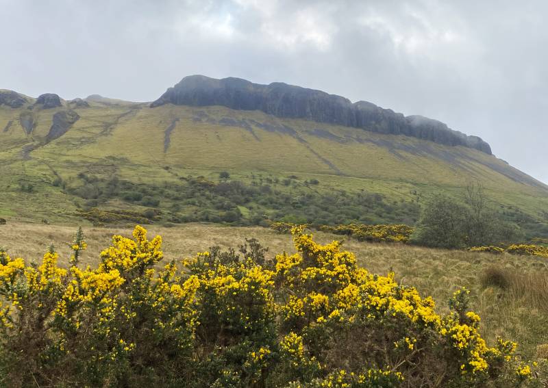
A pretty demanding loop walk taking in two Carns. Parked outside Glanade Church (multiple spaces) and walked 250m south to a gate on the left, (just before the road sign reading ‘Concealed Junction Ahead’). Crossed the gate and followed the grassy trail made by tractors/quads and it rises gently up hill, the impressive cliffs on Keeloges’ west side towering above you.
The impressive western face
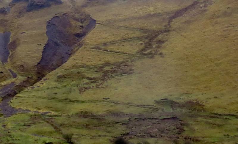
At one point I heard a buzzing behind me and turned to see a farmer in his 70s approaching on a quad, and was fearful he was coming up to remonstrate with me for crossing his field, but he turned out to be extremely friendly, had no issue with me walking and then for 15 minutes we chatted about the geology of the area, the effect of the recent rainfall on farmers and various other matters. The faint grassy trail began to vanish, but up ahead I could see the zig-zag trail that takes you most of the way up the steepest section.
The distinct zigzag track.
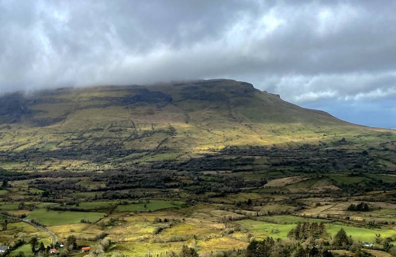
Having ascended this, I turned north for a couple of hundred metres, passing a small lough, to reach the grassy bump that marks the high point. Great views across Glenade Valley.
Tievbaun from Keeloges
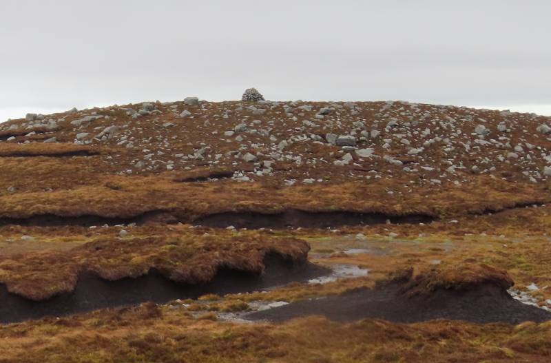
Conscious that I was just 2 metres from a precipitous drop, and given that the howling wind was doing its best to drive me over the edge, I didn’t linger long, but turned SE and began the long trek towards Aganny Top, skirting the unlisted Aghlasteeve. Mostly the ground was firm, grassy, a bit of heather, some rocky outcrops, and navigable, but one section was particularly boggy to the west of Aganny, forcing me to detour a little up towards the small Arroo Lough, and then turn SE for 2km to reach Aganny, which is marked by a large cairn.
Aganny Top cairn
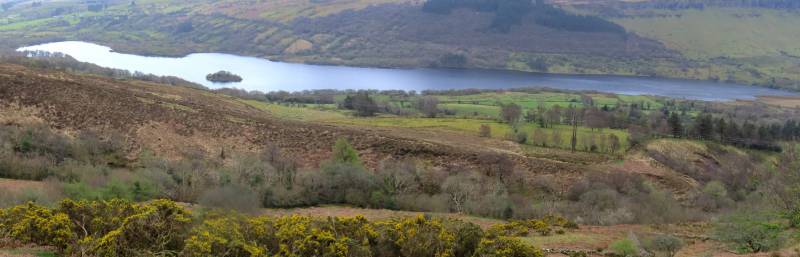
To avoid retracing my steps over the rough ground, I then headed SW for 1.5km, descending through long heather, and then picking up a good track that skirts the east and south of Aghlateeve, providing great views of Glenade Lough, which led me back to the road.
Glenade Lough
Unfortunately I then had long road walk of 3.5km back to the car, but it was better than having to plough back across the hills. A tough but rewarding day with great views, despite some misty conditions.
Editing Details for track/5064
NOTE: ALL information such as Ascent, Length and Creator time taken etc should be regarded as approximate. The creator's comments are opinions and may not be accurate or still correct.
Your time to complete will depend on the speed of the slowest plus break time and your mode of transport.
NOTE: It is up to you to ensure that your route is appropriate for you and your party to follow bearing in mind all factors such as safety, weather conditions, experience and access permission.
Uploaded on: Fri, 12 Apr 2024 (11:31:30), Linkback: https://mountainviews.ie/track/5064/
* Note: A GPS Height in the elevation profile is sourced from the device that recorded the track. An "SRTM" height is derived from a model of elevations for parts of the earth. More detail
Use of MountainViews is governed by conditions and a privacy policy.
Read general information about the site. Opinions in material here are not necessarily endorsed by MountainViews.
Hillwalking is a risk sport. Information in comments, walks, shared GPS tracks or about starting places may
not be accurate for example as regards safety or access permission. You are responsible for your safety and your permission to walk.
See the credits and list definitions.


 Our Facebook page.