Donation Request 2024
You do not have to be logged in to donate.
DONATE
Members and Supporters, the MountainViews Committee requests your help to meet the costs of the website and of other activities such as insured events or publications.You do not have to be logged in to donate.
Welcome to MountainViews
If you want to use the website often please enrol (quick and free) at top right.
If you want to use the website often please enrol (quick and free) at top right.
Overview

For more map options click on any overview map area or any detail map feature.
Detail Map Features
Find Suggested Walks
Find hill, mountain, island, coastal feature.
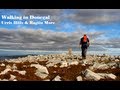
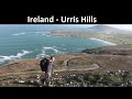
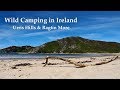
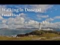
Videos
Recent Contributions
 Get Notifications
Get Notifications
Lake District: Dale Head Horseshoe
Crocknasharragh: Impressive views on nitial ascent.
 Colin Murphy
Crocknasharragh: Fine views on ascent
 Colin Murphy
Lake District: Coledale Horseshoe
Cunnigar: Short trek to summit
 Fergalh
Longish walk to isolated top
 Colin Murphy
Westtown Hill: Tramore's Highest Point
 DeirdreM
Knockbrinnea West Top: Eflanagan on the Knockbrinneas
 eflanaga
Ascending the Knockbrinneas from the north.
 simon3
Knockbrinnea West Top: Larger Twin
 Collaborative entry
Lobawn Loop - Clockwise avoids any steep ascent! Easy stream crossing.
Knockaunanattin West Top: Views, loughs and a navigational aid.
 simon3
Conditions and Info
Use of MountainViews is governed by conditions and a privacy policy.
Read general information about the site.
Opinions in material here are not necessarily endorsed by MountainViews.
Hillwalking is a risk sport. Information in comments, walks, shared GPS tracks or about starting places may not be accurate for example as regards safety or access permission. You are responsible for your safety and your permission to walk.
See the credits and list definitions.
 Visit our Facebook page.
Video display
Inishowen
Area NW: Urris Subarea
Place count in area: 27,
OSI/LPS Maps: 2, 3, 4, 6, 7
Highest place: Slieve Snaght, 614.6m
Maximum height for area: 614.6 metres,
Maximum prominence for area: 600 metres,
Places in area Inishowen:
Cen: Slieve Snaght:Damph 420mSlieve Main 514mSlieve Snaght 614.6m
N: Malin:Croaghglengad 259mCrockalough 282mSoldiers hill 174m
NE: North East Inishowen:Crockavishane 322mCrocknasmug 327.5mGrinlieve 371m
NW: Urris:Binnion 250mBulbin 494mCoolcross Hill 291mCroaghcarragh 400mCrockmain 460mDunaff Hill 230mMamore Hill 423mRaghtin More 502mSlievekeeragh 389mUrris Hills 417m
S: Iskaheen:Crockglass 397mEskaheen Mountain 418mGreenan Mountain 241mHolywell Hill 260mInch Top 222mLeamacrossan Hill 392mMouldy Hill 312mScalp Mountain 484m
Note: this list of places includes island features such as summits, but not islands as such.
Highest place:
Slieve Snaght, 614.6mPlaces in area Inishowen:
Cen: Slieve Snaght:
Damph 420mSlieve Main 514mSlieve Snaght 614.6mN: Malin:
Croaghglengad 259mCrockalough 282mSoldiers hill 174mNE: North East Inishowen:
Crockavishane 322mCrocknasmug 327.5mGrinlieve 371mNW: Urris:
Binnion 250mBulbin 494mCoolcross Hill 291mCroaghcarragh 400mCrockmain 460mDunaff Hill 230mMamore Hill 423mRaghtin More 502mSlievekeeragh 389mUrris Hills 417mS: Iskaheen:
Crockglass 397mEskaheen Mountain 418mGreenan Mountain 241mHolywell Hill 260mInch Top 222mLeamacrossan Hill 392mMouldy Hill 312mScalp Mountain 484mNote: this list of places includes island features such as summits, but not islands as such.

Bedrock type: Banded semi-pelitic & psammitic schist, (Termon Formation)
Overlooks Trawbreaga Bay and Doagh Island Coolcross Hill is the 1182th highest place in Ireland.
Linkback: https://mountainviews.ie/summit/964/
COMMENTS for Coolcross Hill 1 of 1  Follow this place's comments

|
|
|
|
||
| MountainViews.ie, a Hill-walking Website for the island of Ireland. 2400 Summiteers, 1480 Contributors, maintainer of lists: Arderins, Vandeleur-Lynams, Highest Hundred, County Highpoints etc | |||