This website uses cookies, which are small text files that the website puts on your device to facilitate operation. Cookies help us provide a better service to you. They are used to track general user traffic information and to help the website function properly.
Feature count in area: 15, all in Kerry,
OSI/LPS Maps: 70, EW-DC, EW-DW
Highest Place: Brandon 951.7m
Starting Places (18) in area Brandon Group: Ballinloghig, Ballybrack Mid, Brandon Pilgrimage Trail, Brandon Point, Brandon Village, Cloghane Community Centre, Conor Pass, Coosavuddig Quay Brandon Creek, Faha, Feoghanagh River, Hostel Cloghane Village, Lough Camclaun, Lough Doon CP, Mullaghveal Farm, Pedlars Lodge, Pilgrimage Trail Owenmore River, Sauce Creek Walkway Dingle Way, Tiduff
Summits & other features in area Brandon Group: Cen: Faha Ridge: Benagh 822.5m, Faha Ridge 809.2m N: Brandon Point: Faill an tSáis 430.7m N: Brandon Ridge North: Brandon Far North Top 840.1m, Brandon North Top 895.4m, Masatiompan 761.9m, Pierasmore North Top 700m, Pierasmore 745.7m S: Ballysitteragh: An Bhinn Dubh 479.2m, Ballysitteragh 623m, Beennabrack 608.5m S: Brandon Ridge South: Gearhane 803m, Brandon Peak 840m, Brandon 951.7m, Brandon South Top 790m
Note: this list of places may include island features such as summits, but not
islands as such.
Brandon South Top, 790mMountain Faill na nDeamhan A name in Irish,
Place Rating ..
(Ir. Faill na nDeamhan [TCCD], 'cliff of the demons'), Binn Ard, Kerry County in Munster province, in Arderin Beg, Vandeleur-Lynam, Irish Best Hundred Lists, Faill na nDeamhan is the 52nd highest place in Ireland.
Grid Reference Q46836 10704,
OS 1:50k mapsheet 70 Place visited by: 343members, recently by: maryblewitt, Dee68, Marykerry, MeabhTiernan, kelleher, rhw, abeach, maoris, Carolineswalsh, NualaB, ToughSoles, Jai-mckinney, Carolyn105, SmirkyQuill, osullivanm
I visited this place: NO (You need to be a logged-in member for this.)
Longitude: -10.242326, Latitude: 52.227238, Easting: 46836, Northing: 110704,
Prominence: 25m, Isolation: 1.2km ITM: 446819 610757 Bedrock type: Rhythmically bedded sandstone, (Ballymore Sandstone Formation) Notes on name: Máire MacNeill comments on the place-names around Brandon as follows: From An Seabhac's compendium of the place-names of the district we learn that several places on the mountain have names suggestive of myths which recur at other Lughnasa sites, e.g. Macha an Mhíl (the Beast's Pasture), Faill na nDeamhan (the Demons' Cliff), Com na Caillighe (the Hag's Recess), Loch na Mná (the Woman's Lake), Cnoc an Tairbh (the Bull's Hill), etc. [MacNeill, The festival of Lughnasa, 105] Faill na nDeamhan on Brandon is paralled by Log na nDeamhan (Lugnademon) on Croagh Patrick.
Short or GPS IDs, 6 char: BrndSt, 10 char: BrndnSthTp Linkback: https://mountainviews.ie/summit/49/
Gallery for Brandon South Top (Faill na nDeamhan) and surrounds
Summary
for Brandon South Top (Faill na nDeamhan):
Waypoint on the Main Brandon Ridge
Summary created by Onzy
2015-04-28 20:37:16
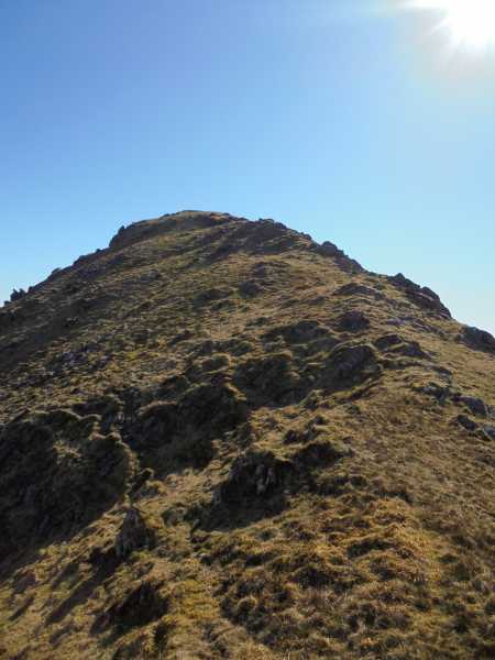
Picture: Final ascent
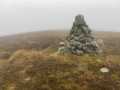
Brandon South Top is a mere notch on the main Brandon Ridge which is extremely unlikely to be climbed on its own and will be more usually visited as part of a walk taking in the ridge and a number of other summits, normally including Brandon itself, Brandon Peak and Gearhane, but possibly being extended north of Brandon as far as Masatiompan.
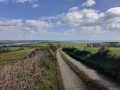
There are many routes onto the Brandon massif; the main starting points are, Ballybrack BrDon PilTr (Q434 094) at the bottom of the Saint's Road leading direct to Brandon and where there is a particularly large car park (often full), Ballyknockane Tiduff (Q434 126) B, at the bottom of the Dingle Way which leads east from here to the col between Masatiompan and Piaras Mor, and Cloghane Faha (Q494 120) C, from where you have have the choice of a path into the coom northeast of Brandon summit, or a higher route over the Faha Ridge.
Once Brandon is reached, the South Top is but a step away along the ridge.
A number of routes from the south are also possible. For a great (and long) day out which would necessitate a second car (or a tent), you could start at the Connor Pass, taking in a number of other summits, Beendubh, Beennabrack, Ballysitteragh Gearhane and Brandon Peak, before reaching the South Top. A further start could be made from Ballinloghig, from around A (Q425 077) D, though parking could be difficult, over spot height 404 and onto the ridge at Gearhane.
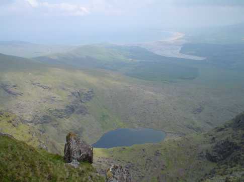
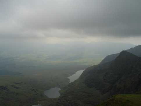
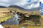
Lough Nalacken as seen from Brandon Mtn South Top .
Cloghane is at the end of the inlet with the grotto at Faha under the start of the ridge on the left side of the photo. A trail marked with yellow arrows pointed the way in June 2004 to the climb up Mount Brandon from Loch Chom an Chnoic. Linkback: mountainviews.ie/summit/49/comment/1102/
Read Less
Read More
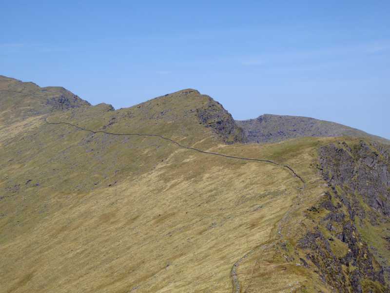
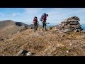
Picture: One of the country's best A Begs
Steep approach from south
by Colin Murphy
16 May 2016
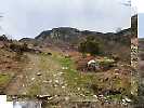
Approaching from the north, this is a doddle. But 15m prominence it may have, yet when you approach from the south the mountain is a pretty steep order, in every sense. Having dropped down from Brandon Peak to the col at B (Q470 104), you then have a 100m ascent to the summit in a NNW direction - it is very steep in parts. The scenery is stunning all round, and that serves as a pleasant distraction. The top is quite well defined. If you are returning to the south, it is not necessary to go back across Brandon Peak. Instead pick up a narrow, but well-defined track near the above grid ref, which skirts most of Brandon Peak and rises gently up to 760m, before it disappears just shy of Gearhane summit. Linkback: mountainviews.ie/summit/49/comment/18531/
Read Less
Read More
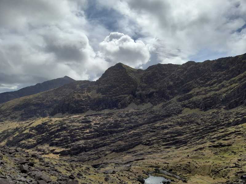
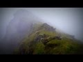
Picture: Formidable north east face of Brandon South Top
A worthy subsidiary
by Bunsen7
21 Apr 2022
The uninitiated can be forgiven for mistaking the south top for the main top on the initial approach to Brandon from Faha Grotto along the pilgrim path. As the path snakes around the Faha ridge, the south top is on the walker's left as they approach the head of the coum from where the "eisc" ferries the walker to the ridge line.
BrandonMountain South Top in the foreground on the extreme left as seen coming down the ridge from Mount Brandon going towards Brandon Peak. The Mountains of Central Dingle are in the background Stradbally Mountain,Beenoskee,An Com Ban, Binn an Tuair Linkback: mountainviews.ie/summit/49/comment/1101/
Use of MountainViews is governed by conditions and a privacy policy.
Read general information about the site. Opinions in material here are not necessarily endorsed by MountainViews.
Hillwalking is a risk sport. Information in comments, walks, shared GPS tracks or about starting places may
not be accurate for example as regards safety or access permission. You are responsible for your safety and your permission to walk.
See the credits and list definitions.


 Our Facebook page.