This website uses cookies, which are small text files that the website puts on your device to facilitate operation. Cookies help us provide a better service to you. They are used to track general user traffic information and to help the website function properly.
Blackstairs MountainsArea, N: Blackstairs North
Subarea
Feature count in area: 13, by county: Wexford: 10, Carlow: 6, of which 3 are in both Carlow and Wexford,
OSI/LPS Maps: 68, EW-B, EW-B
Highest Place: Mount Leinster 794.4m
Starting Places (20) in area Blackstairs Mountains: Ballybawn Lane, Ballybeg Forest Road, Ballygibbon Lane, Ballyglisheen, Ballyvocran Cross, Bog Road L30072, Coonoge Cross Layby, Crooked Bridge, Glynn, Kilbrannish Forest Recreation CP, Mandoran Lane, R746 Half Way House, Raheenkyle, Rathanna Bridge, Sculloge Gap CP, Shannons Lane Sculloge, The Nine Stones CP, Urrin River Mid Rise, Urrin River Zig Zag, Urrin Road
Summits & other features in area Blackstairs Mountains: N: Blackstairs North: Black Rock Mountain 599.6m, Croaghaun 455.5m, Greenoge 425m, Knockmore 228m, Knockroe 538.8m, Mount Leinster 794.4m, Mount Leinster East Top 656.5m, Slievebawn 524.8m S: Blackstairs South: Blackstairs Mountain 732.1m, Carrigalachan 463m, Carrigroe 495m, White Mountain 509m, Slievebaun 441.8m
Note: this list of places may include island features such as summits, but not
islands as such.
Mount Leinster, 794.4mMountain Stua Laighean A name in Irish,
Place Rating ..
(Ir. Stua Laighean [OSI], 'prince or warrior of Leinster'), Suidhe Laighean County Highpoint of Carlow & Wexford and in Carlow/ Wexford counties in Leinster province, in County Highpoint, Arderin, Vandeleur-Lynam, Irish Highest Hundred Lists, Mount Leinster is the highest mountain in the Blackstairs Mountains area and the 47th highest in Ireland. Mount Leinster is the highest point in county Carlow and also the highest in Wexford.
Grid Reference S82656 52533,
OS 1:50k mapsheet 68 Place visited by: 833members, recently by: sineadh, jjbireland700s, patman1974, tonibm, Macros42, oreills8, adgrenna, Aidan_Ennis, djay281, AnthonyJ, ciarraioch, DarrenY, claireod5, dodser, Glengirl
I visited this place: NO (You need to be a logged-in member for this.)
Longitude: -6.780362, Latitude: 52.618157, Easting: 282656, Northing: 152534,
Prominence: 706.4m, Isolation: 1.8km, Has trig pillar
ITM: 682587 652578 Bedrock type: Pale, fine to coarse-grained granite, (Blackstones Type 2 Equigranular Granite) Notes on name: Mount Leinster is not the highest peak in the province of Leinster. That distinction belongs to Lugnaquillia, but Mount Leinster is the highest outside Wicklow. Due to the transmitter mast, there is a road to the top. There is also a substantial cairn on summit. On the saddle connecting to Slievebawn is a stone alignment called the Nine Stones (though there are actually ten). The Irish name Stua Laighean reflects the imagined personification of this noble peak as a prince or warrior standing in protection over the inhabitants of the plains below.
Short or GPS IDs, 6 char: MntLns, 10 char: MntLnstr Linkback: https://mountainviews.ie/summit/44/
Gallery for Mount Leinster (Stua Laighean) and surrounds
Summary
for Mount Leinster (Stua Laighean):
Prominent county highpoint - a boggy steep mountain with panoramic views
Summary created by markmjcampion, Peter Walker, Onzy
19 Dec, 2022
Picture: Mount Leinster from Slievebawn
Mount Leinster, a steep-sided flat-top, is the highest point of both Carlow and Wexford and sits just N of the Blackstairs. Unusually for such a big hill, there is a service road running all the way to the summit from where there are extensive views over the S Wicklow hills, Blackstairs and further afield to Brandon Hill and Slievenamon. Apart from the service road, all approaches can be v boggy after a wet spell.
N. Park at 9 Stones (S81746 54610) and follow the service road - the easiest and most popular walking route to the top. The road begins at a viewing point on the South Leinster Way at a height of some 400m, leaving a climb of around another 400m. Walk up the road to the south, a distance of 2.25k to the summit. 1hr+ return
E. Start at Ballycrystal where there is room for a few cars around Urin Rd (S86025 50665). Go up the track between the forestry plantations. Head for the summit of Black Rock and then west over Mount Leinster E Top and onto the main top. A return trip is c. 4 hours. Some parking is also available at Urin Rise (S84285 51609) which provides a short, but steep ascent directly to the summit or an alternative point for a 2nd car.
SW. Access from Rathanna Bridge appears to be denied at the moment.
S. A longer approach is possible from the Scullogue Gap, starting at Shan Ln (S82428 47894), N to Knockroe and over to Mt. L. 2hrs+
Notable tracks incl track/4577, track/4658 and the long linear track/3778
Add a Place Comment for Mount Leinster, Stua Laighean (44) in Area: Blackstairs Mountains, N: Blackstairs North, County: Carlow/ Wexford, N: Blackstairs North
Member Comments for
Mount Leinster (Stua Laighean)
Although the ascent starts at 400m, I was worried about the long distance to the summit (1.75 miles). What if I got lost?? I was tempted to drive up the private road, as the gate was open, but thought better of it. The ascent of the tarmac road in the forest went fine with my fears of a bear leaping out of the woods unfounded. However, after a tricky crossing of the cattle grid, I had major problems seeing the way forward. In the clear and cloudless skies, the sun was shining straight into my face, making progress difficult. After a few minutes of shielding my eyes with my arm I had to give up since it was getting cramp. I struggled on as best I could given the conditions. Soon however, I was again having trouble seeing the way forward. Sweat was dripping off my forehead and blinding me. Oh for a cloud to shield me from the sun! I managed not to get lost, since the edges of the tarmac road are pretty clear to follow. The rest of the ascent was tortuous. with a nice angle of tarmac road and excellent footing, I was forced to walk near VOx Max pace, breathing hard. As I thought I was near my physical limit and feeling far from the car (well over 1.5 miles by now) a welcome breeze arose and cleared the sweat from my face. I noted frost on the side of the road and wondered about the folly of not having crampons with me. Luckily the short stretch of frozen turf and puddles to the cairn only took about 30 seconds, so the risk wasn't unduly high. I was there! The advenurous committment to continuing in spite of hardship was rewarded with grand views! Watching the workmen haul a big cable up the tower added to the summit activities. I spent a long 5 minutes enjoying the view, not bad after the 30 minutes it thad taken for the ascent. Then there was nothing else but the very long plod down the tarmac road, back at the car in 25 minutes. The final treat was watching the hang gliders coming in to land. (13 Nov 04) Linkback: mountainviews.ie/summit/44/comment/1329/
Read Less
Read More
Picture: Near the summit of Mt Leinster
- from the 9 stones
by paddyobpc
25 Jan 2017
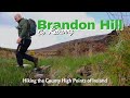
Walk Date: 3 Jul 2016. Nice weather to continue our County High Point Challenge, heading east this time to climb Mt. Leinster, the highest point of Carlow and Wexford. Dillon(dillonkdy) and myself used the recommended route up the Transmitter road starting at an area known as “The 9 stones”. Even from the start the views were unbelievable on a very sunny day. We climbed almost 350m and taking our time stopping regularly to take in the views we were back to the car shortly after 1.5 Hrs. Off to Brandon hill next.
We returned to climb Mt. Leinster for an easy 17 points for gribboneer-of-the-year http://www.highpointireland.com/gribboneer-of-the-year.html on the 27 Dec 2016. This time a lovely frosty morning gave way to a beautiful red sky as the sun came up. Starting before 8am we were at the trig point, photo taken and back to the car in just over an hour.
See Dillon’s (dillonkdy) full story of his County High Point Challenge at https://dillons32chpchallenge.github.io/progress/index.html We also found Kieron Gribbon's High Point Ireland website (www.highpointireland.com) to be a useful source of information for our 32 County High Points challenge. Definitely worth checking out if you're planning to do any of the High Point challenges Linkback: mountainviews.ie/summit/44/comment/18821/
Read Less
Read More
black rock mountain from ballycrystal
by Kennyj
25 Dec 2014
Climbed to mount Leinster summit yesterday following route described by Djouce here,good visibility and quite an easy climb, took me 40 mins from start to the barn on the ridge,I took the track over to Black rock mountain and retraced my steps and headed for the masts at mount Leinster,the track is quite good and easy to follow.Couple of points worth mentioning, the track just west of the parking spot is blocked in two places by falling trees necessitating a detour into the forest and back onto the track, the end of this track is very muddy following cattle but is easily negotiated.On the mention of cattle I met them half way up the track where I had a brief stand off with a young bull, didn't notice the ring in his nose until I got close, thankfully he decided to give way and rejoin his herd.I didn't notice any signs warning of a bull, just wondering is this a regular occurance up here.I returned the same way I went up took me a couple of hours from start to finish. Linkback: mountainviews.ie/summit/44/comment/17771/
Read Less
Read More
Picture: My picture is one of the fantastic views of the sun spliting through the clouds into the countryside
paganji on Mount Leinster
by paganji
3 Dec 2005
The day felt sour, I was indoors for too long, so I put my Boots on. After a brief drive I was at the foot of The Blackstairs and gazed upward toward the faint clouds sweep eerily over the summit of Mt Leinster. To my suprise the ground was firm and the humidity felt fresh. I was determined and just over an hour later I made it to the top and into the ever thickening cloud. Looking down the eastern slopes I could see darkness in the mists, as the heavy mountain was casting its shadow into Wexford. Now I had made something of my day. I went home, Rejuvenated. Linkback: mountainviews.ie/summit/44/comment/2071/
Read Less
Read More
Picture: North west from cottage
djouce on Mount Leinster
by djouce
25 Mar 2008
The Ballycrystal valley provides another way up Mount Leinster. There are parking spaces at Urin Rd (S860 506). Go up the track between the forestry plantations. Head for the summit of Black Rock A (S861 525). Follow the ridge NW past a ruined cottage on the col. Why is it there? Continue westwards over the east top to the summit. I'm told there are great views on a clear day. Follow the ridge down in a southerly direction and descend to the valley. Return to the car on the road (or park another car in the woods at the end of the road Urin Rise (S843 516)) Time taken about 4 hours excluding long breaks. Linkback: mountainviews.ie/summit/44/comment/3018/
Use of MountainViews is governed by conditions and a privacy policy.
Read general information about the site. Opinions in material here are not necessarily endorsed by MountainViews.
Hillwalking is a risk sport. Information in comments, walks, shared GPS tracks or about starting places may
not be accurate for example as regards safety or access permission. You are responsible for your safety and your permission to walk.
See the credits and list definitions.


 Add a Place Comment for Mount Leinster, Stua Laighean


 Our Facebook page.