Guestuser: Login or enrol?
- Home
- Main Display
- Main Display (Old)
- Find a Walk
- Display INTRODUCTION
- DONATE
- Click below for your
profile & contributions
guestuser- New
- Tracks, Walks
- Challenge
- Community
- Lists & Logs
- Popular Lists:
- County Highpoints
- Range & Area Highpoints
- Local 100
- Highest Hundred
- Vandeleur-Lynams
- Arderins
- Carns
- Best rated
- Irish 900 up
- Irish Island
- Munros
- All Lists
- Shorter Irish
- County Highpoints
- Range & Area Highpoints
- Highest Hundred
- Local 100
- Local 100 (pre2014)
- Local Historical Cultural
- Best rated
- Irish 900 up
- Larger Irish
- Arderins
- Arderin Begs
- Arderins + Arderin Begs
- Vandeleur-Lynams
- Vandeleur-Lynams + Arderins
- Carns
- Binnions
- Highest 50 per Province
- Island Features
- Irish Island
- Coastal Hills
- Irish 600 up
- Irish 500 up
- British
- Munros
- British 600 up
- British 500-600
- British Marilyns
- Comprehensive
- All Irish summits
- All Irish features
- All British summits
- All Britain+ Ireland
- Special
- Analysis List
- Simple Irish Listings
- Simple Irish & British Listings
-
- More
- Motley Views
Welcome to MountainViews
If you want to use the website often please enrol (quick and free) at top right.OverviewFor more map options click on any overview map area or any detail map feature.Detail Map FeaturesFind Suggested Walks
Find hill, mountain, island, coastal feature.Videos
Recent Contributions
 Get Notifications
Lake District: Grasmere Round
Meikle Bin: Long trek to summit
Lake District: Langdale South
Cort-ma Law East Top: Do not climb in the rain !
Little Bin: Tough little climb
Lake District: Langdale West
Lecket Hill: Short trek to summit of around 2 Km from Crow road
Great Knock: Short trek to summit
Lake District: Hartsop above How
Brown Knowe: Straight forward track to the summit
Silvermines Hydro Project
Lake District: Hard Knott
Conditions and Info
Use of MountainViews is governed by conditions and a privacy policy.
Read general information about the site.
Opinions in material here are not necessarily endorsed by MountainViews.
Hillwalking is a risk sport. Information in comments, walks, shared GPS tracks or about starting places may not be accurate for example as regards safety or access permission. You are responsible for your safety and your permission to walk.
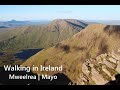
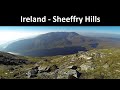
See the credits and list definitions.Video displayMweelrea Area W: Mweelrea SubareaPlace count in area: 12, OSI/LPS Maps: 37, EW-CON, MSW
Highest place: Mweelrea, 814m
Maximum height for area: 814 metres, Maximum prominence for area: 779 metres,
Places in area Mweelrea:
E: Ben Gorm Mountains:Ben Creggan 693mBen Creggan South Top 687mBen Gorm 700m
W: Mweelrea:Ben Bury 795mBen Lugmore 803mBen Lugmore East Top 790mBen Lugmore West Top 790mCorrymailley Hill 286mMweelrea 814mMweelrea SE Spur 495mTawnydoogan 312mTeevnabinnia 379m
Note: this list of places includes island features such as summits, but not islands as such.
(Ir. Cnoc Maol Réidh [GE], 'bald hill with the smooth top') County Highpoint of Mayo in Connacht Province, in County Highpoint, Arderin, Vandeleur-Lynam, Irish Best Hundred, Irish Highest Hundred Lists, Sandstone & conglomerate, ignimbrite Bedrock
Height: 814m OS 1:50k Mapsheet: 37 Grid Reference: L78983 66810
Place visited by 1001 members. Recently by: Jimmel357, Enda66, grainne1397, jmdsk, Rosdonohoe, Miriamowens, gunningp, rwroby, Beeman, Josephineobrien, hikingofireland, Buckz, Brianogorman, rosduke, jjbireland700sI have visited this place: NO (You need to be a logged-in member to change this.)Longitude: -9.830313, Latitude: 53.637241 , Easting: 78983, Northing: 266810 Prominence: 779m, Isolation: 1.5km
ITM: 478962 766828 , GPS IDs, 6 char: Mwlr, 10 char: Mweelrea
Bedrock type: Sandstone & conglomerate, ignimbrite, (Mweelrea Formation)
Mweelrea is the highest mountain in Connacht. The use of the adjective réidh, ‘smooth’, does not have many parallels in Irish hill-names and seems rather unsuited to rugged Mweelrea. Whilst impossible to prove, it seems plausible that this was once a Brittonic name containing bre, comparable to Welsh moelfre ‘bald hill’, of which there are at least seven instances in Wales. A number of townlands in Co. Down called Drummiller or Miller Hill could well have the same origin, the addition of tautological Ir. droim or Eng. hill being a later development. Mweelrea is the highest mountain in the Mweelrea area and the 35th highest in Ireland. Mweelrea is the highest point in county Mayo.
Linkback: https://mountainviews.ie/summit/34/COMMENTS for Mweelrea (Maol Réidh) << Prev page 1 2 3 4 5 6 7 8 9 10 Next page >>  Follow this place's comments
 Height layer: © MapTiler

MountainViews.ie, a Hill-walking Website for the island of Ireland. 2500 Summiteers, 1480 Contributors, maintainer of lists such as: Arderins, Vandeleur-Lynams, Highest Hundred, County Highpoints etc

 Fergalh
 Fergalh
 Fergalh
 Fergalh
 Fergalh
 Fergalh
 Visit our Facebook page.