Cookies. This website uses cookies, which are small text files that the website puts on your device to facilitate operation. Cookies help us provide a better service to you. They are used to track general user traffic information and to help the website function properly.

Click to hide this notice for 30 days.
Welcome to MountainViews
If you want to use the website often please enrol (quick and free) at top right.
Overview
Detail
Zoom: ??
For more map options click on any overview map area or any detail map feature.
Find Suggested Walks
Find hill, mountain, island, coastal feature.
Videos


Recent Contributions
Get Notifications

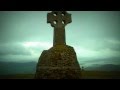
A visit to Tievummera via its South East spur.

Croagh Patrick's ridge to the east, visited from the south.

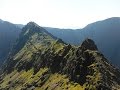
Ben Creggan: Craggy summit with long descending spur to the east.

Teevenacroaghy: Misty Achill.

Dorinish More: Shapely islands in Clew Bay, Co Mayo.

Crott Mountain: Quiet Arderin at the east end of the Croagh Patrick ridge.

Teevenacroaghy: A heathery ridge bump with good views.

Teevenacroaghy: A clear day on the Hill

Madeira: From Pico Arieiro to Pico Ruivo

Madeira: Coastal/Cliff walk to the Eastern Edge

Madeira: Descent from Monte to Funchal

Hag's Tooth: This might hurt

Conditions and Info
Use of MountainViews is governed by conditions and a privacy policy.
Read general information about the site.
Opinions in material here are not necessarily endorsed by MountainViews.
Hillwalking is a risk sport. Information in comments, walks, shared GPS tracks or about starting places may not be accurate for example as regards safety or access permission. You are responsible for your safety and your permission to walk.
See the credits and list definitions.
Video display
Glenbeigh Horseshoe Area   Cen: Glenbeigh Horseshoe Subarea
Place count in area: 20, OSI/LPS Maps: 70, 78, 83, EW-R 
Highest place:
Coomacarrea, 772m
Maximum height for area: 772 metres,     Maximum prominence for area: 457 metres,

Note: this list of places includes island features such as summits, but not islands as such.
Rating graphic.
Drung Hill Mountain Cnoc Droinge A name in Irish (Ir. Cnoc Droinge [UR*], ‘hill of the throng/assembly’) Kerry County in Munster Province, in Arderin, Vandeleur-Lynam, Irish Best Hundred Lists, Purple sandstone & siltstone Bedrock

Height: 640m OS 1:50k Mapsheet: 78/83 Grid Reference: V60277 87804
Place visited by 179 members. Recently by: rhw, orlaithfitz, maoris, Carolineswalsh, ToughSoles, SeanPurcell, Beti13, Krzysztof_K, markwallace, amacsweeney, bagoff, bryanmccabe, farmerjoe, nammona, Oscar-mckinney
I have visited this place: NO (You need to be a logged-in member to change this.)

Longitude: -10.036411, Latitude: 52.02508 , Easting: 60277, Northing: 87804 Prominence: 35m,  Isolation: 1.2km,   Has trig pillar
ITM: 460253 587855,   GPS IDs, 6 char: DrngHl, 10 char: Drung Hill
Bedrock type: Purple sandstone & siltstone, (Ballinskelligs Sandstone Formation)

A fair was held regularly on Drung Hill (Barrington, 'Discovering Kerry', p. 267), which would account for the throng. There is another hill of the same name near Lauragh on the Beara Peninsula. Barrington connects Drung Hill in Iveragh with the 'kingdom of Drung', which apparently paid a tribute of thirty oxen to Cashel. Leacht Fhionáin on Drung Hill is the reputed grave of St. Fionán. It is not at the summit, as marked on the Discovery map, but on a knoll halfway down the N. slope. The penitential station and well were visited on the last Sunday of July (MacNeill, 'The Festival of Lughnasa', pp. 134-37).   Drung Hill is the 218th highest place in Ireland.

Linkback: https://mountainviews.ie/summit/211/
COMMENTS for Drung Hill (Cnoc Droinge) 1 2 Next page >>  
Follow this place's comments
MountainViews.ie Picture about mountain Drung Hill (<i>Cnoc Droinge</i>) in area Glenbeigh Horseshoe, Ireland
Picture: Looking to Drung from the col with Beenmore
 
Viewpoint for Glenbeigh and the sea.
Short Summary created by simon3, jackill  25 Jul 2012
Park off the N70 at V61989 88645 starA, where the is room to park 3 cars on the roadside.
Walk west for 100 meters and follow the waymarked way sign up a track left at V61854 88672 starB.
You will pass a house, an abandoned van and a disused farmyard as well as going through several gates until you reach V60705 88690 starC. Cross the fence and head straight uphill to the summit of Drung Hill. Linkback: https://mountainviews.ie/summit/211/comment/4971/
 
MountainViews.ie Picture about mountain Drung Hill (<i>Cnoc Droinge</i>) in area Glenbeigh Horseshoe, Ireland
Picture: Viaduct on the old Glenbeigh to Caherciveen railway viewed from Drung hill
johnvbrennan on Drung Hill, 2006
by johnvbrennan  31 Jan 2006
I followed the same route up to Drung Hill as Roadie. Parked the car on a small byroad (ref V 616888 starD), just off the N70 (Glenbeigh to Caherciveen road). After leaving the car, we initially walked south east for about 0.25km and picked up the Kerry Way at V 619887 starE. This part of the Kerry way follows along by the coastline and it's not long before you are looking down on Rossbeigh beach, Inch strand and Dingle Bay. We approached Drung hill from the western side. While it's not very high it is pretty steep for the last 10 minutes before you reach the trig point and it certainly got the pulse going. I was very fortunate to have a very clear, sunny spring day for this walk which consisted of Been Hill, Beann Mor, Mullaghnarakill, Coomacarrea Tooth, TeerMoyle, Coomacarrea and Meentog. Linkback: https://mountainviews.ie/summit/211/comment/2158/
Your Score: Very useful <<  >>Average
 
MountainViews.ie Picture about mountain Drung Hill (<i>Cnoc Droinge</i>) in area Glenbeigh Horseshoe, Ireland
Picture: Rossbeigh beach from Drung Hill
 
riverlaune on Drung Hill, 2010
by riverlaune  12 Mar 2010
I climbed Drung Hill for the first time on 16/1/10 on a beautiful frosty morning! I parked the car just off the N70(ref. V6171988788 starF) on a small byroad and followed the sign for the Kerry Way for a 100m or so. Then I picked up the Kerry Way at ref. V6188688707 starG, just past a small cottage and headed upward towards Drung Hill. There are many gates to pass through but eventually you come to a gate at V6073888728 starH with a sheepwire fence that heads in the general direction of the summit. I followed this fence as far as it went and then scrambled up rock hard heather to a small plateau, with a further 30 minutes or so climb to the summit! There is a cairn and a trig. point at the top. My GPS(a new toy for Christmas - SatMap!) gave the trig. point at V60272 87800 starI - which corresponds to Simon's mountain list! From Drung Hill I walked the ridge to Beenmore(660m) but ran out of time for Been Hill(651m). I took a different route back to the car which involved following a sheep wire fence down the mountain starting on the ridge between Drung Hill and Beenmore. I would not do this again as I was hanging off it most of the way down and shredded my gloves in the process! I then picked up the Kerry way back to the car. The walk unbelievably took 6 hours at a leisurely pace and I saw only one person all day and that was on the Kerry Way! Linkback: https://mountainviews.ie/summit/211/comment/4387/
Your Score: Very useful <<  >>Average
 
MountainViews.ie Picture about mountain Drung Hill (<i>Cnoc Droinge</i>) in area Glenbeigh Horseshoe, Ireland
Picture: Sandspits of Rossbeigh & Inch, Barr Tri gCúm and Caherconree From Drung
Cnoc Droinge
by ciarraioch  26 Nov 2011
Drung presents a pleasing conical appearance as one approaches from the north east. Easily accessible off the Ring of Kerry road a few miles south of Glenbeigh. Park along the old road that parallels the new road and join the Kerry Way at V618 886 starJ following the very scenic 'Mountain Stage' to the top of the pass. From here swing up the slope for a steep, but pretty dry ascent. Due to its height at 2100 ft and prominence, its views across Dingle Bay are hard to beat. Linkback: https://mountainviews.ie/summit/211/comment/6635/
Your Score: Very useful <<  >>Average
 
roadie on Drung Hill, 2003
by roadie  12 Sep 2003
My wife and I are heading for our mid-forties but we are very active and since last year we have taken to hill-walkingmountain climbing. We have a holiday home on the Iveragh Penin. and recently we decided to tackle Drung Hill and continue along the horseshoe ridge to finish up at Coomasahran lakeshore. We set out at 10am in generally good weather conditions (high cloud, sunny spells and light winds). To get onto the mountain we had to walk along a narrow boreen for a half-mile then turn right into a field and follow upward to where the heather started at the base of the mountain. From here on it was generally an easy climb following a slight pathway up the edge of the mountain until the steep final quarter- mile to the summit. Once there the view was spectacular: across Dingle Bay, the Blaskets, Rossbeigh Beach, Caherciveen and the other numerous mountains in the area. We began to continue our walk to Beenmore but the weather changed dramatically and with reduced visibility we decided to play it safely and return to Drung Hill and descend.What we did was a great experience and when the weather permits we will return to complete the horseshoe another day. Linkback: https://mountainviews.ie/summit/211/comment/636/
Your Score: Very useful <<  >>Average
 
MountainViews.ie Picture about mountain Drung Hill (<i>Cnoc Droinge</i>) in area Glenbeigh Horseshoe, Ireland
Picture: Purple stones, yellow sand.
 
simon3 on Drung Hill, 2005
by simon3  28 Aug 2005
Lit by reddening evening sun, Drung affords views north towards the beach at Rossbeigh. As Roadie says in another comment, there's views towards Cahirsiveen and much of the Dingle Peninisula. Linkback: https://mountainviews.ie/summit/211/comment/1918/
Your Score: Very useful <<  >>Average
 
COMMENTS for Drung Hill (Cnoc Droinge) 1 2 Next page >>
(End of comment section for Drung Hill (Cnoc Droinge).)

OSi logo OSNI/LPS logo
Some mapping:
Open Street Map
(Various variations used.)
British summit data courtesy:
Database of British & Irish Hills
(Creative Commons Licence)
MountainViews.ie, a Hill-walking Website for the island of Ireland. 2400 Summiteers, 1480 Contributors, maintainer of lists: Arderins, Vandeleur-Lynams, Highest Hundred, County Highpoints etc