Guestuser: Login or enrol?
- Home
- Main Display
- Main Display (Old)
- Find a Walk
- Display INTRODUCTION
- DONATE
- Click below for your
profile & contributions
guestuser- New
- Tracks, Walks
- Challenge
- Community
- Lists & Logs
- Popular Lists:
- County Highpoints
- Range & Area Highpoints
- Local 100
- Highest Hundred
- Vandeleur-Lynams
- Arderins
- Carns
- Best rated
- Irish 900 up
- Irish Island
- Munros
- All Lists
- Shorter Irish
- County Highpoints
- Range & Area Highpoints
- Highest Hundred
- Local 100
- Local 100 (pre2014)
- Local Historical Cultural
- Best rated
- Irish 900 up
- Larger Irish
- Arderins
- Arderin Begs
- Arderins + Arderin Begs
- Vandeleur-Lynams
- Vandeleur-Lynams + Arderins
- Carns
- Binnions
- Highest 50 per Province
- Island Features
- Irish Island
- Coastal Hills
- Irish 600 up
- Irish 500 up
- British
- Munros
- British 600 up
- British 500-600
- British Marilyns
- Comprehensive
- All Irish summits
- All Irish features
- All British summits
- All Britain+ Ireland
- Special
- Analysis List
- Simple Irish Listings
- Simple Irish & British Listings
-
- More
- Motley Views
Welcome to MountainViews
If you want to use the website often please enrol (quick and free) at top right.OverviewFor more map options click on any overview map area or any detail map feature.Detail Map FeaturesShowing 7 items:
Achillbeg Island N Top 109.7m, Achillbeg Island S Top 108.5m,Tracks:3822, 14km 1404, 11km 2667, 11km 2617, 4km 2666, 3km Find Suggested Walks
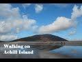
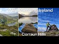
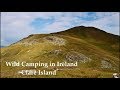
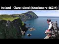
Find hill, mountain, island, coastal feature.Videos
Recent Contributions
 Get Notifications
Knocklettercuss: Ascend via the spur
Dún Briste: You must be joking
Letterettrin - a perspective on the N Connemara peaks
Burren: Black Head Loop
Doonvinalla E Top: Portacloy Cliff Walk
Erris Head Hill: Fantastic loop
Kilbrony Park Ramble
Aghaglasheen: Highest point on the peninsula
Knocknakilton & Cummeen, Dingle Penninsula
Blackstairs Mountain: Good access and a great viewpoint above a patchwork quilt
Silvermines Hydro Project
Carrigroe: Twin tops
Conditions and Info
Use of MountainViews is governed by conditions and a privacy policy.
Read general information about the site.
Opinions in material here are not necessarily endorsed by MountainViews.
Hillwalking is a risk sport. Information in comments, walks, shared GPS tracks or about starting places may not be accurate for example as regards safety or access permission. You are responsible for your safety and your permission to walk.
See the credits and list definitions.Video displayAchill & Corraun Area S: Knockmore Achill SubareaPlace count in area: 16, OSI/LPS Maps: 22, 30, CBW, EW-ACC, EW-ACC
Highest place: Croaghaun, 688m
Maximum height for area: 688 metres, Maximum prominence for area: 688 metres,
Places in area Achill & Corraun:
Cen: Minaun:Minaun (Achill Island) 466m
N: Slievemore:Krinnuck (Achill Island) 214mSlievemore (Achill Island) 671m
NW: Croaghaun:Benmore (Achill Island) 332mCornaclea Hill (Achill Island) 269mCroaghaun (Achill Island) 688mCroaghaun SW Top (Achill Island) 664m
S: Knockmore Achill:Achillbeg Island N Top (Achillbeg Island) 109.7mAchillbeg Island S Top (Achillbeg Island) 108.5mKnockmore (Achill Island) 337mTievereivagh (Achill Island) 286m
SE: Corraun:Knocklettragh 452mCorraun Hill 524mCorraun Hill Highpoint 541m
SW: Clare Island:Knockmore (Clare Island) 462mKnocknaveen (Clare Island) 223m
Note: this list of places includes island features such as summits, but not islands as such.
Mayo County in Connacht Province, in Binnion, Irish Islands Lists, Schists, serpentinite melange Bedrock
Landing grid ref.: L72000 92400
Reachable "On Foot " YHeight: 109.7m OS 1:50k Mapsheet: 30 Grid Reference: L71468 92757
Place visited by 19 members. Recently by: Wes, Fergalh, ppatten, PollyM, markmjcampion, finkey86, Oileanach, frankmc04, Niamhq, bryanjbarry, chalky, wicklore, sandman, madfrankie, jackillIsland visited by 29 members. I have visited this place: NO (You need to be a logged-in member to change this.)I have visited Achillbeg Island: NO (You need to be a logged-in member to change this.)Longitude: -9.954682, Latitude: 53.868434 , Easting: 71469, Northing: 292757 Prominence: 109.65m, Isolation: 0.8km
ITM: 471447 792770 , GPS IDs, 6 char: AchlIs, 10 char: AchlbgIsln
Bedrock type: Schists, serpentinite melange, (South Carrowgarve Formation)
Achillbeg Island N Top is the 1510th highest place in Ireland.
Linkback: https://mountainviews.ie/summit/1374/COMMENTS for Achillbeg Island N Top 1 of 1  Follow this place's comments
 Height layer: © MapTiler

MountainViews.ie, a Hill-walking Website for the island of Ireland. 2500 Summiteers, 1480 Contributors, maintainer of lists such as: Arderins, Vandeleur-Lynams, Highest Hundred, County Highpoints etc

 TommyV
 TommyV
 glencree
 TommyV
 TommyV
 TommyV
 Collaborative entry
 Colin Murphy
 Visit our Facebook page.