Guestuser: Login or enrol?
- Home
- Main Display
- Main Display (Old)
- Find a Walk
- Display INTRODUCTION
- DONATE
- Click below for your
profile & contributions
guestuser- New
- Tracks, Walks
- Challenge
- Community
- Lists & Logs
- Popular Lists:
- County Highpoints
- Range & Area Highpoints
- Local 100
- Highest Hundred
- Vandeleur-Lynams
- Arderins
- Carns
- Best rated
- Irish 900 up
- Irish Island
- Munros
- All Lists
- Shorter Irish
- County Highpoints
- Range & Area Highpoints
- Highest Hundred
- Local 100
- Local 100 (pre2014)
- Local Historical Cultural
- Best rated
- Irish 900 up
- Larger Irish
- Arderins
- Arderin Begs
- Arderins + Arderin Begs
- Vandeleur-Lynams
- Vandeleur-Lynams + Arderins
- Carns
- Binnions
- Highest 50 per Province
- Island Features
- Irish Island
- Coastal Hills
- Irish 600 up
- Irish 500 up
- British
- Munros
- British 600 up
- British 500-600
- British Marilyns
- Comprehensive
- All Irish summits
- All Irish features
- All British summits
- All Britain+ Ireland
- Special
- Analysis List
- Simple Irish Listings
- Simple Irish & British Listings
-
- More
- Motley Views
Welcome to MountainViews
If you want to use the website often please enrol (quick and free) at top right.OverviewFor more map options click on any overview map area or any detail map feature.Detail Map FeaturesFind Suggested Walks
Find hill, mountain, island, coastal feature.Videos
Recent Contributions
 Get Notifications
Meikle Bin: Long trek to summit
Lanzarote, from Femés to Puerto Calera via Pico de la Oveja and Montana Bermeja
Lanzarote, Puerto del Carmen Stroll
Little Bin: Tough little climb
Cort-ma Law East Top: Do not climb in the rain !
Lecket Hill: Short trek to summit of around 2 Km from Crow road
Great Knock: Short trek to summit
Brown Knowe: Straight forward track to the summit
Burren: Black Head Loop
Silvermines Hydro Project
Lamb Knowe: Short trek from Tods Knowe
Letterettrin - a perspective on the N Connemara peaks
Conditions and Info
Use of MountainViews is governed by conditions and a privacy policy.
Read general information about the site.
Opinions in material here are not necessarily endorsed by MountainViews.
Hillwalking is a risk sport. Information in comments, walks, shared GPS tracks or about starting places may not be accurate for example as regards safety or access permission. You are responsible for your safety and your permission to walk.
See the credits and list definitions.Video displayInishowen Area NW: Urris SubareaPlace count in area: 27, OSI/LPS Maps: 2, 3, 4, 6, 7
Highest place: Slieve Snaght, 614.6m
Maximum height for area: 614.6 metres, Maximum prominence for area: 600 metres,
Places in area Inishowen:
Cen: Slieve Snaght:Damph 420mSlieve Main 514mSlieve Snaght 614.6m
N: Malin:Croaghglengad 259mCrockalough 282mSoldiers hill 174m
NE: North East Inishowen:Crockavishane 322mCrocknasmug 327.5mGrinlieve 371m
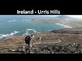
NW: Urris:Binnion 250mBulbin 494mCoolcross Hill 291mCroaghcarragh 400mCrockmain 460mDunaff Hill 230mMamore Hill 423mRaghtin More 502mSlievekeeragh 389mUrris Hills 417m
S: Iskaheen:Crockglass 397mEskaheen Mountain 418mGreenan Mountain 241mHolywell Hill 260mInch Top 222mLeamacrossan Hill 392mMouldy Hill 312mScalp Mountain 484m
Note: this list of places includes island features such as summits, but not islands as such.
poss. Ir. ‡Cnoc Dhún Damh [PDT], 'hill of Dún Damh or fort of Donegal County in Ulster Province, in Binnion List, Whitish quartzite with pebble beds Bedrock
stags/oxen’
Height: 230m OS 1:50k Mapsheet: 2,3 Grid Reference: C30900 48700
Place visited by 23 members. Recently by: Meenat, eamonoc, trostanite, finkey86, Fergalh, Lucky1, IainT, pearnett, chalky, gerrym, David-Guenot, mark-rdc, jmcg, Garmin, AntrimRamblerI have visited this place: NO (You need to be a logged-in member to change this.)Longitude: -7.514512, Latitude: 55.284228 , Easting: 230900, Northing: 448700 Prominence: 215m, Isolation: 4.3km
ITM: 630842 948678 , GPS IDs, 6 char: DnfHl, 10 char: Dunaf Hil
Bedrock type: Whitish quartzite with pebble beds, (Slieve Tooey Quartzite Formation)
Dunaff Hill is the 1340th highest place in Ireland. Dunaff Hill is the second most westerly summit in the Inishowen area.
Linkback: https://mountainviews.ie/summit/1021/COMMENTS for Dunaff Hill (Cnoc Dhún Damh) 1 of 1  Follow this place's comments
 Height layer: © MapTiler

MountainViews.ie, a Hill-walking Website for the island of Ireland. 2500 Summiteers, 1480 Contributors, maintainer of lists such as: Arderins, Vandeleur-Lynams, Highest Hundred, County Highpoints etc

 Fergalh
 simon3
 Fergalh
 Fergalh
 Fergalh
 Fergalh
 Fergalh
 Fergalh
 glencree
 Visit our Facebook page.