This website uses cookies, which are small text files that the website puts on your device to facilitate operation. Cookies help us provide a better service to you. They are used to track general user traffic information and to help the website function properly.
Colin Murphy: Track/5038 in area near Meenavally, Donegal East (Ireland)
Simple, but interesting walk
Ascent: 140m,
Length: 4.2km,
Creator time taken: 59m15s
Descent: 139m,
Time predicted from Naismith's rule: 1h 5m + breaks
Click here to rate track
PlacesStart at H18427 97226, Meenavally, end at Start
Track Rating ..
[RWD version 1 ]
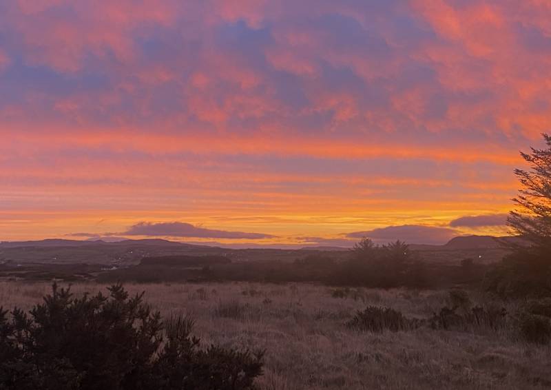
This little hill seems to have multiple names – Meenavally, Mullaghagarry and The Steeples. Take your pick! An amazing sunrise kicked off the day, which was good as there weren’t too many views to come, although the hill isn’t without interest.
Colourful start to the day...
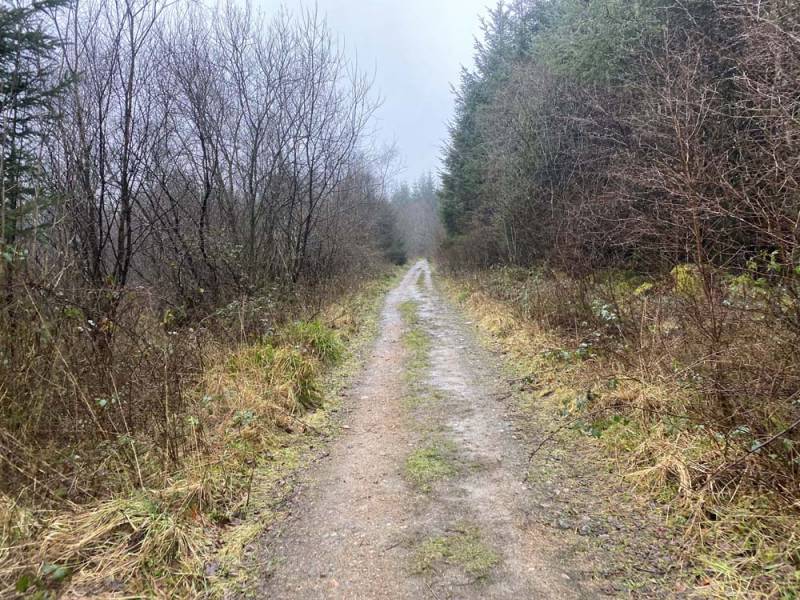
Our starting point was on a narrow road where it is just possible to squeeze a car over to the side without blocking a gate. Proceeded up the road first, which then led onto forest tracks, many of which were well signposted.
Forest tracks lead the way
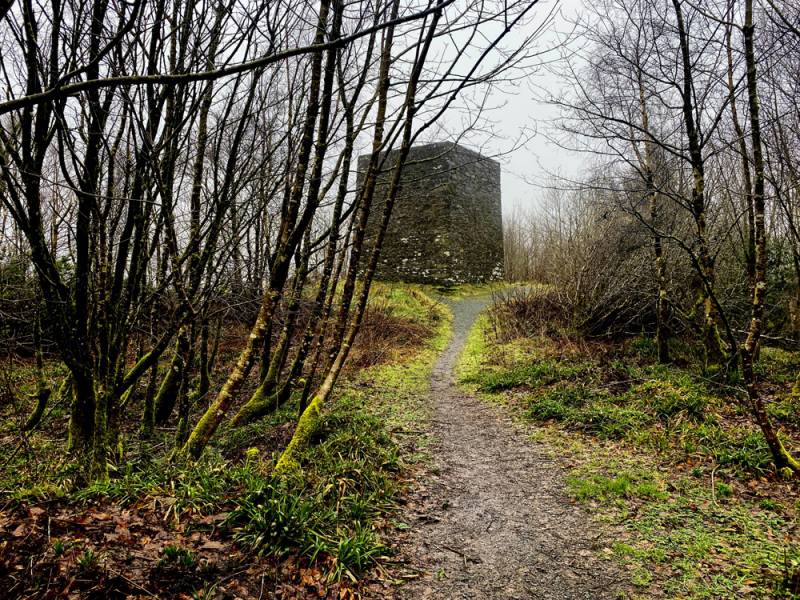
Near the high point the track narrowed, which led up the curious tower at the top, which was built as an observatory by one Sir Henry Stewart in 1810.
The Steeples Tower, as it is known.
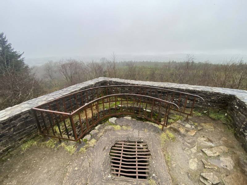
You can climb a narrow curving stair to the flat roof six metres above, which gives good views over the woodland. A simple walk in the woods with little climbing effort involved.
Roof with a view.
Editing Details for track/5038
NOTE: ALL information such as Ascent, Length and Creator time taken etc should be regarded as approximate. The creator's comments are opinions and may not be accurate or still correct.
Your time to complete will depend on the speed of the slowest plus break time and your mode of transport.
NOTE: It is up to you to ensure that your route is appropriate for you and your party to follow bearing in mind all factors such as safety, weather conditions, experience and access permission.
Uploaded on: Mon, 26 Feb 2024 (14:29:16), Linkback: https://mountainviews.ie/track/5038/
* Note: A GPS Height in the elevation profile is sourced from the device that recorded the track. An "SRTM" height is derived from a model of elevations for parts of the earth. More detail
Use of MountainViews is governed by conditions and a privacy policy.
Read general information about the site. Opinions in material here are not necessarily endorsed by MountainViews.
Hillwalking is a risk sport. Information in comments, walks, shared GPS tracks or about starting places may
not be accurate for example as regards safety or access permission. You are responsible for your safety and your permission to walk.
See the credits and list definitions.


 Our Facebook page.