- Home
- Main Display
- Main Display (Old)
- Find a Walk
- Display INTRODUCTION
- DONATE
- Click below for your
profile & contributions
guestuser- New
- Tracks, Walks
- Challenge
- Community
- Lists & Logs
- Popular Lists:
- County Highpoints
- Range & Area Highpoints
- Local 100
- Highest Hundred
- Vandeleur-Lynams
- Arderins
- Carns
- Best rated
- Irish 900 up
- Irish Island
- Munros
- All Lists
- Shorter Irish
- County Highpoints
- Range & Area Highpoints
- Highest Hundred
- Local 100
- Local 100 (pre2014)
- Local Historical Cultural
- Best rated
- Irish 900 up
- Larger Irish
- Arderins
- Arderin Begs
- Arderins + Arderin Begs
- Vandeleur-Lynams
- Vandeleur-Lynams + Arderins
- Carns
- Binnions
- Highest 50 per Province
- Island Features
- Irish Island
- Coastal Hills
- Irish 600 up
- Irish 500 up
- British
- Munros
- British 600 up
- British 500-600
- British Marilyns
- Comprehensive
- All Irish summits
- All Irish features
- All British summits
- All Britain+ Ireland
- Special
- Analysis List
- Simple Irish Listings
- Simple Irish & British Listings
-
- More
- Motley Views
Welcome to MountainViews
If you want to use the website often please enrol (quick and free) at top right.OverviewFor more map options click on any overview map area or any detail map feature.Detail Map FeaturesShowing 20 of a total of 55 items:
Slieve Donard 849m, Slieve Commedagh 767m, Slieve Binnian 745.9m, Slieve Bearnagh 739m, Slievelamagan 702.2m, Slieve Meelbeg 701.9m, Slieve Binnian North Tor 682.5m, Slieve Bearnagh North Tor 680m, Slieve Binnian North Top 678m, Chimney Rock Mountain 656m,Tracks:2672, 38km 4252, 32km 4124, 32km 3423, 25km 3381, 23km 668, 21km 4477, 20km 3052, 20km 5122, 20km 3258, 20km Find Suggested Walks
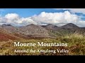
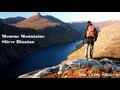
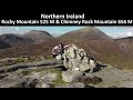
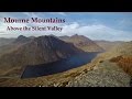
Find hill, mountain, island, coastal feature.Videos
Recent Contributions
 Get Notifications
Argentina - Mendoza - Cerro de la Gloria
Lugnaquilla: Lug from Kelly's Crossroads
Argentina - Bariloche - Mirador Lago Guttierez
Milane Hill: Parking Issue
Pookeen North Top: Only if you must
Argentina - Bariloche - Cascada Nivinco
Sleamaine: Indistinct summit with fine views
Argentina - Bariloche - Cerro Llau Llau
Ballinafunshoge: Clear views from the summit
Tievummera Highpoint: Undistinguished highpoint of spectacular Sheefry scarp.
Near Barnastooka, West Cork Mountains (Ireland)
Tievummera Trig: Bump with trig pillar on long scarp with steep slope to the nor
Conditions and Info
Use of MountainViews is governed by conditions and a privacy policy.
Read general information about the site.
Opinions in material here are not necessarily endorsed by MountainViews.
Hillwalking is a risk sport. Information in comments, walks, shared GPS tracks or about starting places may not be accurate for example as regards safety or access permission. You are responsible for your safety and your permission to walk.
See the credits and list definitions.Video displayOnzy: Track 4599 in area near Slieve Binnian North Tor, Mourne Mountains (Ireland)Mournes: Binnian Circuit Length: 12.5km, Creator time taken: 3h39m, Ascent: 805m,
Descent: 809m
Places: Start at J3450721922, Slieve Binnian North Tor, Slieve Binnian North Top, Slieve Binnian, Slieve Binnian East Top, end at Start
Logged as completed by 2
 Circuit from Carrick Liottle over Slieve Binnian and its associated tops.COMMENTSNo comments uploaded yet.
NOTE: ALL information such as Ascent, Length and Creator time taken etc should be regarded as approximate. The creator's comments are opinions and may not be accurate or still correct.
Your time to complete will depend on your speed plus break time and your mode of transport. For walkers: Naismith's rule, an approximate though often inaccurate estimate, suggests a time of 3h 50m + time stopped for breaks
NOTE: It is up to you to ensure that your route is appropriate for you and your party to follow bearing in mind all factors such as safety, weather conditions, experience and access permission.
* Note: A GPS Height in the elevation profile is sourced from the device that recorded the track. An "SRTM" height is derived from a model of elevations for parts of the earth. More detail Height layer: © MapTiler

MountainViews.ie, a Hill-walking Website for the island of Ireland. 2500 Summiteers, 1480 Contributors, maintainer of lists such as: Arderins, Vandeleur-Lynams, Highest Hundred, County Highpoints etc

 michaelseaver
 DeirdreM
 DeirdreM
 Onzy
Onzy
 hibby
hibby
 Onzy
Onzy
 hibby
hibby
 Collaborative entry
 Collaborative entry
 Visit our Facebook page.