This website uses cookies, which are small text files that the website puts on your device to facilitate operation. Cookies help us provide a better service to you. They are used to track general user traffic information and to help the website function properly.
simon3: Track/4146 in area near Croaghconnellagh, Bluestack Mountains (Ireland)
Character building tale of Croaghconnellagh in the rain.
Ascent: 303m,
Length: 5.5km,
Creator time taken: 2h57m
Descent: 410m,
Time predicted from Naismith's rule: 1h 36m + breaks
Click here to rate track
PlacesStart at H03116 87315, Croaghconnellagh, end at Sheskinlubanagh (SheskLub) H04241 87382, 1.1km E from Start
Track Rating ..
[RWD version 1 ]
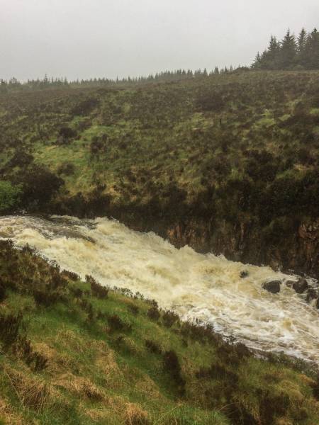
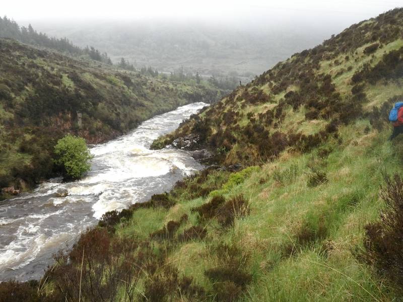
Don't even think of crossing the Lowerymore.
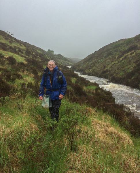
There are various routes published on MV for reaching Croaghconnelagh however they assume that the various streams and rivers are passable. This is how to reach the top when the water is up. But it is NOT guaranteed and definitely has a dangerous stream crossing. Start from the N15 at the prominent carpark. Cross the Lowerymore River by the bridge and immediately head up the valley keeping close to the river on its western side. There is, as of 2019, an overgrown but quite definite and very helpful track along the riverside. Make sure to find this as it will make your walking altogether easier. It is generally about 5m from the river.
The overgrown but useful riverside track.
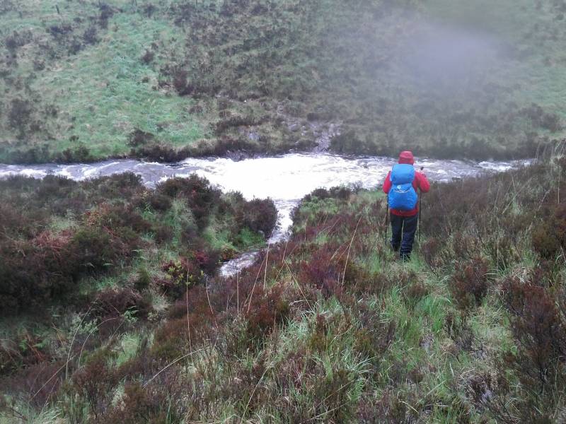
Although not shown in full our outward track went higher which took us through very boggy ground covered in long grass and heather which we found was energy sapping to move through. When the river track reaches a further stream that descends in a NE direction from the higher ground around Croaghconnellagh it is time to turn left and start climbing.
The small stream joining the Lowerymore River.
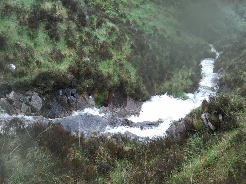
This stream is not shown on OSM derived mapping but is on the OS 1:50k. The track continues for a bit though eventually peters out. It is at this point that you have to choose one of two ways of proceeding. Up the left side of the stream or the right. The 1:50k suggested that the land on the left side, which would be the more direct route to the summit, was steeper. In fact it is much steeper and would have been very difficult in the conditions. The right side of the stream is the preferred way of going and that is what we did and what is shown on the map. However this means crossing the stream which was a dangerous torrent. This was just possible on the day. However I wouldn't assume that this was the case on another occasion. Also I would assume that this stream could rise very fast in response to heavy rain and become impassable, making a return trip very hard. Not all members of a party would find crossing possible.
The small stream, near where we crossed.
We proceeded upwards as shown on the track. The terrain continued to be very difficult with long grass etc until around 400m when the underlying granite which is very walkable started to appear in places. The summit area could be described as convoluted. It's suitable for a difficult mountain leadership assessment using only map and compass and designed to fail as many trainees as possible. There are numerous valleys, outcrops, boggy patches and false summit lumps that have to be negotiated. Also at the top there are at least 3 or 4 cairns on different candidate tops. Given limited visibility we went to all of them since we weren't sure which was the highest.
Rage of the Lowerymore River as we descended on overgrown path.
Return the same way, hoping that you will be able to recross the stream. Going across the Lowerymore River was out of the question. It was 4 metres wide and moving fast.
Editing Details for track/4146
NOTE: ALL information such as Ascent, Length and Creator time taken etc should be regarded as approximate. The creator's comments are opinions and may not be accurate or still correct.
Your time to complete will depend on the speed of the slowest plus break time and your mode of transport.
NOTE: It is up to you to ensure that your route is appropriate for you and your party to follow bearing in mind all factors such as safety, weather conditions, experience and access permission.
Uploaded on: Fri, 31 May 2019 (06:04:10), Linkback: https://mountainviews.ie/track/4146/
* Note: A GPS Height in the elevation profile is sourced from the device that recorded the track. An "SRTM" height is derived from a model of elevations for parts of the earth. More detail
Use of MountainViews is governed by conditions and a privacy policy.
Read general information about the site. Opinions in material here are not necessarily endorsed by MountainViews.
Hillwalking is a risk sport. Information in comments, walks, shared GPS tracks or about starting places may
not be accurate for example as regards safety or access permission. You are responsible for your safety and your permission to walk.
See the credits and list definitions.


 Our Facebook page.