- Home
- Main Display
- Main Display (Old)
- Find a Walk
- Display INTRODUCTION
- DONATE
- Click below for your
profile & contributions
guestuser- New
- Tracks, Walks
- Challenge
- Community
- Lists & Logs
- Popular Lists:
- County Highpoints
- Range & Area Highpoints
- Local 100
- Highest Hundred
- Vandeleur-Lynams
- Arderins
- Carns
- Best rated
- Irish 900 up
- Irish Island
- Munros
- All Lists
- Shorter Irish
- County Highpoints
- Range & Area Highpoints
- Highest Hundred
- Local 100
- Local 100 (pre2014)
- Local Historical Cultural
- Best rated
- Irish 900 up
- Larger Irish
- Arderins
- Arderin Begs
- Arderins + Arderin Begs
- Vandeleur-Lynams
- Vandeleur-Lynams + Arderins
- Carns
- Binnions
- Highest 50 per Province
- Island Features
- Irish Island
- Coastal Hills
- Irish 600 up
- Irish 500 up
- British
- Munros
- British 600 up
- British 500-600
- British Marilyns
- Comprehensive
- All Irish summits
- All Irish features
- All British summits
- All Britain+ Ireland
- Special
- Analysis List
- Simple Irish Listings
- Simple Irish & British Listings
-
- More
- Motley Views
Welcome to MountainViews
If you want to use the website often please enrol (quick and free) at top right.OverviewFor more map options click on any overview map area or any detail map feature.Detail Map FeaturesFind Suggested Walks
Find hill, mountain, island, coastal feature.Videos
Recent Contributions
 Get Notifications
Garraun: Flat and Featureless Summit
Lago Maggiore: Stresa to Belgirate
Ben Gorm: Flattish Summit - high point of an exciting and rugged range.
Lake Como: Como Greenway from Cadenabbia to Lenno
Rutland Island: Interesting history on small island
A circuit of Leenaun Hill.
Inishfree Upper: W.A.W. Trail-point
Inishfree Upper: Free and easy on Inishfree
Steep ascent, stunning views
Inishkeeragh: Flat island in the sun
Long trail to rewarding tops.
Knocknaskea: Truly idyllic
Conditions and Info
Use of MountainViews is governed by conditions and a privacy policy.
Read general information about the site.
Opinions in material here are not necessarily endorsed by MountainViews.
Hillwalking is a risk sport. Information in comments, walks, shared GPS tracks or about starting places may not be accurate for example as regards safety or access permission. You are responsible for your safety and your permission to walk.
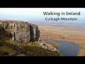
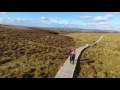
See the credits and list definitions.Video displaypeter1: Track 3354 in area near Breifne (Ireland)Cuilcagh - a great day on the hills! Length: 14.8km, Creator time taken: 3h34m, Ascent: 502m,
Descent: 306m
Places: Start at H0723327497, Cuilcagh, Benbeg, end at H1193324701 5.5km SE from Start
Logged as completed by 1
 Rather than climbing Cuilagh from the high point on the road to the south of Benbeg, I decided to make a traverse of the ridge starting from Glangevlin, set in a beautiful green valley.
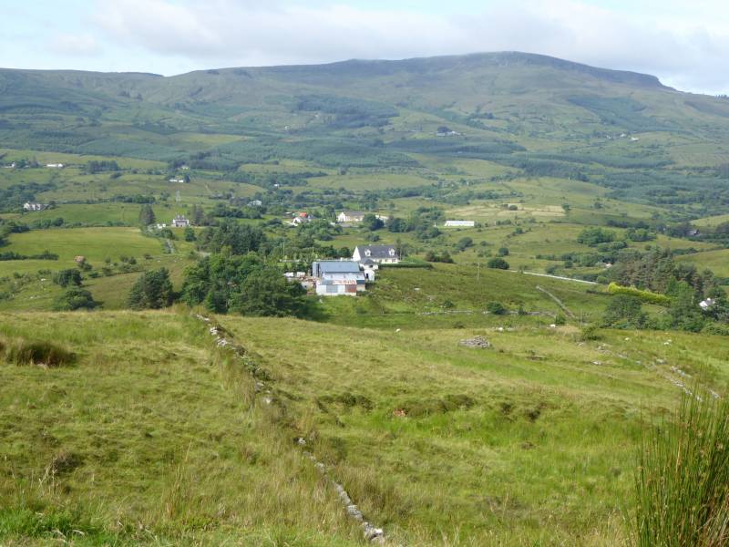
Glangevlin valley from the southern slopes of Tiltinbane
However, as I was travelling on my own and did not fancy the idea of a long road walk, I left my bike hidden in a ditch at the highest point of the road south of Benbeg.
The ascent from Glangevlin is boggy at times and has some deep heather at times too, however, the walk across the ridge to Cuilcagh is just so easy and enjoyable with great views that its easy to forget the earlier hardships.
The weather was superb too, bright warm sunshine and a cool breeze. The traverse to Benbeg is tough going though and sticking to the eastern edge of the ridge makes it a little easier.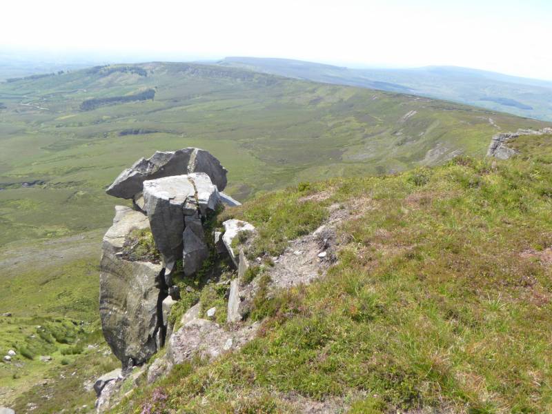
The ridge to Benbeg from Cuilcagh
The descent by bike back to Glangevlin, around 8kms, is almost all downhill and I was able to freewheel the tiredness away. I highly recommend this approach!COMMENTSNo comments uploaded yet.NOTE: ALL information such as Ascent, Length and Creator time taken etc should be regarded as approximate. The creator's comments are opinions and may not be accurate or still correct.
Your time to complete will depend on your speed plus break time and your mode of transport. For walkers: Naismith's rule, an approximate though often inaccurate estimate, suggests a time of 3h 48m + time stopped for breaks
NOTE: It is up to you to ensure that your route is appropriate for you and your party to follow bearing in mind all factors such as safety, weather conditions, experience and access permission.
* Note: A GPS Height in the elevation profile is sourced from the device that recorded the track. An "SRTM" height is derived from a model of elevations for parts of the earth. More detail Height layer: © MapTiler

MountainViews.ie, a Hill-walking Website for the island of Ireland. 2500 Summiteers, 1480 Contributors, maintainer of lists such as: Arderins, Vandeleur-Lynams, Highest Hundred, County Highpoints etc

 Collaborative entry
 Collaborative entry
 Fergalh
 simon3
 Fergalh
 Fergalh
 Colin Murphy
 Fergalh
 Colin Murphy
 Damian120
 Visit our Facebook page.