This website uses cookies, which are small text files that the website puts on your device to facilitate operation. Cookies help us provide a better service to you. They are used to track general user traffic information and to help the website function properly.
Summits & other features in area Cornwall & Devon: Beacon Hill 196m, Bin Down 203m, Bingwell Hill 237m, Carnmenellis 252m, Christ Cross 261m, Colleywell Hill 253m, Fursdon Hill 254m, Great Hill 180m, Hensbarrow Beacon 312m, Kit Hill 334m, Slappers Hill 179m, Stoke Hill 161m, Three Gates Hill 286m, Tregonning Hill 194m, Waddles Down 248m, Watch Croft [White Downs] 253m, White Down 167m Blackdown Hills: Bulverton Hill 212m, Woodbury Common 183m Bodmin Moor: Brown Willy 420m, Kilmar Tor 396m, Rough Tor 400m Dartmoor: Amicombe Hill [Kitty Tor] 584m, Assycombe Hill 497m, Beardown Tors 513m, Bellever Tor 443m, Belstone Tor 479m, Birch Tor 487m, Black Hill 412m, Black Hill 584m, Brent Tor 334m, Brown's House Top 539m, Challacombe Down 463m, Chinkwell Tor 460m, Corndon Tor [Corndon Down] 434m, Cosdon Hill [South Tawton Common] 550m, Cox Tor 442m, Cut Hill 603m, Easdon Tor 439m, East Mill Tor 513m, Great Links Tor 589m, Great Mis Tor 538m, Great Staple Tor 455m, Hameldown [Hamel Down] 532m, Hangingstone Hill 603m, Hare Tor 531m, Haytor Rocks 457m, Heatree Down 414m, High Willhays 621m, Higher White Tor 527m, Hookney Tor 497m, Hound Tor 495m, Hound Tor 414m, Laughter Tor 421m, Mardon Down 356m, North Hessary Tor 517m, Penn Moor 493m, Quickbeam Hill 481m, Rippon Tor 476m, Roos Tor 454m, Ryder's Hill 515m, Sharpitor 410m, Sittaford Tor 538m, South Hessary Tor 454m, Stalldown Barrow 415m, Steeperton Tor 532m, Top Tor 432m, Ugborough Moor 464m, White Ridge 506m, White Tor 468m, Yes Tor 619m Exmoor: Five Barrows Hill 493m, North Molton Ridge 435m, Shoulsbarrow Common 476m Lundy: Beacon Hill 143m
Note: this list of places may include island features such as summits, but not
islands as such.
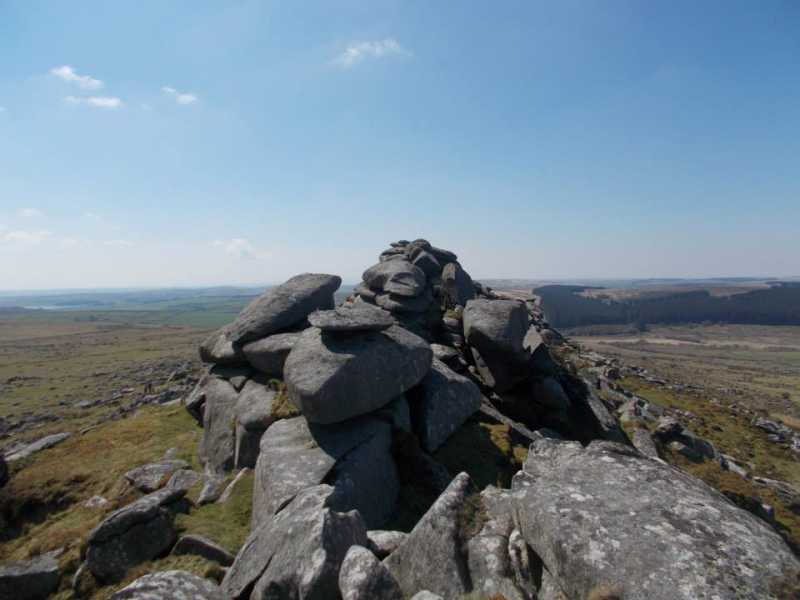
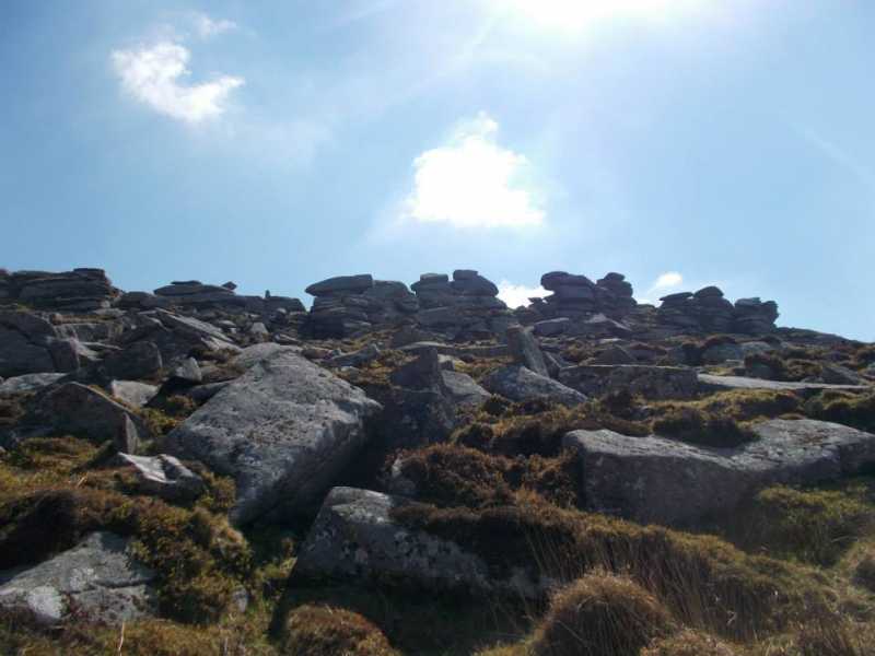
Kilmar Tor, 396mHill
Place Rating ..
, in no lists Grid Reference SX25251 74881,
OS 1:50k mapsheet 201 Place visited by: 4members, recently by: rhw, IainT, Fergalh, chalky
I visited this place: NO (You need to be a logged-in member for this.)
Take the B3254 south of Launceston at the river Inny take a right hand turn up a narrow road to parking spot. This is adjecent to the Hawks Tor and Trewortha Tor slightly to the North. Head south over the twelve mans moor and follow the track to the obvious Summit. A minor scramble to top great views in all directions and some fascinating Tors scattered over the hill top. Linkback: mountainviews.ie/summit/B5402/comment/20998/
Use of MountainViews is governed by conditions and a privacy policy.
Read general information about the site. Opinions in material here are not necessarily endorsed by MountainViews.
Hillwalking is a risk sport. Information in comments, walks, shared GPS tracks or about starting places may
not be accurate for example as regards safety or access permission. You are responsible for your safety and your permission to walk.
See the credits and list definitions.


 Add a Place Comment for Kilmar Tor


 Our Facebook page.