This website uses cookies, which are small text files that the website puts on your device to facilitate operation. Cookies help us provide a better service to you. They are used to track general user traffic information and to help the website function properly.
The River Tees to The WashArea, North York Moors
Subarea
Feature count in area: 18, by county: Yorkshire, East Riding (CoH) Humberside: 1, : 15, Lincolnshire, Parts of Lindsey (CoH) Lin: 1, Cleveland (CoA) Redcar and Cleveland (Co: 1,
Highest Place: Urra Moor - Round Hill 454m
Starting Places in area The River Tees to The Wash:
None for this area
Summits & other features in area The River Tees to The Wash: Bishop Wilton Wold 248m, Danby High Moor 432m, Eston Nab 242m, Great Wold 164m, Noon Hill 404m, Normanby Top [The Wolds] 168m, Oliver's Mount 155m, Seamer Beacon 189m, Yearsley Cross 174m North York Moors: Barns Cliff End 223m, Black Hambleton 400m, Brow Moor 266m, Carlton Moor 408m, Cold Moor [Broughton Bank] 402m, Cringle Moor - Drake Howe 434m, Gisborough Moor 328m, Stony Leas - Louven Howe 299m, Urra Moor - Round Hill 454m
Note: this list of places may include island features such as summits, but not
islands as such.
Urra Moor - Round Hill, 454mHill
Place Rating ..
, in British Marilyn Lists Grid Reference NZ59432 01596,
OS 1:50k mapsheet 93 Place visited by: 8members, recently by: rhw, oakesave, Geansai, IainT, Fergalh, MichaelE, chalky, jimbloomer
I visited this place: NO (You need to be a logged-in member for this.)
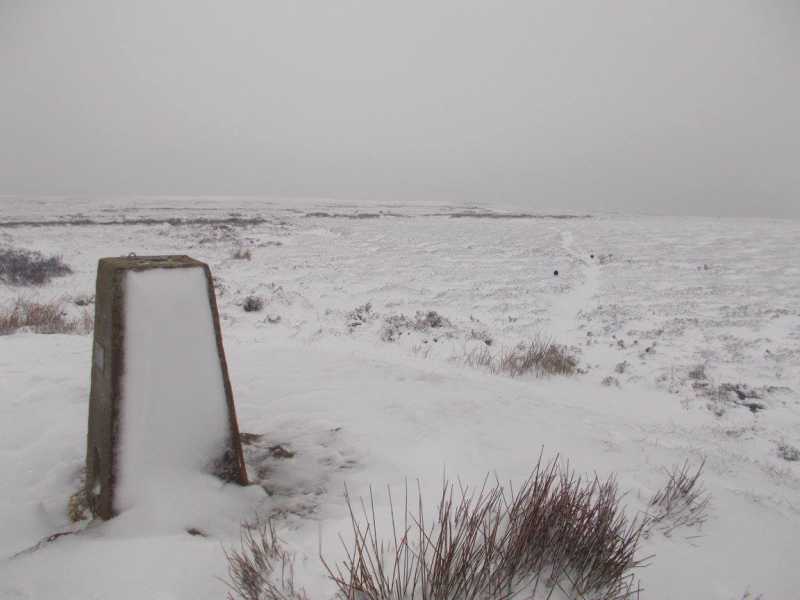
Parked at Clay Bank Car park to the North West and followed track with wall to the left up over Clay Bank. This was a snowy windy day and from here the track was fully exposed to the North Sea Breeze. The track continues south east until finally just after a large junction the trig pillar can be spotted a short distance to the north Linkback: mountainviews.ie/summit/B2830/comment/22382/
Read Less
Read More
Picture: View from Summit of Clay Bank
Snowy view
by Fergalh
15 Feb 2021
Despite not being on Mountainviews the steepness of Clay Bank and the views made this the best part of this trek. The car park is amongst the trees below the lower hill. Linkback: mountainviews.ie/summit/B2830/comment/22383/
Use of MountainViews is governed by conditions and a privacy policy.
Read general information about the site. Opinions in material here are not necessarily endorsed by MountainViews.
Hillwalking is a risk sport. Information in comments, walks, shared GPS tracks or about starting places may
not be accurate for example as regards safety or access permission. You are responsible for your safety and your permission to walk.
See the credits and list definitions.


 Add a Place Comment for Urra Moor - Round Hill


 Our Facebook page.