This website uses cookies, which are small text files that the website puts on your device to facilitate operation. Cookies help us provide a better service to you. They are used to track general user traffic information and to help the website function properly.
Lake District - Northern FellsArea, Lake District - Northern Fells
Subarea
Feature count in area: 75, all in ,
Highest Place: Skiddaw 931m
Starting Places in area Lake District - Northern Fells:
None for this area
Summits & other features in area Lake District - Northern Fells: Lake District - North Western Fells: Barf 469m, Broom Fell 511m, Graystones 452m, Graystones (Birkett) 456m, Kirk Fell (Lorton) 438m, Lord's Seat 552m, Sale Fell 359m, Seat How (Thornthwaite) 495m, Tarbarrel Moss 493m, Ullister Hill 525m, Watch Hill [Setmurthy Common] 254m, Whinlatter Top 525m, Whinlatter [Brown How - Whinlatter] 517m, Widow Hause 404m Lake District - Northern Fells: Atkinson Pike [Foule Crag] 845m, Bakestall 673m, Bannerdale Crags 683m, Binsey 447m, Birk Hill 501m, Blencathra - Hallsfell Top 868m, Bowscale Fell 702m, Bowscale Fell Far East Top 604m, Brae Fell 586m, Broad End 831m, Burn Tod 595m, Burnt Horse 570m, Carl Side 746m, Carrock Fell 663m, Cockup 505m, Coomb Height 627m, Dodd (Skiddaw) 502m, Doddick Fell 742m, Drygill Head 622m, Frozen Fell 625m, Gategill Fell Top 851m, Great Calva 690m, Great Cockup 526m, Great Lingy Hill 616m, Great Sca Fell 651m, Hare Crag 538m, Hare Stones 627m, High Pike (Caldbeck) 658m, Jenkin Hill 735m, Knott 710m, Knowe Crags [Blease Fell] 805m, Little Calva 642m, Little Lingy Hill 600m, Little Sca Fell 633m, Long Side 734m, Longlands Fell 483m, Lonscale Fell 715m, Lonscale Pike [Lonscale Fell East Top] 703m, Lowthwaite Fell 509m, Meal Fell 550m, Miller Moss [Little Lingy Hill] 609m, Miton Hill 607m, Mungrisdale Common 633m, Pike 593m, Round Knott 603m, Sale How 666m, Sandale Hill 373m, Scales Fell 682m, Skiddaw 931m, Skiddaw - Lesser Man 815m, Skiddaw Little Man 865m, Skiddaw Middle Top 928m, Skiddaw North Top 922m, Skiddaw South Top 925m, Souther Fell 522m, Souther Fell South Top 519m, Tarn Crags Top [Bowscale Fell East Top] 665m, The Tongue 553m, Ullock Pike 690m, West Fell 511m, White Hause 464m
Note: this list of places may include island features such as summits, but not
islands as such.
Carl Side, 746mMountain
Place Rating ..
, in British over 600m Lists Grid Reference NY25495 28088,
OS 1:50k mapsheet 89 90 Place visited by: 16members, recently by: rhw, arthurdoylephoto, oakesave, TommyMc, skyehigh, IainT, johnstna, Onzy, Fergalh, MichaelE, chalky, Geansai, jimbloomer, Harry Goodman, liz50
I visited this place: NO (You need to be a logged-in member for this.)
Short or GPS IDs, 6 char: CrlSd, 10 char: Carl Side Linkback: https://mountainviews.ie/summit/B2325/
Gallery for Carl Side and surrounds
No summary yet for this place
.
Add a Place Comment for Carl Side (b2325) in Area: Lake District - Northern Fells, Lake District - Northern Fells, County: , Lake District - Northern Fells
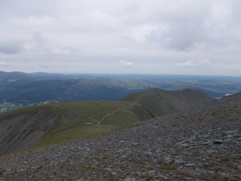
From Broad End a climb back up the four Skiddaw peaks at the summit is followed by a drop down onto the spur with 3 peaks called Longside Edge. The first Peak you come to after the steep descent off the Skiddaw plateau is marked with a small cairn Linkback: mountainviews.ie/summit/B2325/comment/22073/
Use of MountainViews is governed by conditions and a privacy policy.
Read general information about the site. Opinions in material here are not necessarily endorsed by MountainViews.
Hillwalking is a risk sport. Information in comments, walks, shared GPS tracks or about starting places may
not be accurate for example as regards safety or access permission. You are responsible for your safety and your permission to walk.
See the credits and list definitions.


 Add a Place Comment for Carl Side


 Our Facebook page.