This website uses cookies, which are small text files that the website puts on your device to facilitate operation. Cookies help us provide a better service to you. They are used to track general user traffic information and to help the website function properly.
Feature count in area: 70, by county: : 69, Flintshire [Sir Fflint] (CoH) Flintshire: 1,
Highest Place: Moel y Gamelin 576.9m
Starting Places in area Llandudno to Wrexham:
None for this area
Summits & other features in area Llandudno to Wrexham: Boncyn Foel-bach 408m, Bryn Euryn 131m, Bryn Ocyn 441m, Bryn Pydew 128m, Bryn y Gors-goch 453m, Bryn yr Orsedd 405m, Cader Dinmael 452m, Cefn Du 422m, Cefn y Cist 492m, Cefn yr Ogof 204.4m, Coed Hyrddyn [Moel Tan y Coed] 232.4m, Cyrn-y-Brain 564.6m, Eglwyseg Mountain 512.1m, Esclusham Mountain 460m, Ffrithuchaf 404m, Foel 433m, Foel Frech 453m, Foel Gasnach 405m, Fron Fawr 378m, Great Orme 207.1m, Hope Mountain 330m, Little Orme [Creigiau Rhiwledyn] 141m, Llechwedd 450m, Llys Dymper 466.2m, Llys y Frenhines 414m, Maesyrychen Mountain 420.9m, Moel Dywyll 475m, Moel Eithinen 434m, Moel Fodiar 390m, Moel Garegog 413.1m, Moel Llanfair 447m, Moel Llys-y-coed 465m, Moel Maelogen 424m, Moel Morfydd [Llantysilio Mountain] 549.6m, Moel Plas-yw 420m, Moel Rhiwlug 433m, Moel Seisiog 467.1m, Moel Tywysog 400.1m, Moel y Faen [Llantysilio Mountain] 547.1m, Moel y Gaer 503.5m, Moel y Gaer 303.7m, Moel y Gamelin 576.9m, Moel y Plas 440m, Moel Ytta 404m, Moelfre Isaf 317m, Moelfre Uchaf 396m, Mwdwl-eithin 389m, Mwdwl-eithin 470m, Mynydd Marian 208m, Mynydd Poeth 417m, Mynydd Rhyd Ddu 389m, Mynydd Tryfan 402m, Pen yr Orsedd 442.2m, Penbryn-ci 447.4m, Tre-pys-llygod 320m, Y Drum 417m Clwydian Hills: Bryn Alyn 408.3m, Foel Fenlli 510.9m, Moel Arthur 456m, Moel Famau 554.8m, Moel Gyw 467m, Moel y Waun 411.9m, Mynydd y Cwm [Coed Cwm] 304.8m, Penycloddiau 440m Hiraethog: Bryn Trillyn 497.8m, Craig Bron-banog 501.8m, Gorsedd Bran 518m, Marial Gwyn [Foel Goch] 519m, Mwdwl-eithin 532m, Tir Mostyn 492m
Note: this list of places may include island features such as summits, but not
islands as such.
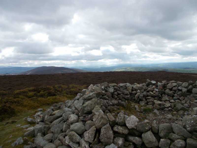
Cyrn-y-Brain, 564.6mMountain
Place Rating ..
, in British 500-600m, British Marilyn Lists Grid Reference SJ20818 48881,
OS 1:50k mapsheet 117 Place visited by: 7members, recently by: rhw, oakesave, IainT, Fergalh, MichaelE, chalky, jimbloomer
I visited this place: NO (You need to be a logged-in member for this.)
Parked in lay-by on A525 at Llandegla forest, through forest and up to Watkins Tower, then onto summit (South) which is marked by a cairn. The trig pillar on the northern Top is not the summit Linkback: mountainviews.ie/summit/B2040/comment/21346/
Use of MountainViews is governed by conditions and a privacy policy.
Read general information about the site. Opinions in material here are not necessarily endorsed by MountainViews.
Hillwalking is a risk sport. Information in comments, walks, shared GPS tracks or about starting places may
not be accurate for example as regards safety or access permission. You are responsible for your safety and your permission to walk.
See the credits and list definitions.


 Add a Place Comment for Cyrn-y-Brain


 Our Facebook page.