This website uses cookies, which are small text files that the website puts on your device to facilitate operation. Cookies help us provide a better service to you. They are used to track general user traffic information and to help the website function properly.
Feature count in area: 50, by county: : 48, Shropshire (CoH) Shropshire (CoA) Shrops: 1, Telford and Wrekin (UA): 1,
Highest Place: Brown Clee Hill 540m
Starting Places in area Shropshire:
None for this area
Summits & other features in area Shropshire: Black Mountain 448m, Black Rhadley Hill 402.1m, Callow 412.3m, Cefn Gunthly 400.8m, Cefn Hepreas 412m, Cothercott Hill 442m, Craig-y-Rhiw 362m, Dowke Hill 416m, Garn Rock Hill 437m, Grindle 460.2m, Grinshill Hill 192m, Hawkstone Hill 208m, Hergan 409m, Knolls 456m, Linley Hill 409m, Llanfair Hill 432m, Norbury Hill 411m, Ratlinghope Hill 411m, Reilth Top 406m, Stapeley Hill 403m, Yearlet 465.8m Shropshire Hills: Black Hill 441m, Brown Clee Hill 540m, Bryn Hill 408m, Burrow 358m, Caer Caradoc Hill 459m, Callow Hill 336m, Clee Burf 510m, Clunbury Hill 304m, Colebatch Hill 416m, Coxall Knoll 262m, Cwm-Sanaham Hill 409m, Diddlebury Common 317m, Earl's Hill 319.5m, Heath Mynd 452.6m, Hope Bowdler Hill 426m, Long Mynd - Pole Bank 516.6m, Middlehope Hill 324m, Norton Camp 294m, Oakeley Mynd 309m, Ragleth Hill 398m, Rock Hill 436m, Stiperstones 536.9m, Stow Hill 434m, Sunnyhill 393m, The Lawley 377m, The Paddock 503m, The Wrekin 407m, Titterstone Clee Hill 533m, View Edge 321m
Note: this list of places may include island features such as summits, but not
islands as such.
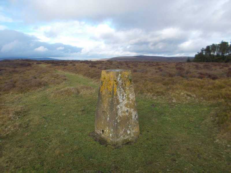
Knolls, 456mHill
Place Rating ..
, in no lists Grid Reference SO40300 90200,
OS 1:50k mapsheet 137 Place visited by: 3members, recently by: rhw, IainT, Fergalh
I visited this place: NO (You need to be a logged-in member for this.)
Parked near gate of the midlands Glider club to the north and followed track through grounds to south before heading for the summit. The trig pillar is not the summit which is a small unmarked mound 100 metres north Linkback: mountainviews.ie/summit/B16958/comment/22369/
Use of MountainViews is governed by conditions and a privacy policy.
Read general information about the site. Opinions in material here are not necessarily endorsed by MountainViews.
Hillwalking is a risk sport. Information in comments, walks, shared GPS tracks or about starting places may
not be accurate for example as regards safety or access permission. You are responsible for your safety and your permission to walk.
See the credits and list definitions.

 Add a Place Comment for Knolls


 Our Facebook page.