This website uses cookies, which are small text files that the website puts on your device to facilitate operation. Cookies help us provide a better service to you. They are used to track general user traffic information and to help the website function properly.
Feature count in area: 19, all in Cork,
OSI/LPS Maps: 84, 85, 88, 89
Highest Place: Mount Gabriel 407m
Starting Places (14) in area Mizen/Sheeps Head: Ahakista Pier, Brow Head Watch Tower, Cahergal, Carr Clós Dún Óir, Coosacuslaun Bay, Derrylahard East, Durrus Village, Kilcrohane, Letter Cillin CP, Mount Corrin Road, Mount Gabriel Road, Sheeps Head Turning Point, Sherkin Island Pier, Sui Finn Car Park
Summits & other features in area Mizen/Sheeps Head: NE: Mizen NE: Derrylahard East 301m, Knockaughna 268m, Mount Corrin 284m, Mount Gabriel 407m, Mount Kid 296.1m NW: Sheeps Head: Ballyroon Mountain 239m, Caher Mountain 338m, Fahane 233m, Gouladane 303m, Seefin 345m S: Cape Clear: Cnoicín an tSeabhaic (Clear Island) 160m S: Knockomagh: Knockomagh 197m S: Sherkin: Slievemore (Sherkin Island) 101m SW: Mizen SW: Brow Head 108m, Knockaphuca 237m, Knockatassonig 207m, Knocknamaddree 313m, Lackenakea 164m, Mizen Peak 232m
Note: this list of places may include island features such as summits, but not
islands as such.
Knocknamaddree, 313mHill Cnoc na Madraí A name in Irish,
Place Rating ..
(prob. Ir. Cnoc na Madraí [PDT], 'hill of the dogs'), Cork County in Munster province, in Binnion Lists, Knocknamaddree is the 1131th highest place in Ireland.
Grid Reference V79010 29869,
OS 1:50k mapsheet 88 Place visited by: 21members, recently by: chelman7, nickywood, roops, thomas_g, Fergalh, learykid, BillWatson, eamonoc, scapania, Wildrover, bergman, TommyV, frankmc04, chalky, garrettd
I visited this place: NO (You need to be a logged-in member for this.)
Short or GPS IDs, 6 char: Knc313, 10 char: Kncknmdr Linkback: https://mountainviews.ie/summit/942/
Gallery for Knocknamaddree (Cnoc na Madraí) and surrounds
Summary
for Knocknamaddree (Cnoc na Madraí):
Hope you get the weather
Summary created by simon3, jackill
2021-06-30 04:57:40
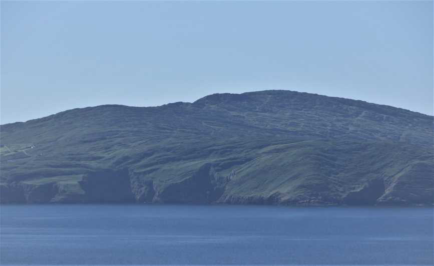
Picture: View from the North
Park in a layby at a bad bend in the road at A (V79100 30650), room for 3 cars. Walk directly uphill, keeping near the crest as its less up and downs.You will still have to zig-zag it upwards across shelves of rock and ledges of bog to the summit cairn
Started the climb of Knocknamadree from the highest part of the road, beside a red holiday house at B (V798 304). There is a space for most of one car on the opposite side of the road from the house on the southern side. The best route is to stay on the ridge away from the inviting grassy vistas that are in fact very spongy, even after a decent summer. I suspect the rain runs off the rock and collects in these culverts and are probably atrocious in winter. There is a small lake on the ascent which has had a causeway built across it to make two lakes. There is a reasonably large cairn at the summit and the views in all directions are superb, possibly the best of any of the Mizen peaks, and that is saying something. Return by the same way. Another possible (steeper) route would be from the road that skirts the mountain on its northern flank. Linkback: mountainviews.ie/summit/942/comment/17611/
Read Less
Read More
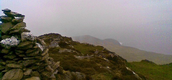
Picture: That rounded bump is Bird Island
See how much she loves you, climb Knocknamaddree!
by jackill
3 Jun 2010
I am forever grateful to my long suffering wife.
She does not enjoy hillwalking and yet has tolerated my early departures to knockwhatsitsname near ballyhellifIknow for many years now.
Last weekend though she surpassed herself. We were away for a romantic weekend in west Cork and on Saturday we spent a glorious day walking the roads of Clear Island then, on the way home on Sunday, she insisted I knock off the summits nearby on the basis that it would need a 2.5 hour drive on my part to get back to the end of the Mizen peninsula.
Knocknamaddree then was climbed from the road at A (V79100 30650), zig-zag it upwards across shelves of rock and ledges of bog to the summit cairn. Linkback: mountainviews.ie/summit/942/comment/5845/
Read Less
Read More
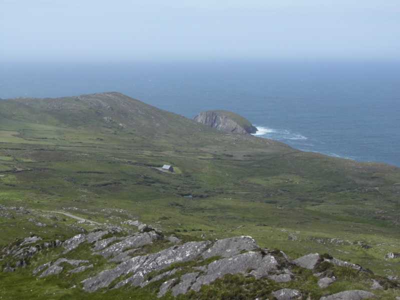
Picture: Little house on the prairie.
Lesser visited gem.
by TommyV
2 Nov 2018
I tackled this hill from the North East side as there was room for parking at C (V79058 30617) and access onto the open hill. Head South for little over a kilometer and you will reach the summit. There are some surprisingly steep parts on this hike so you may find yourself zig zagging a bit. Lovely views over to the Sheeps Head peninsula. Linkback: mountainviews.ie/summit/942/comment/20155/
Use of MountainViews is governed by conditions and a privacy policy.
Read general information about the site. Opinions in material here are not necessarily endorsed by MountainViews.
Hillwalking is a risk sport. Information in comments, walks, shared GPS tracks or about starting places may
not be accurate for example as regards safety or access permission. You are responsible for your safety and your permission to walk.
See the credits and list definitions.


 Our Facebook page.