This website uses cookies, which are small text files that the website puts on your device to facilitate operation. Cookies help us provide a better service to you. They are used to track general user traffic information and to help the website function properly.
Feature count in area: 14, all in Galway,
OSI/LPS Maps: 44, 45, EW-CON
Highest Place: Shannavara 358m
Starting Places (40) in area South Connemara: Angler's Return, Bealagrooaun, Brandy Harbour, Callanatrush Lough, Cashel Church, Cloonsie Quay, Cnoc Mordáin, Derroura Woods, Dogs Bay Beach, Drehidanookera Bridge, Drimmavohaun, Eragh Island South, Fuschia Lane, Glen Trasna Lough, Glencoaghan River Bridge, Gort Mór, Inaghbeg Path, Inchamakinna, Inishlay, Inishnee Bridge, Knockranny Road, Leitir Creamha Rua Lough, Lettercallow School Road, Lettershinna Hill, Loch Con Aortha N, Loch Con Aortha S, Lough Shindilla S, Maumwee Lough, Naughton's Property, Oorid Lough, Pound Road, Ross Quay, Roundstone, Screeb Waterfall, Seecon Wood, Tawnabeg Lough North, Tawnrawer Cartron, The Big Ring, Toombeola Bridge, Water Tank
Summits & other features in area South Connemara: Cen: Kilkieran: Cnoc Mordáin 354m E: Moycullen: Newtown Hill 198m N: Cashel: Cashel Hill 311m, Lettershinna Hill 192m N: Derroura: Cappanalaurabaun 273m, Keeraunnageeragh 305m N: Oughterard: Cloghermore 280m, Knocknasilloge 346m, Knocknalee 291m, Leam Hill 253m N: Shannavara: Knockadav 224m, Shannavara 358m S: Lettermore: Lettermore 117m W: Roundstone: Errisbeg 300m
Note: this list of places may include island features such as summits, but not
islands as such.
Shannavara, 358mHill Seanadh Bhéara A name in Irish,
Place Rating ..
(Ir. Seanadh Bhéara [logainm.ie], 'slope of Béara'), Galway County in Connacht province, in Binnion Lists, Seanadh Bhéara is the highest hill in the South Connemara area and the 1043th highest in Ireland.
Grid Reference L93334 43718,
OS 1:50k mapsheet 45 Place visited by: 24members, recently by: paulbrown, Haulie, markwallace, Fergalh, tphase, TommyV, markmjcampion, Murray-Tucker, erun, sandman, eamonoc, frankmc04, MichaelE, conormcbandon, jimbloomer
I visited this place: NO (You need to be a logged-in member for this.)
Longitude: -9.605383, Latitude: 53.432119, Easting: 93334, Northing: 243718,
Prominence: 301m, Isolation: 2.2km ITM: 493321 743646 Bedrock type: Paragneiss, migmatite, pebble beds, (Cashel Schist Formation) Notes on name: On Tim Robinson's map of Connemara, Seanadh Bhéara (Shannavara) only appears as a townland name. This hill is named Cnoc Úraid. A legend predicts that Cnoc Úraid / Oorid Hill will be the site of the last battle for Christianity. [TR]
Short or GPS IDs, 6 char: Shnvr, 10 char: Shannavara Linkback: https://mountainviews.ie/summit/888/
Gallery for Shannavara (Seanadh Bhéara) and surrounds
Summary
for Shannavara (Seanadh Bhéara):
Rugged hill with good views at the north of a vast, remote-feeling expanse
Summary created by markmjcampion
28 Nov, 2020
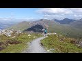
Picture: Shannavara from the boggy south
Shannavara is one of those many low Connemara hills that offer great views. If visited from the south the hill is a steep pull up and it feels like you're as far from civilisation as anyone has ever been but from the north it's less of an effort to ascend (assuming you get permission from this side!) and you will hear plenty of traffic from the N59 to remind you that it's not always easy to escape reality!
S. Park at Gort Mór (L92716 38708) where there is room for two cars. Follow the wide track north as it hugs Lough Inveragleragh narrowing thereafter to a somewhat more intermittent trail, although you will always be able to make out the greenish scar of the next part of the trail further along. It can be very wet in places esp. when there are a lot of post-deluge streams running off the western flanks of Knockadav. The trail eventually swings ENE when it meets a small stream at A (L93096 42620). Cross the stream and ascend any way you chose. It's steep but a lot easier to ascend than descend! Allow 2 hrs to the top. Return the same way or follow track/3133 around to Knockadav for a less steep descent off Shannavara.
N. As of 2018 there are access issues from the north. The two cul de sacs that give access to the north and northeast of the hill are both resident to farmers who will more than likely send you packing but, if you have the time and energy, it's no harm in asking...just let us know how you get on if you do!
This is the first comment on Seanadh Bheara, but somebody obviously beat me to the summit as there are tiny cairns (sitting on rocks) to mark two points competing for the highest!! (they are about 100m apart). Although small in height at 358m, it is an isolated summit and has fabulous panoramic views. The first section of the Maamturks (Corcog to Binn Mhor) looms to the north. The Twelve Bens are also visible, with Ben Lettery and Bengower most prominent on the skyline(west north west). However the views west and south are the most spectacular; Seanadh Bheara is the perfect vantage point for those million or so lakes in South Connemara, as it is much closer than the Maamturks or Bens. I lost count at about ten thousand. The Aran Islands were clearly visible, and the shower that was west of Inis Mor when I was at the summit caught me within 20 mins and before I had reached the car! My point of access was the end of the cul de sac road that leads south east (on average) from the N59 past Oorid Lough (B (L931 450)). I asked for permission to access the hill at the second last house as the start of the walk goes through a farmyard area and there are several gates and fenced enclosures on the first few minutes of the walk. An absolute gem to compete with any in Connemara. Linkback: mountainviews.ie/summit/888/comment/4541/
Read Less
Read More
Access Issues
by TommyV
14 Aug 2017
I was bagging a few hills in the South Connemara on Saturday 12th August. Shannavara was to be my 4th hill of the day. I followed bryanmccabe's directions and met the landowner who was out and about. I asked if it was okay to access the hill through his property (expecting a friendly yes as bryanmccabe had no issues). Instead I was surprisingly met with a friendly no. The farmer was very friendly and explained that he has had issues with walkers bringing dogs onto the land and leaving gates open.There was also a case where one walker hurt his ankle on the farmers property and tried to unsuccessfully to sue the farmer. Due to these reasons the farmer has imposed a blanket ban on walkers accessing the hill through his farm. I just wanted to let the hill walker community know that this is no longer an option to access Shannvara. Does anybody know if the route mentioned by Sandman is still an option? Linkback: mountainviews.ie/summit/888/comment/19682/
Read Less
Read More
Picture: Shannavara cairn
Rain on the way!
by paddyhillsbagger
23 May 2011
After cycling the 75 mile Tour De Lough Corrib what do you do but bag some nearby hills?
Followed bryanmccabe's excellent directions and made it to the top in slightly damper conditions which hindered the fine views.
Rather boggy climb but up and down in hour and a half as was getting cold and wet. Linkback: mountainviews.ie/summit/888/comment/6358/
Read Less
Read More
Picture: View of Shannavara from south of Maam Cross
Low lying but definitely worth the bog slog!
by markmjcampion
21 Nov 2020
I accessed this hill from the south a few years back (around sept 2017) having done a car split earlier in the day. We met the farmer mentioned elsewhere and got a bit of a mouthful from him on access issues and the general blot on the landscape that are hillwalkers! So, it's probably best to follow Bryan's route from C (L93083 45004) or to double back on the route from the south. That said, the farmer was long in the tooth and may either relent in his dotage or forget to proscribe access in his will! Linkback: mountainviews.ie/summit/888/comment/21481/
Read Less
Read More
Picture: Lough Invernagleragh
Third time lucky
by TommyV
29 Oct 2018
Having previously tried to access this hill from North side from the start point mentioned by bryanmccabe, I tried to approach it from the North again from the point mentioned by sandman and again met another farmer who told me the route up this way is all fences with no gates and he would prefer if I didn't go this way. So there was no other option but to approach this hill from the South side at the start point mentioned by sandman. This route involves following an old very faint track North past Lough Ivernagleragh for about 5km, before ascending the hill. Accessing this hill from the South turns a potential 4/5 kilometer hike into a 12 kilometer hike. The old track is flooded in places even so only try this after a period of good weather. Linkback: mountainviews.ie/summit/888/comment/20107/
Use of MountainViews is governed by conditions and a privacy policy.
Read general information about the site. Opinions in material here are not necessarily endorsed by MountainViews.
Hillwalking is a risk sport. Information in comments, walks, shared GPS tracks or about starting places may
not be accurate for example as regards safety or access permission. You are responsible for your safety and your permission to walk.
See the credits and list definitions.


 Add a Place Comment for Shannavara, Seanadh Bhéara


 Our Facebook page.