Donation Request 2024
You do not have to be logged in to donate.
DONATE
Members and Supporters, the MountainViews Committee requests your help to meet the costs of the website and of other activities such as insured events or publications.You do not have to be logged in to donate.
Welcome to MountainViews
If you want to use the website often please enrol (quick and free) at top right.
If you want to use the website often please enrol (quick and free) at top right.
Overview

For more map options click on any overview map area or any detail map feature.
Detail Map Features
Find Suggested Walks
Find hill, mountain, island, coastal feature.
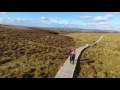
Videos
Recent Contributions
 Get Notifications
Get Notifications
Lake District: Dale Head Horseshoe
Crocknasharragh: Impressive views on nitial ascent.
 Colin Murphy
Crocknasharragh: Fine views on ascent
 Colin Murphy
Lake District: Coledale Horseshoe
Cunnigar: Short trek to summit
 Fergalh
Longish walk to isolated top
 Colin Murphy
Westtown Hill: Tramore's Highest Point
 DeirdreM
Knockbrinnea West Top: Eflanagan on the Knockbrinneas
 eflanaga
Ascending the Knockbrinneas from the north.
 simon3
Knockbrinnea West Top: Larger Twin
 Collaborative entry
Lobawn Loop - Clockwise avoids any steep ascent! Easy stream crossing.
Knockaunanattin West Top: Views, loughs and a navigational aid.
 simon3
Conditions and Info
Use of MountainViews is governed by conditions and a privacy policy.
Read general information about the site.
Opinions in material here are not necessarily endorsed by MountainViews.
Hillwalking is a risk sport. Information in comments, walks, shared GPS tracks or about starting places may not be accurate for example as regards safety or access permission. You are responsible for your safety and your permission to walk.
See the credits and list definitions.
 Visit our Facebook page.
Video display
Fermanagh & South Tyrone
Area W: Derrygonnelly Subarea
Place count in area: 15,
OSI/LPS Maps: 11, 17, 18, 19
Highest place: Belmore Mountain, 398m
Maximum height for area: 398 metres,
Maximum prominence for area: 323 metres,
Places in area Fermanagh & South Tyrone:
Cen: Tempo Hills:Brougher Mountain 317mDerrin 268mStranisk 312mTopped Mountain 277m
E: Aughnacloy:Rehagy Mountain 194m
N: Largy:Largy 230m
NE: Ballygawley Hills:Cappagh Mountain 286mSlievemore 314m
S: Slieve Beagh:Slieve Beagh 380mSlieve Beagh SE Top 373m
W: Derrygonnelly:Belmore Mountain 398mCullen Hill 201mKnockmore 277mLegg 343mTullybrack 386m
Note: this list of places includes island features such as summits, but not islands as such.
Highest place:
Belmore Mountain, 398mPlaces in area Fermanagh & South Tyrone:
Cen: Tempo Hills:
Brougher Mountain 317mDerrin 268mStranisk 312mTopped Mountain 277mE: Aughnacloy:
Rehagy Mountain 194mN: Largy:
Largy 230mNE: Ballygawley Hills:
Cappagh Mountain 286mSlievemore 314mS: Slieve Beagh:
Slieve Beagh 380mSlieve Beagh SE Top 373mW: Derrygonnelly:
Belmore Mountain 398mCullen Hill 201mKnockmore 277mLegg 343mTullybrack 386mNote: this list of places includes island features such as summits, but not islands as such.

Bedrock type: Sandstone with subordinate argillaceous rocks & l, (Glenade Sandstone & Bellavalley Formation (undifferentiated))
The summit is located in the townland of Aghamore. The Discoverer Map shows the name Tullybrack to the NW and Mulderg to the SE. It is not clear which applies to this hill, if either, but the former has been chosen as it is slightly nearer. The hill Sliabh Dá Chon, mentioned in the Annals of the Four Masters, is a lower point in these uplands to the NW. Note that there is also a townland of Tullybrack or Ora More nearby, but this is lower down near Belcoo. Has been called Reyfad. Tullybrack is the second highest hill in the Fermanagh & South Tyrone area and the 985th highest in Ireland.
Linkback: https://mountainviews.ie/summit/856/
COMMENTS for Tullybrack (Tulaigh Bhreac) 1 of 1  Follow this place's comments

|
|
|
|
||
| MountainViews.ie, a Hill-walking Website for the island of Ireland. 2400 Summiteers, 1480 Contributors, maintainer of lists: Arderins, Vandeleur-Lynams, Highest Hundred, County Highpoints etc | |||