This website uses cookies, which are small text files that the website puts on your device to facilitate operation. Cookies help us provide a better service to you. They are used to track general user traffic information and to help the website function properly.
Feature count in area: 15, by county: Fermanagh: 9, Tyrone: 7, Monaghan: 1, of which 2 are in both Fermanagh and Tyrone,
OSI/LPS Maps: 11, 17, 18, 19
Highest Place: Belmore Mountain 398m
Starting Places (15) in area Fermanagh & South Tyrone: Aghanaglack, Carn Road, Carrickreagh Viewpoint, Crackrawer Road, Cullen Hill, Derrin, Dooletter, Largy S, Largy W, Lendrum Bridge Windfarm, Pollnagollum, Screggagh Windfarm, Slievemore, Tempo, Tullybrack
Summits & other features in area Fermanagh & South Tyrone: Cen: Tempo Hills: Brougher Mountain 317m, Derrin 268m, Stranisk 312m, Topped Mountain 277m E: Aughnacloy: Rehagy Mountain 194m N: Largy: Largy 230m NE: Ballygawley Hills: Cappagh Mountain 286m, Slievemore 314m S: Slieve Beagh: Slieve Beagh 380m, Slieve Beagh SE Top 373m W: Derrygonnelly: Belmore Mountain 398m, Cullen Hill 201m, Knockmore 277m, Legg 343m, Tullybrack 386m
Note: this list of places may include island features such as summits, but not
islands as such.
Largy, 230mHill
Place Rating ..
, Tyrone County in Ulster province, in Binnion Lists, Largy is the 1337th highest place in Ireland. Largy is the second most northerly summit in the Fermanagh & South Tyrone area.
Grid Reference H27361 65694,
OS 1:50k mapsheet 17 Place visited by: 22members, recently by: Oscar-mckinney, Carolyn105, trostanite, AntrimRambler, dregishjake, dregish, Colin Murphy, madfrankie, BogRunner1, eamonoc, LorraineG60, MichaelG55, jackill, Aidy, sandman
I visited this place: NO (You need to be a logged-in member for this.)
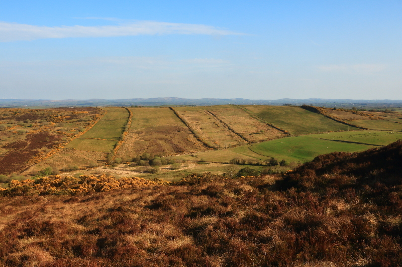
This hill is quite near home for me, and on a Sunday when I couldn't get away for a longer walk, it allowed me to salvage something, offering an extremely quick outing. I went up via a similar route as Fergalh, starting just a bit further east where a wide track has now been cut part of the way up the hill. Literally two minutes up the track, and another minute up the hillside and I'd reached the top. Views were nice but not spectacular. Lough Erne and Legg Hill/Navar viewing point could be seen, but were pretty distant, and almost lost in the haze on the evening I was there. Better than nothing though, and it got me out when otherwise I wouldn't have had the chance. Linkback: mountainviews.ie/summit/1248/comment/18536/
Read Less
Read More
A hill with a lack of nothing !
by Fergalh
29 Dec 2021
Take the road east from Lack and take second right, then first right, drive past quarry and find a spot to park (LargW (H26786 65272)). Then start from here, cross gap in fence and climb to top. Nice views in all directions.
Use of MountainViews is governed by conditions and a privacy policy.
Read general information about the site. Opinions in material here are not necessarily endorsed by MountainViews.
Hillwalking is a risk sport. Information in comments, walks, shared GPS tracks or about starting places may
not be accurate for example as regards safety or access permission. You are responsible for your safety and your permission to walk.
See the credits and list definitions.


 Add a Place Comment for Largy


 Our Facebook page.