Cookies.
This website uses cookies, which are small text files that the website puts on your device to facilitate operation. Cookies help us provide a better service to you. They are used to track general user traffic information and to help the website function properly.
Features
Nearby features appear when you click the map.
Declutter tracks on map.
Place Search
Video
X
Pub: by
Inishowen Area , S: Iskaheen Subarea
Feature count in area: 27, by county: Donegal: 27, Derry: 1, of which 1 is in both Derry and Donegal, OSI/LPS Maps: 2, 3, 4, 6, 7
Highest Place: Slieve Snaght 614.6m

Starting Places (43) in area Inishowen:
Adderville Upper, Barnes Bend, Bunacrick, Butlers Bridge, Carnaghan Presbyterian Church, Castruse Upper, Craignacoolagh, Craignamuck, Croaghglengad West, Crockavishane South, Diarmuid and Gráinne's Bed, Doherty's Dún, Dunree Bay Carpark, EEl Hole, Effishmore Upper, Evishbreedy Bridge, Five Fingers Strand, Gap of Mamore Grotto, Gap of Mamore Road, Gap of Mamore Viewpoint, Glack, Glasmullan, Golan Bridge Track, Goorey Hill, Grania's Gap, Gransha Árd, Green Hill, Leamacrossan Hill East, Lisfannon Beach, Lough Shivnagh, Lough Turk North, Magilligan Point View, Meenabroagh, Meenyollan River, Moor House, Mullagh, Pincher's Corner, Rashenny, Roosky Upper, Rowantree Hill, St Michael's Church, Stroove Beach, Tullagh Beach

Summits & other features in area Inishowen:
Cen: Slieve Snaght: Damph 420m, Slieve Main 514m, Slieve Snaght 614.6m
N: Malin: Croaghglengad 259m, Crockalough 282m, Soldiers hill 174m
NE: North East Inishowen: Crockavishane 322m, Crocknasmug 327.5m, Grinlieve 371m
NW: Urris: Binnion 250m, Bulbin 494m, Coolcross Hill 291m, Croaghcarragh 400m, Crockmain 460m, Dunaff Hill 230m, Mamore Hill 423m, Raghtin More 502m, Slievekeeragh 389m, Urris Hills 417m
S: Iskaheen: Crockglass 397m, Eskaheen Mountain 418m, Greenan Mountain 241m, Holywell Hill 260m, Inch Top 222m, Leamacrossan Hill 392m, Mouldy Hill 312m, Scalp Mountain 484m

Note: this list of places may include island features such as summits, but not islands as such.
Rating graphic.
Scalp Mountain, 484m Hill An Scailp A name in Irish,
Place Rating ..
(Ir. An Scailp [ÉT], 'the cleft' or 'rock shelter'), Donegal County in Ulster province, in Carn Lists, Scalp Mountain is the 617th highest place in Ireland.
Grid Reference C40612 27144, OS 1:50k mapsheet 7
Place visited by: 48 members, recently by: ChrisC, leader1, Colin Murphy, Claybird007, eamonoc, pmeldrum, Fergalh, eejaymm, madfrankie, trostanite, doopa, windy, sperrinlad, MichaelE, jimbloomer
I visited this place: NO (You need to be a logged-in member for this.)
Longitude: -7.364784, Latitude: 55.089918, Easting: 240612, Northing: 427144, Prominence: 289m,  Isolation: 3.8km, Has trig pillar
ITM: 640551 927126
Bedrock type: Dark pelitic & psammitic schist, (Fahan Slate Formation)

  Short or GPS IDs, 6 char: SclpMn, 10 char: SclpMntn

Linkback: https://mountainviews.ie/summit/502/
Gallery for Scalp Mountain (An Scailp) and surrounds
Summary for Scalp Mountain (An Scailp): High point of a ridge.
Summary created by simon3 16 Sep, 2013
            MountainViews.ie picture about Scalp Mountain (An Scailp)
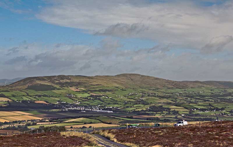
Picture: Scalp is the high point of this ridge, photographed from the SW
Scalp Mountain is the highest point on a ridge stretching approximately west (at Cashel Hill) to east where the ridge turns towards the NE (at Crockglass).

One way of visiting it is to start from around Grania's Gap at around A (C431 277), where a road goes over a col on the ridge, and walk along the rough vegetated skyline to Scalp.

Another way up starts from Green Hl (C396 249). The private access road may have the sign "closed" on it, however to the left of this is the house of the owners of the road, who in the past have readily given permission to use the road, even for walkers to drive up part way.

Scalp and its ridge is an outer wall of [London]Derry separating the city from Donegal. This wall is less controversial and provides a view of both the city and much of the Inishowen peninsula.
Linkback: mountainviews.ie/summit/502/comment/5261/
Member Comments for Scalp Mountain (An Scailp)

            MountainViews.ie picture about Scalp Mountain (An Scailp)
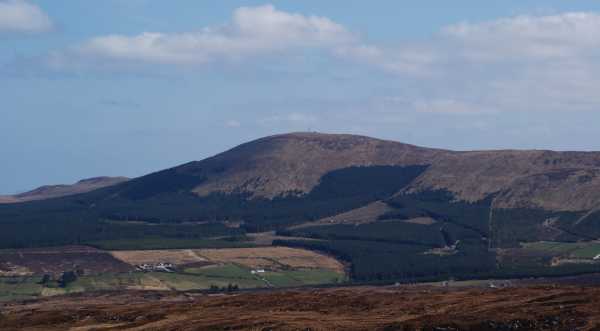
Picture: Eskaheen Mt. from the summit of Scalp Mt.
The soft but very pleasing option!
by Harry Goodman 9 Sep 2010
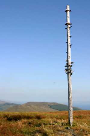
On 2 Sept 2010 my wife and I decided to go and have a look at Scalp Mt. Having read gerrym's comments about an "initially brutal uphill climb" of some 3 miles on a concrete road to the top and having an aversion to road walking I did not savour the prospect of the climb or even more so the descent. I drove to the start of the concrete road B (C249 396) and as suggested by gerrym called at the house on the left just before a sign on the gate indicating that the road ahead was closed. I spoke to the landowners son and he assured me there was no problem in using the concrete road to access the hill and indeed if I wanted to, I could drive to the top. In pointing to the sign that the road was closed he re-affirmed that I could use it to drive up and, if questioned, to say that the owner's son had given me permission. After a very brief consideration of what we should do we opted to drive up part way and in doing so cut out the steep uphill grind on concrete of some 3k. Once past the first set of communications masts the hill flattened out considerably and I decided to park at C (C39896 26670) off road near a stone seat and just over 1k from the summit. From here it was a fairly gentle climb to the second set of communications masts and the end of the concrete road. The high point of the hill lies directly behind the communications compound at D (C40607 27140) and is marked by a high isolated telegraph pole adorned with a number of direction indicators to points in Scotland and much nearer to home in and around Donegal. Although the day was warm and hazy we could see the main Sperrins ridge and closer at hand the Urris Hills, Raghtin More, Bulbin, Slieve Main and Slieve Snaght. Due to the haze the mountains to the W were bearly visable but given a clear day I have no doubt this would be a fine viewing platform from which to see them. When there we also walked out to the trig pillar E (C40687 26966) and, some 50 metres beyond it, to a small rough wooden cross placed there quite recently by some nuns. In total this short walk was only about 2.5 k with 80 metres of climb and, allowing for some time spent wandering around the summit area, could comfortably be done in 45 minutes. When driving down I pulled over to allow a 4wd to pass. The driver was another son of the owner who was going up to do some fencing and he further confirmed that we were welcome to be there. Yes I have been to the top of Scalp Mt. and yes I drove two-thirds of the way there but I have no regrets to have avoided an unecessary bone crunching ascent/descent of 6k on arthritic joints when it could be avoided. For anyone of a like mind I would suggest that, when seeking permission to access the hill, you also ask if you might drive up part of the way. For the purist seeking an off road option to climb this hill, it may be possiblle to access it from Grannia's Gap F (C43100 27700) and climb the ridge S over Rocky Hill and then SE over Nadaphreaghane and then E to Scalp Mt. Linkback: mountainviews.ie/summit/502/comment/6090/
Read Less
Read More

            MountainViews.ie picture about Scalp Mountain (An Scailp)
Picture: Scalp from the west
road to the top
by gerrym 18 Apr 2010
Scalp stands guardian over the gateway to the wonderful Inishowen peninsula and provides a grand viewing platform for modest effort.

This dander follows the access road to the two sets of communication masts atop the 1.5 mile back of the hill. This starts at Green Hl (C396 249) and there is limited parking at a layby a little further along outside a couple of houses. The access road passes a house and has a gate with a large 'closed ' sign on it. This had me slighty worried but a chat with the owner put me at ease. The access road is privately owned and was built by the family to the first masts (operated by Vodafone) and later extended to the top of the hill itself after access was negotiated from the forestry commission. The family then built the masts here themselves to rent out. The road itself was opened for paying traffic for a number of summers but this has ceased due to concerns over insurance. Ther is no real issue with walker access but obviously pays to seek permission of the landowner to use the road to the top!

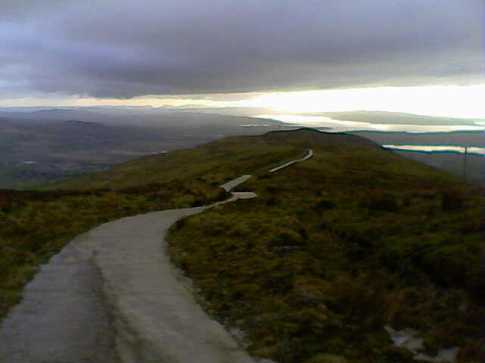
The concrete road is initially brutally straight uphill, burning leg muscles, before it gains height more gradually through a number of hairpin bends. Views over Lough Foyle, Derry City and the Sperrins accompany the walk and this is extended to Lough Swilly and the hills of Inishowen as the lower end of the hill is reached. A walk along the top on the road is relatively easy and offers fantastic views - even on a day with cloud. There are a few large stone seats at good viewing points (from the small quarries used for the road on the way up no doubt) and probably hark back to when the hill was open for business!

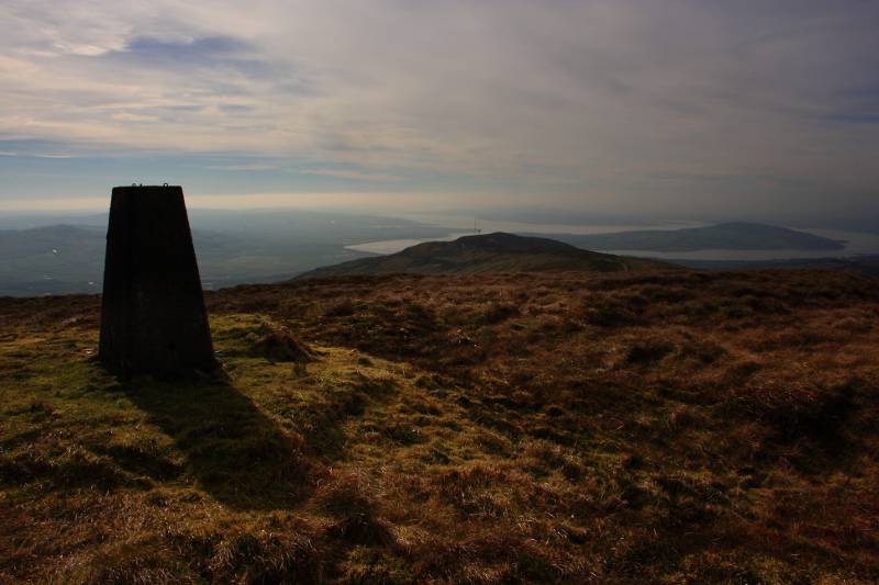
Top reached in 2.78 miles and 55 minutes - more masts and a newly installed wind turbine which was turning furiously in the strong breeze. An isolated telegraph pole marks the top and has a number of waymarkers - Muckish 30miles, Errigal 35 miles, Paps of Jura 80miles and Ben More 120 miles. Today at times i could barely make out the pole as mist swept in but the owner informs me that the Scottish coast is certainly within range of the eye. The trig pillar is located a little way off and reached by a path. This looks out over Derry, Lough Foyle and the Foyle river as it snakes away south - also gives a good perspective on the small hills surrounding the city. A crudely fashioned wooden cross also looks over the city and a number of inscribed pieces of stone are lain at the pillar.

The return journey is very relaxing with views over Inch Island and Lough Swilly, though lower down there is the strain of braking on the steeper sections of the road. All in all 5.5 miles and 1.75 hours. On a clear day i have no doubt the views would be totally stunning - though i am not complaining about today! Linkback: mountainviews.ie/summit/502/comment/4223/
Read Less
Read More

            MountainViews.ie picture about Scalp Mountain (An Scailp)
Picture: Looking from Scalp Mountain to Grannia's Gap
A tough two hours
by Peter Walker 20 Oct 2010
I can confirm the feasibility of Harry Goodman's musings regarding an ascent from Grannia's Gap: park just west of the top of the road where a track leads north (through a gate) to the disused quarry noted under Eskaheen Mountain: I squeezed the car off the road opposite this. A clamber over a gate led to open hillside.

Now, I know it's heresy to suggest it, but the experience leads me to suggest using the elsewhere-mentioned access road for the ascent. My route from the Gap is not horrendously hard, but whether or not you stick to the ridgeline or else attempt to cut across the slope to the final col there's still that annoying feeling of expending much more effort than should really be necessary for a shortish distance and a limited height gain: thick, energy-sapping grass is the order of the day for much of the walk. On my return I decided to cut my losses by using the track marked as starting at (G (C420 271)) (but actually starting from almost the ridge) and then walking up the Grannia's Gap road to regain my car: this was much easier, and fortunately proceeding in this direction meant I didn't see the 'No Trespassing' signs until I reached said tarmac! Linkback: mountainviews.ie/summit/502/comment/6140/
Read Less
Read More

            MountainViews.ie picture about Scalp Mountain (An Scailp)
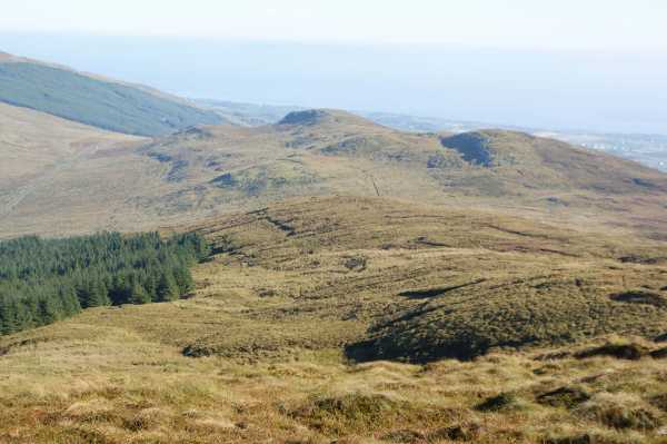
Picture: At the trig pillar, looking down over the Western side of the ridge, over Inch Island.
Mind Your Eyes!
by Aidy 11 Mar 2014
It was too good to waste what felt like the first day of Spring, so took a half day from work, and made for the nearest mountain I could find. From Burnfoot I took the Monreagh Park Road, and after about 1 kilometre, I saw the access road leading up the Southwestern side of Scalp. As the sign advised, I asked for permission at the house on the right, which was duly given by the friendly farmer's son who happened to be passing in a 4x4. Stopping to chat, he also advised taking the car as far as the first mast, where the concrete surface ran out, to avoid an unnecessary part of the walk. On this warm afternoon I took his advice, and thanked him before driving up the steep road. I parked in a laybay just before the concrete surface turned to a rougher track, which i followed for the short distance to the masts. From there, the trig pillar was clearly visible along a further short path.

Despite the haze, views were magnificent over Lough Foyle, Inishowen, Lough Swilly, Inch Island and Greenan Mountain. Huge ravens were very noticable soaring around the summit, and on the way back down I met the farmer's son and his brother going up the road, who stopping for another chat, gave me one explanation for their presence. They said they needed to go up and check the sheep, which on warm days, sometimes lay down, rolled on to their backs, and could not then get up again. As they lay helpless, the ravens would alight and take their eyes. With glee, they said if you happened to become immobile, the ravens would do the same to you! Don't let it put you off though - easy mountain from where I parked with fantastic views. Linkback: mountainviews.ie/summit/502/comment/15915/
Read Less
Read More

            MountainViews.ie picture about Scalp Mountain (An Scailp)
Lalo P'Ley on Scalp Mountain
by Lalo P'Ley 20 May 2007
I went up Scalp after the St.Paddy's weekend storm. It was the first nice day we had in Derry tho' on the hill it was cloudy all around me was sun.
It's not a very challenging walk, took about 2 very casual hrs to reach the top. Quite a view of the Inch and Derry, all along the Swilly.
Good for people to warm up on for bigger climbs. Linkback: mountainviews.ie/summit/502/comment/2706/
Read Less
Read More
EDIT Point of Interest
text
Videos


Recent Contributions
x
Conditions and Info
Use of MountainViews is governed by conditions and a privacy policy.
Read general information about the site.
Opinions in material here are not necessarily endorsed by MountainViews.
Hillwalking is a risk sport. Information in comments, walks, shared GPS tracks or about starting places may not be accurate for example as regards safety or access permission. You are responsible for your safety and your permission to walk.
See the credits and list definitions.

OSi logo
OSNI/LPS logo
Open Street Map
(Various variations used.)
British summit data courtesy:
Database of British & Irish Hills