Donation Request 2024
You do not have to be logged in to donate.
DONATE
Members and Supporters, the MountainViews Committee requests your help to meet the costs of the website and of other activities such as insured events or publications.You do not have to be logged in to donate.
Welcome to MountainViews
If you want to use the website often please enrol (quick and free) at top right.
If you want to use the website often please enrol (quick and free) at top right.
Overview

For more map options click on any overview map area or any detail map feature.
Detail Map Features
Showing 7 items:
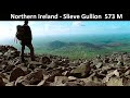
Slieve Gullion 573m,
4995, 13km
2508, 13km
4345, 10km
2449, 10km
3842, 4km
2220, 3km
Slieve Gullion 573m,
Tracks:
Find Suggested Walks
Find hill, mountain, island, coastal feature.
Videos
Recent Contributions
 Get Notifications
Get Notifications
Lake District: Dale Head Horseshoe
Crocknasharragh: Impressive views on nitial ascent.
 Colin Murphy
Lake District: Coledale Horseshoe
Cunnigar: Short trek to summit
 Fergalh
Longish walk to isolated top
 Colin Murphy
Westtown Hill: Tramore's Highest Point
 DeirdreM
Knockbrinnea West Top: Eflanagan on the Knockbrinneas
 eflanaga
Ascending the Knockbrinneas from the north.
 simon3
Knockbrinnea West Top: Larger Twin
 Collaborative entry
Lobawn Loop - Clockwise avoids any steep ascent! Easy stream crossing.
Knockaunanattin West Top: Views, loughs and a navigational aid.
 simon3
Ireland's County Second Summits
 murphysw
Conditions and Info
Use of MountainViews is governed by conditions and a privacy policy.
Read general information about the site.
Opinions in material here are not necessarily endorsed by MountainViews.
Hillwalking is a risk sport. Information in comments, walks, shared GPS tracks or about starting places may not be accurate for example as regards safety or access permission. You are responsible for your safety and your permission to walk.
See the credits and list definitions.
 Visit our Facebook page.
Video display
Gullion
Area SE: Ring of Gullion Subarea
Place count in area: 11,
OSI/LPS Maps: 28, 29, EW-CLY
Highest place: Slieve Gullion, 573m
Maximum height for area: 573 metres,
Maximum prominence for area: 478 metres,
Places in area Gullion:
N: Gullion North:Carrigatuke 365mTullyhappy 209m
SE: Ring of Gullion:Camlough Mountain 423mCotracloghy 225mCroslieve 308mFeede Mountain 233mFoughill 241mHill of Faughart 113mMullaghbane Mountain 243mSlieve Gullion 573mTievecrom 264m
Note: this list of places includes island features such as summits, but not islands as such.
Highest place:
Slieve Gullion, 573mPlaces in area Gullion:
N: Gullion North:
Carrigatuke 365mTullyhappy 209mSE: Ring of Gullion:
Camlough Mountain 423mCotracloghy 225mCroslieve 308mFeede Mountain 233mFoughill 241mHill of Faughart 113mMullaghbane Mountain 243mSlieve Gullion 573mTievecrom 264mNote: this list of places includes island features such as summits, but not islands as such.

Bedrock type: Granite granophyre, (Slieve Gullion Complex)
The Cailleach Bhéirre is remembered in several names on and around Slieve Gullion. A passage tomb on the summit is known as Calliagh Birra’s House. This is one of the highest megalithic tombs in the country (after those on Slieve Donard and the Paps in Kerry). The legend is that when Fionn Mac Cumhaill was enticed inside, he went fresh and youthful but emerged as an exhausted old man. A small lake on the plateau north of the summit is called Calliagh Berra’s Lough. Lower down in the townland of Aghadavoyle on a hillock called Spellick is a rock feature known as the Cailleach Bearea’s Chair. This was regularly visited on 'Blaeberry Sunday', when everybody on the outing would take a turn to sit in the chair. It is recorded by Máire MacNeill as a Lughnasa site (160-61). Slieve Gullion is the highest mountain in the Gullion area and the 354th highest in Ireland. Slieve Gullion is the highest point in county Armagh.
Linkback: https://mountainviews.ie/summit/322/
COMMENTS for Slieve Gullion (Sliabh gCuillinn) 1 2 3 4 5 Next page >>  Follow this place's comments

|
|
|
|
||
| MountainViews.ie, a Hill-walking Website for the island of Ireland. 2400 Summiteers, 1480 Contributors, maintainer of lists: Arderins, Vandeleur-Lynams, Highest Hundred, County Highpoints etc | |||