Members and Supporters, the MountainViews Committee requests your help to meet the costs of the website and of other activities such as insured events or publications.
Short or GPS IDs, 6 char: Ctrclg, 10 char: Ctrclghy Linkback: https://mountainviews.ie/summit/1255/
Gallery for Cotracloghy and surrounds
Summary
for Cotracloghy :
Don't climb it for the views !
Summary created by Harry Goodman
2014-05-31 16:37:31
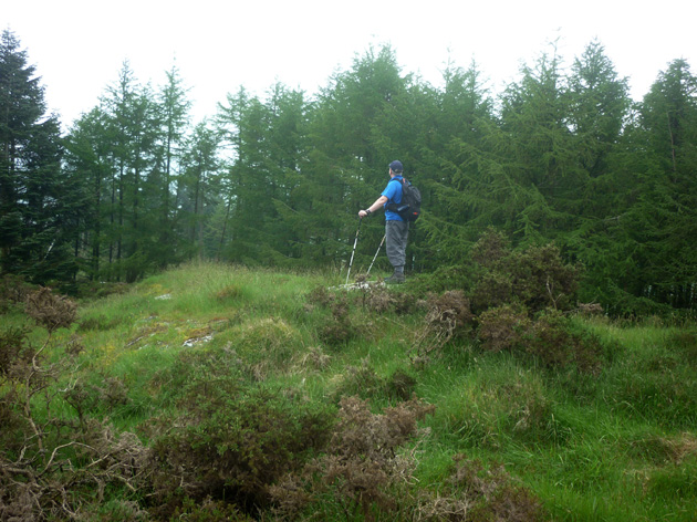
Picture: Topping out on Cotracloghy.
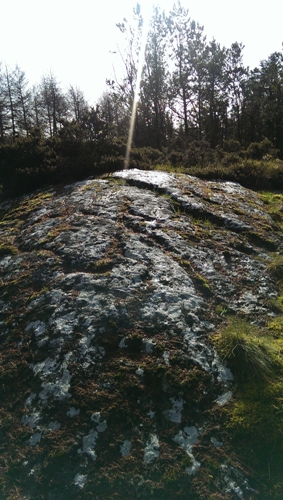
Park off road beside a forest entrance at CrkBroad (J04327 15353) adjacent to an Engineering Workshop. Take the track going SW straight ahead. Where it turns sharply to the left, either leave it and continue up the fence line over rough open ground to meet it again at A (J04074 14977) or follow it up and around to the same point. Continue up along the track to where three large boulders have been placed across it. Just beyond this point note a narrow boggy path going off to the left towards but not into the trees. Follow it B (J03972 14920) before leaving the open ground and going SW into the trees. Although passage through the trees is over rough ground a prominent high embankment soon appears ahead. On reacking it, if the face above is sheer,rocky and uninviting, go right around its edge to soon meet a grassy but equally steep bank that leads up to the top. Although out in open grass and heather covered ground the top is surrounded by trees and lies on a low, level but prominent rocky outcrop which is moss covered and very slippery in wet conditions. Any views to be had are on the open ground on the way up or down with Slieve Gullion particularly prominent. A climb of this hill can easily be included with climbs of other stand alone tops in the area on the same day. These include Mullaghabane Mtn., Faughill, Feede Mtn. and Slievenaglough .
Park at forest entrance CrkBroad (J04327 15353) beside engineering works and ascend directly to summit at C (J03918 14847). If parking outside works please ask for permission. Linkback: mountainviews.ie/summit/1255/comment/15887/
Read Less
Read More
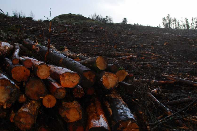
Picture: Top of Hill laid bare
Views restored, at a price!
by eamonoc
12 Dec 2014
Climbed Gortracloghy 11/12/2014, Views from top now restored due to a large ongoing tree felling operation. Was able to follow forest track to its high point and easily attained top via log track laid for forestry machinery through clear felled area close to top. Linkback: mountainviews.ie/summit/1255/comment/17757/
Use of MountainViews is governed by conditions and a privacy policy.
Read general information about the site. Opinions in material here are not necessarily endorsed by MountainViews.
Hillwalking is a risk sport. Information in comments, walks, shared GPS tracks or about starting places may
not be accurate for example as regards safety or access permission. You are responsible for your safety and your permission to walk.
See the credits and list definitions.


 Our Facebook page.