Cookies.
This website uses cookies, which are small text files that the website puts on your device to facilitate operation. Cookies help us provide a better service to you. They are used to track general user traffic information and to help the website function properly.
Features
Nearby features appear when you click the map.
Declutter tracks on map.
Place Search
Video
X
Pub: by
Mangerton Area , Cen: Mangerton Subarea
Feature count in area: 28, all in Kerry, OSI/LPS Maps: 78, 79, EW-KNP, EW-R
Highest Place: Mangerton 838.2m

Starting Places (30) in area Mangerton:
Cummeenboy Stream, Derrycunihy Church, Dunkerron Mid, Garries Bridge, Gowlane School Ruin, Hidden Valley Pet Farm, Inchimore West, Kenmare Bridge, Killarney Hiking Parking Lot, Knockanaskill N, Knocknsallagh Bridge, Loo River Junction, Looscaunagh Lough W, Lough Barfinnihy CP, Lough Guitane E, Lough Guitane SE, Lough Guitane W, Lynes Farm, Mangerton Walk N CP, Mangerton Walk Start, Molls Gap, Muckross Lake S, Old Rail Level Crossing, Poulacapple, River Roughty, Rossacroo na Loo Forest, Sahaleen Bridge, Shaking Rock W, Shronaboy Farm MTB, Torc Waterfall CP

Summits & other features in area Mangerton:
Cen: Dromderlough: Dromderalough 650m, Dromderalough NE Top 654m, Dromderalough NW Top 625m, Knockbrack 610m, Knockrower 554m, Shaking Rock 402m
Cen: Inchimore: Inchimore 256m
Cen: Mangerton: Glencappul Top 700m, Mangerton 838.2m, Mangerton North Top 782m, Stoompa 705m, Stoompa East Top 608m
NE: Crohane: Bennaunmore 454m, Carrigawaddra 425m, Crohane 650m, Crohane SW Top 477m
NW: Torc: Cromaglan Mountain 371m, Torc Mountain 534.8m, Torc Mountain West Top 479.4m
SE: Esknabrock: Esknabrock 406m
SW: Peakeens: Derrygarriff 492m, Derrygarriff West Top 382m, Foardal 409.8m, Knockanaguish 509m, Peakeen Mountain 554.7m, Peakeen Mountain Far NW Top 525.5m, Peakeen Mountain North-West Top 522.7m, Peakeen Mountain West Top 538.7m

Note: this list of places may include island features such as summits, but not islands as such.
Rating graphic.
Mangerton, 838.2m Mountain An Mhangarta A name in Irish,
Place Rating ..
(Ir. An Mhangarta [OSI], poss. 'the long-haired (mountain)'), Kerry County in Munster province, in Arderin, Vandeleur-Lynam, Irish Highest Hundred Lists, Mangerton is the highest mountain in the Mangerton area and the 26th highest in Ireland.
Grid Reference V98034 80782, OS 1:50k mapsheet 78
Place visited by: 757 members, recently by: TommyMc, Marykerry, eimirmaguire, endaodowd, maryblewitt, kieran117, rhw, MartMc, Deirdreb, orlaithfitz, maoris, Kenod, Carolineswalsh, knightsonhikes, Brianodonovankil
I visited this place: NO (You need to be a logged-in member for this.)
Longitude: -9.48441, Latitude: 51.970284, Easting: 98035, Northing: 80782, Prominence: 583.2m,  Isolation: 1.2km, Has trig pillar
ITM: 498007 580842
Bedrock type: Green sandstone & purple siltstone, (Glenflesk Chloritic Sandstone Formation)
Notes on name: The Horses' Glen and the Devil's Punchbowl carve deep hollows on the north side of Mangerton, but the southern flanks form a huge plateau, one of the most extensive areas of mountain wilderness in Ireland. Herds of red deer and sika deer roam this moorland. The northern slopes of Mangerton were the scene of a great battle in 1262 between the MacCarthys and Geraldine (Anglo-Norman) forces, following the rout at Callan Glen near Kilgarvan the previous year. The battle-site is known as Tooreencormick (Tuairín Cormaic, 'little field of Cormac') from the fall of Cormac MacCarthy, brother of the chief Fingen MacCarthy, in this battle. The battle was less decisive than Callan, but as a result of these two encounters the Anglo-Normans were kept out of South Kerry and West Cork for over three centuries afterwards. An alternative interpretation of An Mhangartach may be worth considering: it could be the noun mangart + suffix -ach. Dinneen defines mangart as 'movement' or 'shaking'. Thus the adjective (not listed in any dictionary) could mean 'moving', 'shaking', 'quaking'. This could refer to the physical movement of the bog which is prevalent on the southern slopes, but perhaps it could be understood figuratively as 'vacillating' or 'fickle'. For further information on the name, see Paul Tempan, Some Notes on the Names of Six Kerry Mountains, JKAHS, ser. 2, vol. v (2005), 5-19.
  Short or GPS IDs, 6 char: Mngrtn, 10 char: Mangerton

Linkback: https://mountainviews.ie/summit/25/
Gallery for Mangerton (An Mhangarta) and surrounds
Summary for Mangerton (An Mhangarta): Bulky flat-top with stunning corries at eastern edge of Killarney National Park
Summary created by markmjcampion, scapania, jackill 2023-08-17 11:35:09
            MountainViews.ie picture about Mangerton (<em>An Mhangarta</em>)
Picture: Mangerton and the Horse's Glen in the snow
Mangerton is a large mountain to the S of Killarney with great northern corries and superb views of the national park and the mountains of Iveragh and Beara. Take care of steep ground to the North in bad weather.

N. Park at Mangerton Walk Start (V98398 84844) and take the path S to the Devil's Punchbowl A (V97556 81719). Expansive views of the lakes of Killarney open up as you ascend. From the punchbowl either head up the steep W ridge which quickly relents to give an easy walk over the boggy plateau to the trig point. Or head even more steeply up the semi arête between the punchbowl and the Horses' Glen with stunning views of the glen. Descend the opposite way you ascended to complete a fine circuit of the punchbowl. 1.5 - 2 hrs to summit.

N. From the same car park head S for about 1km before heading E through the relatively flat expanses of wet, heather strewn bog to reach the outflow of Lough Garagarry at B (V99544 83571) Cross the river and head up onto the N spur of Stoompa. Follow a feint, intermittent track to the summit and follow the rim of the enormous corrie around to Mangerton. Allow 2.5 - 3 hrs - 9k route with 800m ascent.

W. Park at Killarney Hiking Parking Lot (V96689 84255) and take forest trails to C (V96983 83608) - here the trail up to the Devil's Bit starts. After reaching open country at D (V97113 83352) head roughly ESE to join the path to the punchbowl. Descend via the first route to E (V98292 85334) and navigate the forest tracks back to your car.

Notable tracks include track/2161 and track/3289.
Linkback: mountainviews.ie/summit/25/comment/4785/
Member Comments for Mangerton (An Mhangarta)
Comment create / edit display placeholder

            MountainViews.ie picture about Mangerton (<em>An Mhangarta</em>)
Geo on Mangerton
by Geo 9 Feb 2009
From Stoompa in the mist along the top of the glen, the cloud cleared off as we approached the turn where Mangerton begins to rise up and over the loughs below, cliffs towering fearfully but safely to our right. Lunch taken in the lee of a sheltered outcrop of rock, before we made the assault on the highest point of the walk. Rather than hug the cliff tops to the right we moved out a couple of hundred metres and trudged through the peat hags as they appeared in the several inches of snow. Although the snow was at times a drag and some of us went up to our knees at times it was still a relatively easy ascent towards Mangerton's summit. Eventually a long wand appeared upright and several metres tall ahead, slipping in and out of view as the mist came and went in the fresh northerly. At the summit we took our pic's and thought about what was next. 5 or 6 minutes brought us in a direct line over to the the cliff edge overlooking the arete snaking across the Mangerton's NE top. A short look around and a bit of head scratching and we agreed it would be too risky in the strong wind and the icy conditions to take this route, so we followed becketts path down to the outlet of the Devils Punchbowl. For chapter 3 see Mangerton North Top. Linkback: mountainviews.ie/summit/25/comment/3574/
Read Less
Read More

            MountainViews.ie picture about Mangerton (<em>An Mhangarta</em>)
Picture: The Devil's Punch Bowl
beckett on Mangerton
by beckett 8 Aug 2006
I tried this walk on Sunday 16th of July. It was a beautiful summer morning with clear blue cloudless skies; it might explain some of my enthusiasm for the place. From Killarney take the Kenmare road. Pass Muckross House and then take the first sharp left after Moll Darcy's pub. After a little while you meet a fork in the road with a sign for Mangerton. Take the road to the right and drive along this road until you meet a narrow car park (F (V984 857)). If this car park is full, you may also be able to park further down the road on the right hand side.
Walk down the road until you meet a track running up into the open ground. This track ( Mangerton Walk Start (V984 848)) will take you all the way to the Devil's punchbowl. The start of the walk presents you with a gradual climb as the track meanders either side of a largely dry riverbed. The Lakes of Killarney emerge spectacularly on your right as you gradually gain height. The track winds on upwards until you eventually reach the punchbowl. As you round that final twist of the track, you are presented with a most wonderful sight. The lake meets you almost at eye level, and on the bright summer morning that I made this trip it looked at it's very best with the sun glimmering on its surface and its rocky walls sweeping impressively down on to its edges.
You then climb above the western ridge with a precipitous drop to your left and bear south west for Mangerton peak (G (V980 807)). Mangeton peak is rather non-descript with a radio mast and a cairn marking its highest point. On a clear day, the mast is visible from the walk along the edge of the punchbowl. From Mangerton you can go back to the spur (H (V982 813)) between Lough Erhogh and the punchbowl. This is a beautiful section of the walk with Lough Erhogh on your right walled by near vertical slopes of rock and the deep blue corrie lake of the punch bowl on your left contrasting magnificently against the green and silver grey of the surrounding landscape. Follow the perimeter of the bowl back to the point where it narrows to a river. If it is a windy day, there is the shell of a long decayed stone dwelling that offers some respite from the elements. You eventually meet the track that brought you to this wonderful place.

It is busy when I visited in July with lots of walkers and sightseers. Despite this, the place exudes a wonderful tranquillity and a captivating sense of calm. Its one of those areas of natural beauty that keeps those of us compelled to wonder the mountains coming back again and again in search of gems. Linkback: mountainviews.ie/summit/25/comment/2453/
Read Less
Read More

            MountainViews.ie picture about Mangerton (<em>An Mhangarta</em>)
Picture: Inspirational folk ahead
Inspiration in unlikely places
by wicklore 19 Feb 2013
In his book ‘Reach for the Sky’, Pat Falvey describes his first hillwalk in Ireland. He was in a deep depression following the failure of his business. The banks were circling like crows to take his home and everything he had. His secretary’s father, Val Deane, persuaded Pat to join the Cork Mountaineers on a climb of Mangerton to ‘take his mind off things’. Pat didn’t want to go but kept his absently-minded given word.

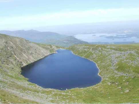
Pat describes how his indifference and depression lifted, and how rising exhilaration set in as he climbed higher and higher. “Behind me the spell weaving beauty of Muckross Lake and Lough Guitane and below, deep in the glen, the necklace formation of Lough Garagarry, Lough Managh and Lough Erlogh drained all negative thoughts from my mind..” Pat describes his feeling of elation as he stood on his first summit, Mangerton. He also describes the breathtaking view, including the Magillicuddy Reeks to the west. When Pat discovered they contained the highest summit in Ireland he climbed Carrauntoohil the following week.

Pat is clearly a man who strives to be the best and ‘reaches for the sky’ - climbing Ireland’s highest mountain on his second ever day hillwalking attests to this relentless drive to the top- and a admitted compulsive nature. (He also describes in the book starting a 13 hour Alps climb in an ‘ alcohol-induced fug’ after three hours sleep that resulted in a dramatic rescue for him and his team). His description of climbing Mangerton is worth noting, especially his dawning recognition of hillwalking as a source of positive mental and physical energy.

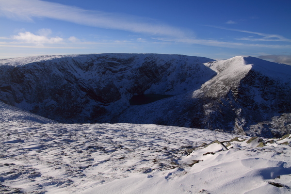
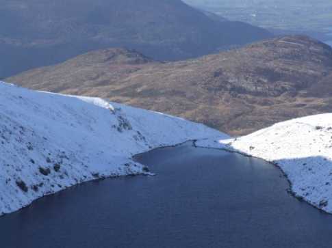
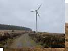
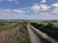
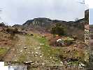
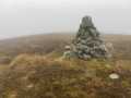
I was thinking about Pat as I climbed higher on my own first ascent of Mangerton last week. Despite cold and wet weather I enjoyed the long haul up from the north, following the rising trail up to the Devils Punch Bowl. The cloud boiled and swirled in the cliffs and crags to my left as I climbed the final section to Mangerton’s boggy plateau. Later I sat on some rocks in the col between Mangerton and the North Top. As I sat on the boulders I met four members of Bishopstown Hillwalking Club as they arrived up the hill. One of them was a lady called Kathleen who one of her friends described as ‘well into her seventies’ and who has had two hip replacements. Asking her if she was enjoying the walk she commented ‘it wasn’t this wet when I came up last week’. I was struck by what Kathleen was achieving – not only to be out walking in tough weather conditions on a big mountain, but to do so in her seventies and with two replacement hips!

Pat Falvey is inspirational in his ‘reach for the sky’ and ‘anything is possible’ mentality. This will appeal to, and inspire those who dream of conquering the world. But for those with lesser, but equally valid, ambitions of simply overcoming adversity and returning to normal, then people like Kathleen are also an inspiration and a role model to us all. Well done Pat and Kathleen. Linkback: mountainviews.ie/summit/25/comment/14929/
Read Less
Read More

            MountainViews.ie picture about Mangerton (<em>An Mhangarta</em>)
Picture: devils bowl in snow
dexterg on Mangerton
by dexterg 9 Mar 2009
This was early afternoon in February commencing a descent having climbed up via Stoompa and the ridge, great conditions in the Kerry hills. interesting contrast to Becketts pic earlier. Dex & Fern Linkback: mountainviews.ie/summit/25/comment/3634/
Read Less
Read More

            MountainViews.ie picture about Mangerton (<em>An Mhangarta</em>)
pln@qad.com on Mangerton
by pln@qad.com 2 Dec 2003
Followed the Tooreencormick Bridle Path up to the Devil's Punch Bowl. Very good path for most of the way. Headed upto the Peak following anti-clockwise from the Lake. The climb up was fine, although some hail did hit near the top. The descent on Eastern side of the punch bowl was loose and in many cases had become a stream. We took it slow and got down fine, but this would be a potentially dangerous section of the walk - especially after heavy rains. Great walk and a great mountain. I recommend Joss Lynam's "Best Irish Walks" for the route desciption. Linkback: mountainviews.ie/summit/25/comment/762/
Read Less
Read More
EDIT Point of Interest
text
Videos


Recent Contributions
x
Conditions and Info
Use of MountainViews is governed by conditions and a privacy policy.
Read general information about the site.
Opinions in material here are not necessarily endorsed by MountainViews.
Hillwalking is a risk sport. Information in comments, walks, shared GPS tracks or about starting places may not be accurate for example as regards safety or access permission. You are responsible for your safety and your permission to walk.
See the credits and list definitions.

OSi logo
OSNI/LPS logo
Open Street Map
(Various variations used.)
British summit data courtesy:
Database of British & Irish Hills