This website uses cookies, which are small text files that the website puts on your device to facilitate operation. Cookies help us provide a better service to you. They are used to track general user traffic information and to help the website function properly.
Feature count in area: 38, all in Donegal,
OSI/LPS Maps: 1, 11, 2, 6
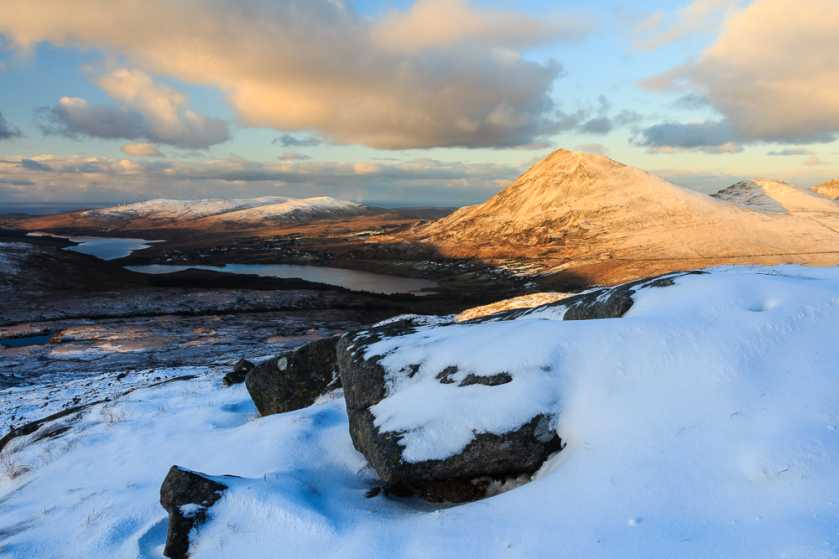
Highest Place: Errigal 751m
Starting Places (29) in area Derryveagh Mountains: Aleahan Lough, Altderry Bridge, An Chúirt Hotel, Astelleen Burn Waterfall, Derryreel Lough, Dunlewy Lough E, Dunlewy Lough Viewing Point, Errigal Hostel, Errigal Parking, Glenveagh Bridge, Glenveagh National Park SW, Glenveigh Castle, Keel Lough N, Losset North, Lough Acrobane Farmhouse, Lough Ascardan, Lough Barra Slipway CP, Lough Barra W, Meenagoppoge Burn Bridge, Mín Uí Bhaoil, Muckish Gap Shrine, Muckish North Access Road, Nabrackbaddy Lough, Procklis Lough, River Barra Bridge NE, River Barra Bridge SW, Sand Lough NE, Sruhancrolee Bridge, Stranamarragh Bridge
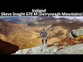
Summits & other features in area Derryveagh Mountains: Cen: Dooish: Dooish 651.5m, Dooish SW Top 528m, Dooish SE Top 553.9m, Saggartnadooish 506.4m, Saggartnadooish East Top 478.9m Cen: Errigal: Errigal 751m, Mackoght 555m Cen: Glenveagh Upper: Crockfadda 485m, Crockfadda East Top 454m, Crockballaghgeeha 480m, Crockmulroney 430m, Staghall Mountain 486m, Croaghnasaggart 480m, Maumlack 480m Cen: Lough Keel (Meencorwick): Crockglass 489m, Addernymore 416m, Grogan More 457m, Crocknafarragh 517m, Crocknafarragh SE Top 470m Cen: Slieve Snaght: Crockfadda 529m, Crockfadda NE Top 502m, Crocknasharragh 495m, Drumnalifferny Far NE Top 535m, Bingorms 578m, Drumnalifferny Mountain 596m, Drumnalifferny Mountain NE Top 585m, Slieve Snaght 678m N: Aghla: Aghla Beg 563.9m, Aghla Beg South Top 602.3m, Aghla More 581.2m, Ardloughnabrackbaddy 472.5m, Crocknalaragagh 470.6m N: Muckish: Muckish 667.1m, Croaghaderry 222m, Crockawama 238m, Derryreel 232m S: Doochary: Croaghleconnell 266m S: Dungloe: Crovehy 315m
Note: this list of places may include island features such as summits, but not
islands as such.
Drumnalifferny Mountain NE Top, 585mMountain Sliabh Dhroim na Luifearnaí (mullach thoir thuaidh) A name in Irish,
Place Rating ..
For origin of name, see Sliabh Dhroim na Luifearnaí / Drumnalifferny Mountain., Donegal County in Ulster province, in Arderin Beg, Irish Best Hundred Lists, Sliabh Dhroim na Luifearnaí (mullach thoir thuaidh) is the 327th highest place in Ireland.
Grid Reference B93691 16004,
OS 1:50k mapsheet 1 Place visited by: 72members, recently by: Carolineswalsh, adam.mann, Krzysztof_K, miriam, farmerjoe, Arcticaurora, Grumbler, AntrimRambler, leader1, annem, AlanReid, david bourke, eflanaga, thrifleganger, eamonoc
I visited this place: NO (You need to be a logged-in member for this.)
Nothing better than being in the mountains in the snow! I walked up from Dunlewey Church, on the rising ground to the south west of the Poison Glen. It was hard enough going in the snow, with deep drifts at times, over a couple of false summits, but it was worth every bit of the effort. The views were stunning in the snow, particularly around the Poison Glen, across to Errigal, and over Dunlewey. I also encountered deer several times. Linkback: mountainviews.ie/summit/1409/comment/19822/
Read Less
Read More
More of a challenge than you might think!
by millsd1
25 Aug 2015
Climbed Drumnalifferney N.E. top 24/8/2015 as part of a circuit comprising Crockfadda, Crockfadda N.E., Slieve Snaght, Drumnalifferney and Bingorms. (Car parked at Barra Slip (B929 124)).
Starting from Drumnaliffreney (A (B933 156)) and referring to OSI sheet 1, I had laid off courses to the north and east around the little lake shown at approx B (B933 158). (This is actually the largest of 3 small lakes in the area).
Due to several fault lines approx 5 m wide and deep at right angles to the route, the approximately 1000m round trip took about 15 minutes longer than anticipated. A challenging little extension to the circuit! Linkback: mountainviews.ie/summit/1409/comment/18268/
Use of MountainViews is governed by conditions and a privacy policy.
Read general information about the site. Opinions in material here are not necessarily endorsed by MountainViews.
Hillwalking is a risk sport. Information in comments, walks, shared GPS tracks or about starting places may
not be accurate for example as regards safety or access permission. You are responsible for your safety and your permission to walk.
See the credits and list definitions.


 Our Facebook page.