This website uses cookies, which are small text files that the website puts on your device to facilitate operation. Cookies help us provide a better service to you. They are used to track general user traffic information and to help the website function properly.
Feature count in area: 14, all in Galway,
OSI/LPS Maps: 44, 45, EW-CON
Highest Place: Shannavara 358m
Starting Places (40) in area South Connemara: Angler's Return, Bealagrooaun, Brandy Harbour, Callanatrush Lough, Cashel Church, Cloonsie Quay, Cnoc Mordáin, Derroura Woods, Dogs Bay Beach, Drehidanookera Bridge, Drimmavohaun, Eragh Island South, Fuschia Lane, Glen Trasna Lough, Glencoaghan River Bridge, Gort Mór, Inaghbeg Path, Inchamakinna, Inishlay, Inishnee Bridge, Knockranny Road, Leitir Creamha Rua Lough, Lettercallow School Road, Lettershinna Hill, Loch Con Aortha N, Loch Con Aortha S, Lough Shindilla S, Maumwee Lough, Naughton's Property, Oorid Lough, Pound Road, Ross Quay, Roundstone, Screeb Waterfall, Seecon Wood, Tawnabeg Lough North, Tawnrawer Cartron, The Big Ring, Toombeola Bridge, Water Tank
Summits & other features in area South Connemara: Cen: Kilkieran: Cnoc Mordáin 354m E: Moycullen: Newtown Hill 198m N: Cashel: Cashel Hill 311m, Lettershinna Hill 192m N: Derroura: Cappanalaurabaun 273m, Keeraunnageeragh 305m N: Oughterard: Cloghermore 280m, Knocknasilloge 346m, Knocknalee 291m, Leam Hill 253m N: Shannavara: Knockadav 224m, Shannavara 358m S: Lettermore: Lettermore 117m W: Roundstone: Errisbeg 300m
Note: this list of places may include island features such as summits, but not
islands as such.
Newtown Hill, 198mHill Cnoc an Bhaile Nua A name in Irish,
Place Rating ..
baile - townland, town, homestead; nua - new; cnoc - hill, Galway County in Connacht province, in Binnion Lists, Cnoc an Bhaile Nua is the 1403th highest place in Ireland. Cnoc an Bhaile Nua is the most easterly summit and also the second most southerly in the South Connemara area.
Grid Reference M18388 33902,
OS 1:50k mapsheet 45 Place visited by: 18members, recently by: Wilderness, TommyV, markmjcampion, conormcbandon, bryanmccabe, markwallace, Jamessheerin, juliewoods, moggy40, moggy40t, Cathal-Kelly, sandman, paddyhillsbagger, eamonoc, deirdrenig
I visited this place: NO (You need to be a logged-in member for this.)
Longitude: -9.226243, Latitude: 53.349266, Easting: 118388, Northing: 233902,
Prominence: 105m, Isolation: 7.2km ITM: 518355 733928 Bedrock type: Rock xenoliths, (Zone rich in country rock xenoliths) Notes on name: http://www.logainm.ie/ga/1398676
Short or GPS IDs, 6 char: Nwt198, 10 char: NwtwnHi198 Linkback: https://mountainviews.ie/summit/1296/
Gallery for Newtown Hill (Cnoc an Bhaile Nua) and surrounds
No summary yet for this place
.
Member Comments for
Newtown Hill (Cnoc an Bhaile Nua)
I started from the North at A (M17631 34375). Asked a local farmer who informed me hill was commonage and named Oldtown Hill. No problem with access but wet underfoot. Lovely sweeping views of Lough Corrib, Galway Bay and the Burren beyond. Linkback: mountainviews.ie/summit/1296/comment/18456/
Read Less
Read More
Connemara magic
by Fergalh
27 Sep 2022
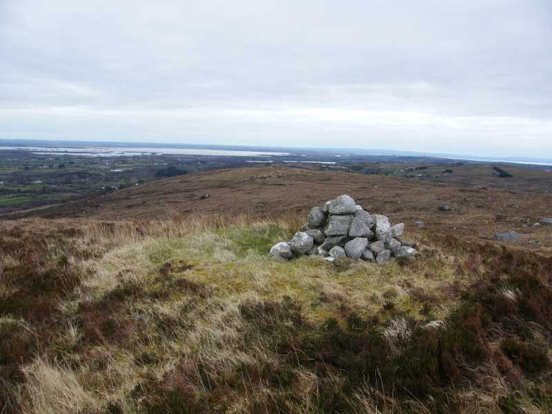
Take first left after Moycullen, then park at Drm'Vohn (M18665 33010) near some houses in a row. Proceed through bog and fields to top behind marked with cairn. Linkback: mountainviews.ie/summit/1296/comment/15977/
Read Less
Read More
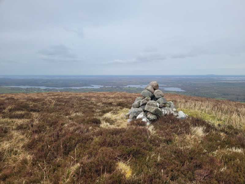
Picture: Ross Lake and Lough Corrib in the background
Unpleasant Experience
by TommyV
16 Apr 2023
I parked at the South side of this hill a little bit further down the road from the spot mentioned by Fergalh. I followed a road past a few houses and a farm that leads to a gate out onto the hill at B (M17798 33146). There was a beware of the bull sign on the gate but when you see the terrain you would wonder if any cattle could survive in it. Perhaps the sign is a deterrent to anybody stupid enough to want to bag this hill. A slog through some wet, boggy, heathery ground for about a kilometre will have you to the top. I went down a different way to make a bit of a loop of the walk but I wouldn't recommend this. All in all a very forgettable experience. Linkback: mountainviews.ie/summit/1296/comment/23906/
Use of MountainViews is governed by conditions and a privacy policy.
Read general information about the site. Opinions in material here are not necessarily endorsed by MountainViews.
Hillwalking is a risk sport. Information in comments, walks, shared GPS tracks or about starting places may
not be accurate for example as regards safety or access permission. You are responsible for your safety and your permission to walk.
See the credits and list definitions.


 Our Facebook page.