This website uses cookies, which are small text files that the website puts on your device to facilitate operation. Cookies help us provide a better service to you. They are used to track general user traffic information and to help the website function properly.
Summits & other features in area North East Midlands: Cen: Ballyjamesduff: Aghalion Hill 249m Cen: Oldcastle: Mullaghmeen 258m, Slieve Na Calliagh 276m, Spire of Lloyd 131m, The Hill of Mael 241m E: Kingscourt: Carrickleck Hill 173m N Cen: Cavan Town: Shantemon 218m, Slieve Glah 320m, Tievenanass 261m NE: Ballybay: Bunnanimma 268m NE: Carrickmacross: Corduff 243m NE: Castleblaney: Mullyash Mountain 317m NE: Cen Bailieborough: Cornasaus 339m, Taghart South 290m NW Cen: Arva: Bruse Hill 260m NW: Aughavas: Lugganammer 190m S Cen: Crookedwood: Cruckboeltane 199m, Knockeyon 214m S: Westmeath South West: Knockastia 200m SE: Boyne Valley: Hill of Slane 160.4m, Mount Oriel 251m, Tara 155m W: Ardagh: Bawn Mountain 200m W: Drumlish: Corn Hill 278m
Note: this list of places may include island features such as summits, but not
islands as such.
Taghart South, 290mHill
Place Rating ..
, Cavan County in Ulster province, in Binnion Lists, Taghart South is the 1184th highest place in Ireland.
Grid Reference H73094 00484,
OS 1:50k mapsheet 35 Place visited by: 28members, recently by: trostanite, Jai-mckinney, Oscar-mckinney, Carolyn105, osullivanm, TommyMc, Harry Goodman, briankelly, abcd, LorraineG60, MichaelG55, Pepe, jackill, conormcbandon, bryanjbarry
I visited this place: NO (You need to be a logged-in member for this.)
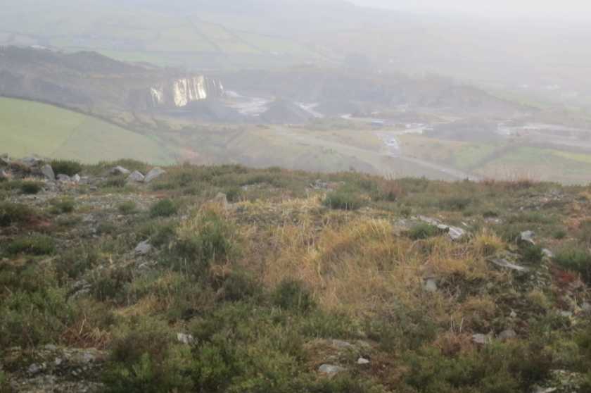
Parked at A (H730 002) between the DEEP QUARRY KEEP OUT sign and walked 200 mtrs to the summit. Taghert is a working quarry and the quarry works extend almost to the summit. On the way back I noticed a roadway at B (H733 013), this might provide a more discreet passageway to the summit. Linkback: mountainviews.ie/summit/1156/comment/15790/
Read Less
Read More
Picture: Taghart South Quarry and hill.
Bag it while you can.
by paddyhillsbagger
16 Mar 2014
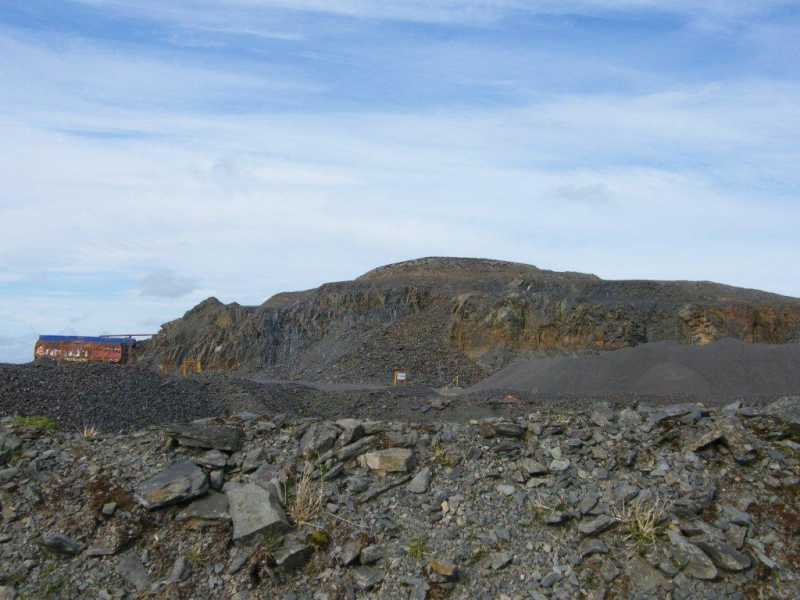
This top can only be bagged by ignoring the warning signs associated with a working quarry. There was also a planning notice on a post for a proposed wind farm to add to the mix. The only pleasant view I had was of a soaring buzzard above the site. Linkback: mountainviews.ie/summit/1156/comment/15925/
Read Less
Read More
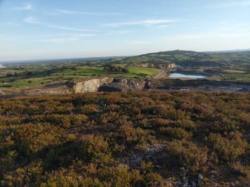
Picture: View towards Loughanleagh
Only one way up
by TommyMc
19 Sep 2019
The only practical way to access this hill is from near the locked quarry gates on the road in front of it. I attempted it across the fields and scrub to the north via the adjacent masts, and the combination of furze, long grass, brambles and the odd wet ditch made for an unpleasant walk that I couldn't recommend to anyone.
On the bright side, quarrying seems to have permanently ceased on the hill itself, although the quarry approx a half-mile to the south is as busy as ever, and there are extensive views in all directions. What I saw of the quarry did not suggest any particularly dangerous hazards. Linkback: mountainviews.ie/summit/1156/comment/20653/
As Muschi stated in his comments this is a working quarry and at present the summit is approx one rock blast away from becomming one of the lowest summits in the north midlands. Linkback: mountainviews.ie/summit/1156/comment/15883/
Use of MountainViews is governed by conditions and a privacy policy.
Read general information about the site. Opinions in material here are not necessarily endorsed by MountainViews.
Hillwalking is a risk sport. Information in comments, walks, shared GPS tracks or about starting places may
not be accurate for example as regards safety or access permission. You are responsible for your safety and your permission to walk.
See the credits and list definitions.


 Our Facebook page.