This website uses cookies, which are small text files that the website puts on your device to facilitate operation. Cookies help us provide a better service to you. They are used to track general user traffic information and to help the website function properly.
Feature count in area: 19, all in Cork,
OSI/LPS Maps: 84, 85, 88, 89
Highest Place: Mount Gabriel 407m
Starting Places (14) in area Mizen/Sheeps Head: Ahakista Pier, Brow Head Watch Tower, Cahergal, Carr Clós Dún Óir, Coosacuslaun Bay, Derrylahard East, Durrus Village, Kilcrohane, Letter Cillin CP, Mount Corrin Road, Mount Gabriel Road, Sheeps Head Turning Point, Sherkin Island Pier, Sui Finn Car Park
Summits & other features in area Mizen/Sheeps Head: NE: Mizen NE: Derrylahard East 301m, Knockaughna 268m, Mount Corrin 284m, Mount Gabriel 407m, Mount Kid 296.1m NW: Sheeps Head: Ballyroon Mountain 239m, Caher Mountain 338m, Fahane 233m, Gouladane 303m, Seefin 345m S: Cape Clear: Cnoicín an tSeabhaic (Clear Island) 160m S: Knockomagh: Knockomagh 197m S: Sherkin: Slievemore (Sherkin Island) 101m SW: Mizen SW: Brow Head 108m, Knockaphuca 237m, Knockatassonig 207m, Knocknamaddree 313m, Lackenakea 164m, Mizen Peak 232m
Note: this list of places may include island features such as summits, but not
islands as such.
Gouladane, 303mHill
Place Rating ..
, Cork County in Munster province, in Binnion Lists, Gouladane is the 1155th highest place in Ireland. Gouladane is the second most northerly summit in the Mizen/Sheeps Head area.
Grid Reference V86800 42100,
OS 1:50k mapsheet 85 & 88 Place visited by: 36members, recently by: Oscar-mckinney, Kirsty, Carolyn105, maoris, daitho9, annem, kmicheal, learykid, jackos, jlk, ciarraioch, Deise-Man, ilenia, MichaelG55, LorraineG60
I visited this place: NO (You need to be a logged-in member for this.)
Parked at start of old green road A (V889 437) then followed Sheep's Head Way marker posts to summit. Up and down easily in two hours. Unfortunately we had low cloud and therefore low visibility but on a good day the view over Bantry Bay would be outstanding. Linkback: mountainviews.ie/summit/1138/comment/20888/
Read Less
Read More
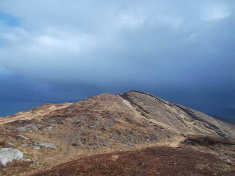
Picture: The view of Gouldane from the nearby top to the west
Worth the effort....
by Fergalh
15 Oct 2020
Climbed this in March when ground was wet, followed sheeps head way from south West .Parked at B (V853 411) Ground is okay on Top but the slopes can be difficult with wet elephant grass at the beginning. Linkback: mountainviews.ie/summit/1138/comment/20919/
Use of MountainViews is governed by conditions and a privacy policy.
Read general information about the site. Opinions in material here are not necessarily endorsed by MountainViews.
Hillwalking is a risk sport. Information in comments, walks, shared GPS tracks or about starting places may
not be accurate for example as regards safety or access permission. You are responsible for your safety and your permission to walk.
See the credits and list definitions.


 Our Facebook page.