This website uses cookies, which are small text files that the website puts on your device to facilitate operation. Cookies help us provide a better service to you. They are used to track general user traffic information and to help the website function properly.
Feature count in area: 31, by county: Leitrim: 22, Sligo: 10, of which 1 is in both Sligo and Leitrim,
OSI/LPS Maps: 16, 17, 25, 26
Highest Place: Truskmore 647m
Starting Places (22) in area Dartry Mountains: Aghavoghil Middle, Arroo Trail CP, Ballaghnatrillick, Ballintrillick Forest, Barrs East, Castletown, Crumpaun, Curraghan Road, Dough Mountain NW, Dough Mountain West, Drumcliff River Road, Eagles Rock, Edenbaun, Glencar Waterfall, Gleniff Horseshoe Road, Lough Cloonaquin North, Luke's Bridge, Mountain Wood, Poulveha River, Thur East, Tormore Car Park, Truskmore Transmitter Entrance
Summits & other features in area Dartry Mountains: N: Truskmore: Gortnagarn 445m, Tievebaun 611m, Truskmore 647m, Truskmore SE Cairn 631m NE: Arroo Keeloges: Aganny Top 482m, Aghalateeve 432m, Agow Top 423m, Arroo Mountain 523m, Conwal North 421m, Crocknagapple 372m, Keeloges 452m NW: Benbulbin: Annacoona Top 597m, Benbulbin 526m, Benwiskin 514m, Benwiskin South Top 508m, Kings Mountain 462m SE: Manorhamilton Hills: Ballaghnabehy Top 413m, Benbo 415m, Dough Mountain 462m, Lackagh Mountain 449m, Larkfield 305m, Naweeloge Top 441m, Thur Mountain 442m SW: Castlegal Hills: Copes Mountain 452m, Crockauns 463m, Hangmans Hill 400m, Keelogyboy Mountain 438m, Keelogyboy Mountain Far East Top 418m, Keelogyboy Mountain NE Top 435m, Keelogyboy Mountain SW Top 417m, Leean Mountain 417m
Note: this list of places may include island features such as summits, but not
islands as such.
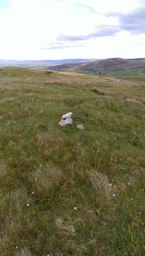
Crocknagapple, 372mHill
Place Rating ..
, Leitrim County in Connacht province, in Binnion Lists, Crocknagapple is the 1016th highest place in Ireland.
Grid Reference G88777 44361,
OS 1:50k mapsheet 16 Place visited by: 11members, recently by: conormcbandon, magnumpig, FrankMc1964, eamonoc, Hilldweller, frankmc04, chalky, Garmin, sandman, leader1, Fergalh
I visited this place: NO (You need to be a logged-in member for this.)
Joe is the farmer that lives on the cul-de-sac adjacent to where i parked (A (G87796 43520)) who gave me permission to enter his land and access the summit (B (G88777 44361)) via the lower track on left of parking spot. As is the normal conclusion to hill bagging lower summits if you get permission from the landowner whose land the summit is situated on there is never the need to cross fences except in very rare circumstances.For such a low hill fine views can be had. Linkback: mountainviews.ie/summit/1080/comment/16067/
Use of MountainViews is governed by conditions and a privacy policy.
Read general information about the site. Opinions in material here are not necessarily endorsed by MountainViews.
Hillwalking is a risk sport. Information in comments, walks, shared GPS tracks or about starting places may
not be accurate for example as regards safety or access permission. You are responsible for your safety and your permission to walk.
See the credits and list definitions.


 Our Facebook page.