Cookies.
This website uses cookies, which are small text files that the website puts on your device to facilitate operation. Cookies help us provide a better service to you. They are used to track general user traffic information and to help the website function properly.
Features
Nearby features appear when you click the map.
Declutter tracks on map.
Place Search
Video
X
Pub: by
Dunkerron Mountains Area , SW: Scarriff Subarea
Feature count in area: 65, all in Kerry, OSI/LPS Maps: 78, 83, 84, 85, EW-KNP, EW-R
Highest Place: Stumpa Dúloigh 784m

Starting Places (66) in area Dunkerron Mountains:
Ballaghasheen Coilte, Ballaghasheen Pass Viewpoint, Ballaghbeama Gap, Bohacullia, Bridia Valley End, Cahersavane Road, Cahersavane Schoolhouse, Cloon Lough NE, Cloon Lough SE, Coad Cemetery, Coad Road End, Com an Chiste, Coomaclarig Bridge, Coomnahorna River, Coomyanna Bridge, Dereenavurrig, Derreendarragh Church, Derrynane Quay, Dunkerron Mid, Eagles Lough Access Trailhead, Esknaloughoge Forest Trailhead, Fermoyle Farm, Foot Stick Ford Road, Gap of Dunloe Head of, Glashaknockbrassel Stream, Glasheenoultagh Stream, Gortaclohane Lane End, Gortaclohane Lane NE Branch, Gortagowan Wood, Gowlane School Ruin, Gowlanes Wood, Graces Landing, Inchimore West, Isknagahinney Lough E, Kenmare Bridge, Knockanamadane, Knockanaskill N, Knocknasullig, Knocknsallagh Bridge, Laghtacallow, Lissatinnig Bridge Boreen, Looscaunagh Lough W, Lough Barfinnihy CP, Lough Brin S, Lough Coomeen SE, Lough Dromtine NE, Lough Dromtine SE, Lough Fada N, Lough Iskanamacteery N, Lough Iskanamacteery NW, Lough Reagh N, Maghanlawaun Bridia Valley, Molls Gap, Ochtiabh Road, Poulacapple, River Owroe Source, River Sneem Fermoyle Loop, Rossacoosane Mid, Sahaleen Bridge, Scarriff Island, Shamrock Farmhouse B&B, Sneem, Tooreenboy Lough, Tooreennafersha Mid, Tooreennafersha South, Waterville Promenade

Summits & other features in area Dunkerron Mountains:
Knocknagantee Near West Top 628m
Cen: An Bheann Mhór: An Bheann Mhór 674.7m, An Bhinn Láir 514m, Coomcallee 648.9m, Beann na Stiocairí 673.1m, Coomnahorna 590m, Glanbeg 485.8m, Slievenashaska 578m, Slievenashaska South Top 565.4m
Cen: Knocknagantee: Knockmoyle 682.1m, Finnararagh 667m, Cnoc Breasail 591m, Knocknagantee 674.3m, Knocknagantee West Top 553m, Coomnacronia 636m, Coomura Mountain 666m
Cen: Mullaghanattin: An Cnoc Riabhach 534m, Beann 752m, Beann Far SW Top 636.2m, Beann NE Top 692m, Beann South Top 639m, Beann SW Top 657m, Sallagh 570m, Mullaghanattin 773m, Mullaghanattin East Top 594m, Sallagh South-West Top 543m
E: Kenmare: Gortamullin 205m, Knockanaskill 356m, Letter South 362m
N: Knocknacusha: Knocknacusha 547m
NE: Knocknabreeda Ridge: Crossderry 489m, Knocknabreeda 569m, Mothaillín 506m
NE: Knocknagapple: Bascadh 595m, Bascadh West Top 569m, Boughil 631m, Cnoc na gCapall 639m, Knocklomena 641m
NE: Stumpa Dúloigh: Broaghnabinnia 745m, Knockaunanattin 569m, Knockaunanattin West Top 466.1m, Stumpa Dúloigh 784m, Stumpa Dúloigh SE Top 780m, Stumpa Dúloigh SW Top 663m
SW: Caherdaniel: Farraniaragh Mountain 468m, Eagle Hill 155m, Reenearagh 162m, Beenarourke 304m, Knocknasullig 117m, Cahernageeha Mountain 498.7m
SW: Coad ( Castle Cove ): Beenrour 418m, Eagles Hill 549m, Mullaghbeg 509m
SW: Coomduff: Coomduff 244m
SW: Deenish: Deenish Island (2) 144m
SW: Esknaloughoge: Esknaloughoge 416m, Esknaloughoge North Top 420m
SW: Scarriff: Scarriff Island 252m
SW: Sneem: An Bheann Mhór 309.3m, Dereenavurrig Hill 261m, Knockanamadane 270m, Knocknafreaghane 316.5m, Knocknagullion 413m
SW: Staigue: Staigue Top 459m, Staigue NE Top 435m

Note: this list of places may include island features such as summits, but not islands as such.
Rating graphic.
Scarriff Island, 252m Hill An Scairbh A name in Irish,
Place Rating ..
(Ir. An Scairbh [logainm.ie], poss. 'rough place'), Kerry County in Munster province, in Binnion, Irish Islands Lists, Scarriff Island is the 1279th highest place in Ireland. Scarriff Island is the most southerly summit and also the most westerly in the Dunkerron Mountains area.
Reachable "On Foot " Y
Grid Reference V44376 55202, OS 1:50k mapsheet 84
Place visited by: 9 members, recently by: DavidWalsh, chalky, Conor74, kernowclimber, mcrtchly, dbloke, wicklore, Peter Walker, jackill , Island visited by 10 members.
I visited this place: NO (You need to be a logged-in member for this.)
, I visited this island: NO
Longitude: -10.253098, Latitude: 51.728125, Easting: 44376, Northing: 55202, Prominence: 252m,  Isolation: 2.3km
ITM: 444363 555266
Bedrock type: Green sandstone & siltstone, (St. Finans Sandstone Formation)
Notes on name: Why Scariff is so named is something of a mystery, as it is quite some distance from the mainland in deep water. One possible solution is to interpret the name as Ir. garbh, 'rough', with a prosthetic s-, as happens with many other words, such as teach and creag.
  Short or GPS IDs, 6 char: ScrfIs, 10 char: ScrfIslnd

Linkback: https://mountainviews.ie/summit/1000/
Gallery for Scarriff Island (An Scairbh) and surrounds
No summary yet for this place .
Member Comments for Scarriff Island (An Scairbh)
Comment create / edit display placeholder

            MountainViews.ie picture about Scarriff Island (<em>An Scairbh</em>)
Picture: Towards the Scarriff Steps
Mind the Goats
by wicklore 25 Jul 2011
‘Mind the goats’ the man said cheerily. ‘They’re not used to people so they might go for you’. And he shoved off from the island, leaving us to our fate. And these weren’t typical goats. They were the big hairy kind, the strong kind with massive curved horns. The kind of goats that when they appear out of the shrouding mist look big and scary and make you stand ever so subconsciously closer to the next person. As we ascended Scarriff I noticed that the goats initially appeared in 1’s and 2’s before slipping away into the cloud. Each time they reappeared there were more of them. ‘They’re grouping for an all out counter-assault’ I whispered to my fellow walkers. ‘They won’t take this invasion of their territory lightly.’ But the goats played a diplomatic hand. They chose to wait and ascertain our motive for being there, before deciding their own move. And they discovered our motive was benign- to simply have the unique joy of climbing to the top of Scarriff Island. We meant no harm to the goats, the bird population, the flora, or the plentiful butterflies. And so the goats left us in peace and we left them in peace, giving each other something to talk about in the days ahead.

It’s not often, nay rarely, that humans land on this island. But some do, and the evidence of their passing is there to see. Scarriff has the remains of a dwelling. This family left in the 1920’s under a Government relocation scheme, supposedly after a resident had to swim several miles ashore to seek help for an ill family member. Their ruined home remains, along with overgrown stone walls which are home to some of the island’s many nesting birds. It was emotional to stand at their former home and imagine what life was like for the children growing up there. I could almost hear their laughter as I imagined them running up and down the steep grassy slopes above their house

There is evidence of more recent activity too – modern post and wire fencing is erected here and there, its purpose unclear. However the island was used periodically for grazing sheep so perhaps this fencing is a leftover from those times. But all of this has little impact on the 365 acre island – most of the time that you are walking you will see nothing but the high grass, heather and gorse that cover the land. The goats will appear sporadically and disappear just as quickly. And of course you will have the eternal accompanying sounds of the myriad of birdlife that choose this as their home.

Scarriff is an island almost completely encircled by cliffs and insurmountable rocks. But someone in the distant past thoughtfully carved out some tentative steps in one section of gentle sloping rock, making access a little less slippery. It was here that our boatmen dropped us with their friendly warning about the goats. Reaching the summit in the cloud, we found an unmarked grassy mound. We chose to leave it as we found it, and took nothing but precious memories. Linkback: mountainviews.ie/summit/1000/comment/6433/
Read Less
Read More

The violent history
by Conor74 27 Jul 2011
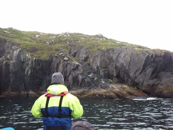
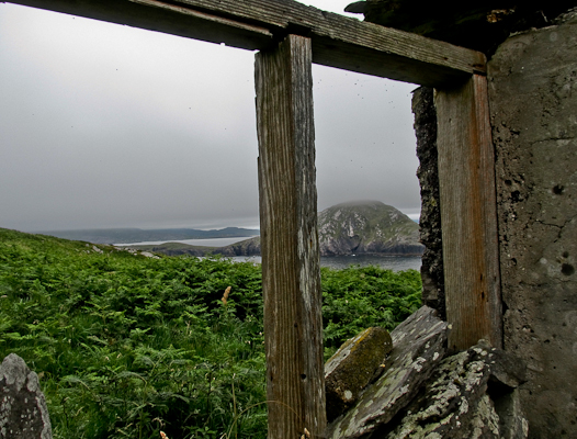
Richard Mersey, in his "Hills of Cork and Kerry" refers to an event in medieval times involving John Arundel, Knight of Cornwall (not sure that title is accurate) who pillaged a convent in England, sailed to Ireland where he threw the nuns overboard to lighten the ship during a storm, and who landed on this island only to be dragged off it and to his death by a wave. There is no indication as to how accurate this version is, but it would be rather interesting to speculate if the Oratory, whose ruins we passed, would have stood gazing down on the scene. Anyway, I just had to check this one out a little more, and Wikepedia obliges with 2 different entries...

1. Sir John Arundell of Lanherne (died 1379), was an English naval commander...celebrated for his repulse of the French fleet off the coast of Cornwall in 1379... Having, according to Thomas Walsingham's story, profaned a convent at or near Southampton, and carried off many of its occupants, the fleet was pursued by a violent tempest, when the wretched nuns who had been carried off were thrown overboard to lighten the ships. The vessels were, however, wrecked on the Irish coast, according to some authorities near Scariff, but according to others at Cape Clear Island. Sir John Arundell, together with his esquires, and other men of high birth, were drowned, and twenty-five ships were lost with most of their crews.

2. He was born in Etchingham, Sussex, England to Richard Fitzalan, 10th Earl of Arundel and his second wife Eleanor of Lancaster (Eleanor Plantagenet).

Being in command of a naval expedition in aid to the Duke of Brittany, he defeated the French fleet off the coast of Cornwall.

Commanding a force with the purpose of bringing relief to the Duke of Brittany, Sir John was compelled to wait for stronger winds. During this wait he decided to take refuge in a nunnery, where his men "took no notice of the sanctity of the place and... violently assaulted and raped" those they found inside. Further to this Sir John "allowed his men to ransack the countryside as they liked and to impoverish the people". When the force eventually set out to sea, carrying with them goods stolen from a nearby church and under a pronouncement of excommunication from the wronged priests, the expedition was caught in a storm. Thomas Walsingham reports that during the panic of the storm, Sir John murdered those of his men who refused to make for shore for fear of being shipwrecked upon the rocks. Subsequently, after safely arriving on an island off the Irish coast, Sir John and his boat captain were swept back into the sea and drowned. He was buried in Lewes, Sussex.

Source'The Chronica Maiora of Thomas Walsingham, 1376-1422', ed. & trans. J. Taylor, W. Childs & L. Watkiss Linkback: mountainviews.ie/summit/1000/comment/6435/
Read Less
Read More

            MountainViews.ie picture about Scarriff Island (<em>An Scairbh</em>)
Picture: Mountainviewers reach new heights
First Ascent
by mcrtchly 25 Jul 2011
As we approached Scarriff Island it appeared almost ominously through the fog ahead of us. As we got closer we could see that the island was draped in cloud which looked to me almost like some land that 'time forgot'. We landed on the NE coast of Scarriff , half expecting to meet some prehistoric creatures but we only found a herd of goats (along with the resident seabirds) and followed a SW line for about 1.6km to the summit. The going was a bit harder than Puffin Island, which we had already done on the same day, mainly because the extensive cover of long grass, bracken, gorse and heather which was sodden from the fog shrouding the island. Although there were no views from the summit (because of the fog) the views from lower down gave a stunning perspective of the coastline and an appreciation of the isolation of the family who lived on the island until the early C20th. Once again thanks to Wicklore for organising the visit. Linkback: mountainviews.ie/summit/1000/comment/6432/
Read Less
Read More

            MountainViews.ie picture about Scarriff Island (<em>An Scairbh</em>)
Picture: dead eyes
Supervalu and chocolate
by jackill 25 Jul 2011
Back in 1911 Lawerence Shea and his wife Bridget would have looked out of this bedroom window at Deenish Island.
He could not read or write and spoke only Irish. Five of his seven living children recorded in the census could and spoke Irish and English.
How alien would our lifes today seem to these people
In 1901 the same Sheas were living on the mainland in the townland of Coomatloukane.
Two shepherds father and son John and Patrick Galvin shared the house on the island at that time.
One of our boatmen said that a story goes locally that one of the Galvins once swam to the mainland to get help for a family member with appendicitis.

Thatch gone now, and only one window with a frame. Linkback: mountainviews.ie/summit/1000/comment/6429/
Read Less
Read More

Long live the Goats
by chalky 31 Jul 2015
Des O'Shea operates a RIB from Wave Crest campsite, Caherdaniel ,www.ribtrips.ie and took me to Deanish first then on to Scarriff which has a natural harbour near the NE corner . Presumably the Goats are keeping the vegetation in check so easier going than Deanish. Mass is held every year in the ruined house on the island ,this year 100 attented ! Linkback: mountainviews.ie/summit/1000/comment/18217/
Read Less
Read More
EDIT Point of Interest
text
Videos

Recent Contributions
x
Conditions and Info
Use of MountainViews is governed by conditions and a privacy policy.
Read general information about the site.
Opinions in material here are not necessarily endorsed by MountainViews.
Hillwalking is a risk sport. Information in comments, walks, shared GPS tracks or about starting places may not be accurate for example as regards safety or access permission. You are responsible for your safety and your permission to walk.
See the credits and list definitions.

OSi logo
OSNI/LPS logo
Open Street Map
(Various variations used.)
British summit data courtesy:
Database of British & Irish Hills