- Home
- Main Display
- Main Display (Old)
- Find a Walk
- Display INTRODUCTION
- DONATE
- Click below for your
profile & contributions
guestuser- New
- Tracks, Walks
- Challenge
- Community
- Lists & Logs
- Popular Lists:
- County Highpoints
- Range & Area Highpoints
- Local 100
- Highest Hundred
- Vandeleur-Lynams
- Arderins
- Carns
- Best rated
- Irish 900 up
- Irish Island
- Munros
- All Lists
- Shorter Irish
- County Highpoints
- Range & Area Highpoints
- Highest Hundred
- Local 100
- Local 100 (pre2014)
- Local Historical Cultural
- Best rated
- Irish 900 up
- Larger Irish
- Arderins
- Arderin Begs
- Arderins + Arderin Begs
- Vandeleur-Lynams
- Vandeleur-Lynams + Arderins
- Carns
- Binnions
- Highest 50 per Province
- Island Features
- Irish Island
- Coastal Hills
- Irish 600 up
- Irish 500 up
- British
- Munros
- British 600 up
- British 500-600
- British Marilyns
- Comprehensive
- All Irish summits
- All Irish features
- All British summits
- All Britain+ Ireland
- Special
- Analysis List
- Simple Irish Listings
- Simple Irish & British Listings
-
- More
- Motley Views
Welcome to MountainViews
If you want to use the website often please enrol (quick and free) at top right.OverviewFor more map options click on any overview map area or any detail map feature.Detail Map FeaturesShowing 17 of a total of 48 items:
Mullaghcleevaun 846.7m, Moanbane 703m, Silsean 698m, Black Hill 602.2m, Sorrel Hill 599.5m, Lugnagun 446.2m, Carrigleitrim 408m,Tracks:4531, 23km 2248, 21km 2864, 20km 3826, 19km 3765, 17km 4448, 17km 4240, 17km 4189, 16km 2354, 16km 2293, 16km Find Suggested Walks
Find hill, mountain, island, coastal feature.Videos


Recent Contributions
 Get Notifications
Lamb Knowe: Short trek from Tods Knowe
Dunsink and Killegar
Tods Knowe: Long and heather bash descent to summit
Lanzarote: Femés to Puerto Calero via Lomo del Pozo.
Broad Law: Do not approach on a misty day
Broad Law: Straight forward track to the summit
East Cairn Hill: Two summits on this hill 500 metres apart
Lake District: Grasmere Round
West Cairn Hill: Follow the wall
Lake District: Langdale South
Cairnpapple Hill: Head for Ballinacrieff Hill
Crocknasleigh: short hill with long views
Conditions and Info
Use of MountainViews is governed by conditions and a privacy policy.
Read general information about the site.
Opinions in material here are not necessarily endorsed by MountainViews.
Hillwalking is a risk sport. Information in comments, walks, shared GPS tracks or about starting places may not be accurate for example as regards safety or access permission. You are responsible for your safety and your permission to walk.
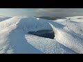
See the credits and list definitions.Video displaymarch-fixer: Track 4408 in area near Sorrel Hill, Wicklow (Ireland)Sorrel Hill Circuit Length: 13.1km, Creator time taken: 3h53m, Ascent: 600m,
Descent: 605m
Places: Start at O0122911023, Sorrel Hill, Black Hill, end at Start
Logged as completed by 1
 With restrictions on how far we can circumnavigate our area, this local circuit provides stunning views, reasonable length and good lonlieness. This was a good choice to banish the cobwebs at the start of the New Year.
Starting from Richardson's shop in Lacken you will access the Mass Path within 20 meters of your car. Follow this new path up on to the saddle of Carrig. There is then a defined track heading east for the summit of Sorrell. From there head south south east to summit Black Hill.
From here you will need your compass/GPS to meet up with the end of the Green Road. Track east to the head of Cook Brook just below The Brushes. There is a fairly decent track leading down the west side of the brook. This track leads you to the end of Broe's Lane. Follow the Lake Drive Road back to Lacken.COMMENTSNo comments uploaded yet.NOTE: ALL information such as Ascent, Length and Creator time taken etc should be regarded as approximate. The creator's comments are opinions and may not be accurate or still correct.
Your time to complete will depend on your speed plus break time and your mode of transport. For walkers: Naismith's rule, an approximate though often inaccurate estimate, suggests a time of 3h 37m + time stopped for breaks
NOTE: It is up to you to ensure that your route is appropriate for you and your party to follow bearing in mind all factors such as safety, weather conditions, experience and access permission.
* Note: A GPS Height in the elevation profile is sourced from the device that recorded the track. An "SRTM" height is derived from a model of elevations for parts of the earth. More detail Height layer: © MapTiler

MountainViews.ie, a Hill-walking Website for the island of Ireland. 2500 Summiteers, 1480 Contributors, maintainer of lists such as: Arderins, Vandeleur-Lynams, Highest Hundred, County Highpoints etc

 Fergalh
 Fergalh
 simon3
 Fergalh
 Fergalh
 Fergalh
 Fergalh
 Fergalh
 Collaborative entry
 Visit our Facebook page.