This website uses cookies, which are small text files that the website puts on your device to facilitate operation. Cookies help us provide a better service to you. They are used to track general user traffic information and to help the website function properly.
Peter Walker: Track/3736 in area near Dartry Mountains (Ireland)
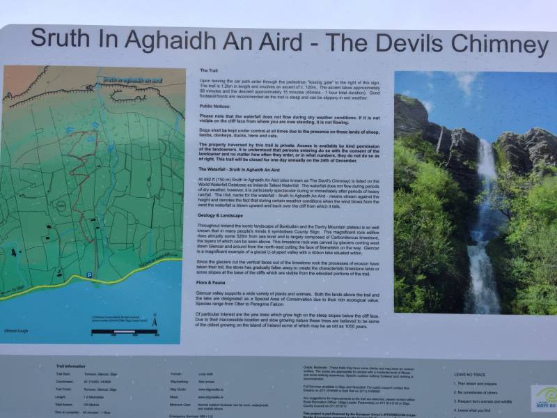
Sruth in Agaidh an Aird (The Devil's Chimney)
Ascent: 102m,
Length: 2.1km,
Creator time taken: 29m37s
Descent: 171m,
Time predicted from Naismith's rule: 0h 36m + breaks
Click here to rate track
PlacesStart at Tormore Car Park (Tormore CP) G74483 43714, end at Start
Track Rating ..
[RWD version 1 ]
Noticeboard at the bottom...if you can't see this, you're somewhere else
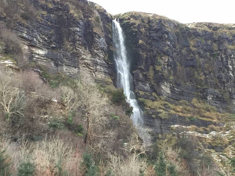
Many have driven along the N16 to or from Sligo and noticed the signs beckoning around to the north side of Glencar Lough to visit the Glencar Waterfall, and a decent spectacle it is, with its woodland setting and (more often than not) an ice cream van in the car park. But the motorist might also see something a bit further away than a signpost. For not too far to the west of the aforementioned cataract is an entirely greater sort of cascade (given the right conditions), a mare's tail plunging around 150m down the cliffs, hugely impressive and hugely conspicuous if it's flowing (there's just a black streak left in a dry spell). This is Sruth in Agaidh an Aird, the Devil's Chimney, and it's comfortably higher than the Powerscourt Waterfall.
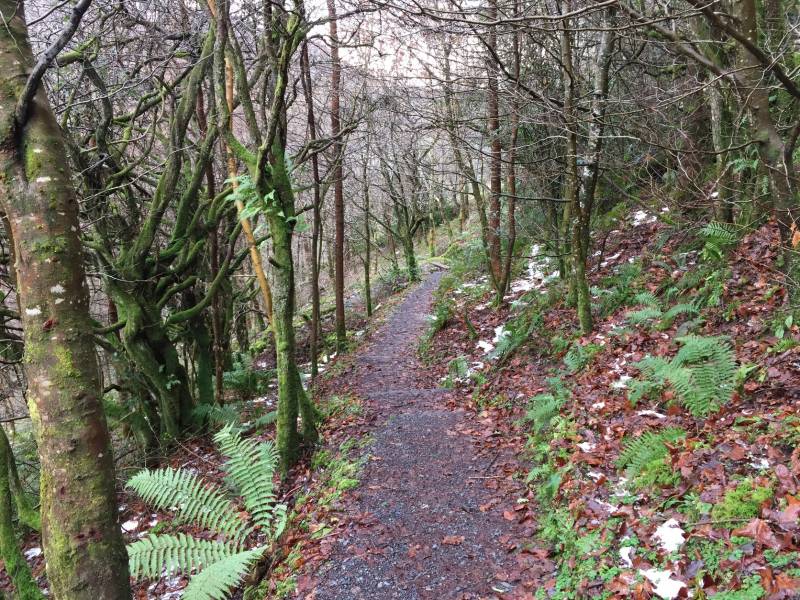
The path
A local landowner has cottoned onto this and built a path across their land to various viewing platforms below the falls. This is very well constructed, generally gently uphill with a few brief steeper sections moderated by steps. As things stand the closest viewpoints are still not up close and personal with the falls, but provide a far better view than the road...a planning application is in to extend the path further, possibly to the very foot of the falls, or perhaps even to the top. Regardless, the loop in the top of the existing path provides plenty of opportunity to admire both the falls and some lovely views along Glencar.
Sruth in Agaidh an Aird
There is sufficient marked parking at the foot of the path. Recommended.
Editing Details for track/3736
NOTE: ALL information such as Ascent, Length and Creator time taken etc should be regarded as approximate. The creator's comments are opinions and may not be accurate or still correct.
Your time to complete will depend on the speed of the slowest plus break time and your mode of transport.
NOTE: It is up to you to ensure that your route is appropriate for you and your party to follow bearing in mind all factors such as safety, weather conditions, experience and access permission.
Uploaded on: Wed, 28 Feb 2018 (18:55:19), Linkback: https://mountainviews.ie/track/3736/
* Note: A GPS Height in the elevation profile is sourced from the device that recorded the track. An "SRTM" height is derived from a model of elevations for parts of the earth. More detail
Use of MountainViews is governed by conditions and a privacy policy.
Read general information about the site. Opinions in material here are not necessarily endorsed by MountainViews.
Hillwalking is a risk sport. Information in comments, walks, shared GPS tracks or about starting places may
not be accurate for example as regards safety or access permission. You are responsible for your safety and your permission to walk.
See the credits and list definitions.


 Our Facebook page.