Members and Supporters, the MountainViews Committee requests your help to meet the costs of the website and of other activities such as insured events or publications.
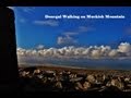
Jim Holmes: Track/3112 in area near Muckish, Donegal NW (Ireland)
The Glover Highlander Challenge Walk 2015
Ascent: 2225m,
Length: 25.3km,
Creator time taken: 10h15m
Descent: 2258m,
Time predicted from Naismith's rule: 8h 46m + breaks
Click here to rate track
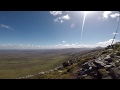
PlacesStart at C01178 31310, Muckish, Crocknalaragagh, Aghla Beg, Aghla Beg South Top, Aghla More, Mackoght, Errigal, end at Errigal Parking (Errigal CP) B94292 19736, 13km SW from Start
Track Rating ..
[RWD version 1 ]
This was the route taken on the Glover Highlander Challenge Walk 2015 as hosted by the North West Mountaineering Club in 2015 The day turnned out to be a very strenous day that required a gargantuan effort by all! Savage weather at times learns itself to the reasoning as to why "the scenic route" was taken at times (you may enjoy my "scenic" horseshoe trail cerca Aghla Beg! No doubt there is a more streamlined version to follow (next time I get clearer weather on the next Glover Highlander!). Jim Holmes. Read the Report of the day (copy and paste address into your browser). http://mountainviews.ie/challengecalendar/node/82/
Editing Details for track/3112
NOTE: ALL information such as Ascent, Length and Creator time taken etc should be regarded as approximate. The creator's comments are opinions and may not be accurate or still correct.
Your time to complete will depend on the speed of the slowest plus break time and your mode of transport.
NOTE: It is up to you to ensure that your route is appropriate for you and your party to follow bearing in mind all factors such as safety, weather conditions, experience and access permission.
Uploaded on: Sun, 13 Sep 2015 (17:24:39), Linkback: https://mountainviews.ie/track/3112/
* Note: A GPS Height in the elevation profile is sourced from the device that recorded the track. An "SRTM" height is derived from a model of elevations for parts of the earth. More detail
Use of MountainViews is governed by conditions and a privacy policy.
Read general information about the site. Opinions in material here are not necessarily endorsed by MountainViews.
Hillwalking is a risk sport. Information in comments, walks, shared GPS tracks or about starting places may
not be accurate for example as regards safety or access permission. You are responsible for your safety and your permission to walk.
See the credits and list definitions.


 Our Facebook page.