This website uses cookies, which are small text files that the website puts on your device to facilitate operation. Cookies help us provide a better service to you. They are used to track general user traffic information and to help the website function properly.
simoburn: Track/2744 in area near Corraun Hill East Top, Achill/Corraun (Ireland)
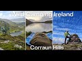
PMG Walk 73 - The Corrauns
Ascent: 630m,
Length: 13.9km,
Creator time taken: 2h47m
Descent: 635m,
Time predicted from Naismith's rule: 3h 50m + breaks
Click here to rate track
PlacesStart at Belfarsad Bridge (Belfarsad) L74896 98529, Corraun Hill Highpoint, Corraun Hill, end at Start
Track Rating ..
[RWD version 1 ]
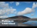
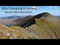
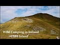
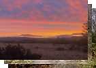
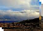
PMG Walk 73 - The Corrauns.Day 16 in the hills! After the previous 4 days of walking today was going to be easier going. I would start off near Achill Sound and climb two hills to start the day off. Sadly the summits were cloud filled but just below the summits some nice views were had. I wasn't really liking or hating the walk, I was just going through the motions. I was tired, my body was tired but I didn't want to waste a day that was not wet! Then walk number two took me on to Achill Island, a place I have many fond memories of. I have spent several family holidays on the Island. Slievemore at 671m was the goal. The last time I was on the summit was back in 2008 with my brother Philip. As I drove along the Island and came in to Keel beach I was excited and I could feel the energy come surging back. I spent half an hour on the beach just being there and then jumped back into the car and drove to the foot of Slievemore. A quick snack and I was off. Walked through the old deserted village and off towards the summit. I had been up and down this mountain in the past the same way...the way I was going today. So I decided to descend down the other ridge to Doogort beach. The summit was for a few seconds here and there cloud free. With very high winds I headed down the other ridge and wow what a ridge!! I was excited and at the same time found myself crouching at times in the strong gusts of wind all the while walking down the ridge. One wouldn't want to lose their balance at the wrong "gusty" time. The wind was blowing you in the wrong direction, over the cliffs Afterwards I walked back to the car feeling tired but yet recharged. Tomorrow sees rain coming but lucky enough I only have 1 other walk on the Island. I hope/plan to do it before it gets to wet and wild! Interestingly enough I only have 3 PMG summits on an Island (other than our fine Isle as such) to climb...2 more to go..tomorrow...hopefully! 78 PMG summits left in the project!
Editing Details for track/2744
NOTE: ALL information such as Ascent, Length and Creator time taken etc should be regarded as approximate. The creator's comments are opinions and may not be accurate or still correct.
Your time to complete will depend on the speed of the slowest plus break time and your mode of transport.
NOTE: It is up to you to ensure that your route is appropriate for you and your party to follow bearing in mind all factors such as safety, weather conditions, experience and access permission.
Uploaded on: Tue, 18 Nov 2014 (13:50:01), Linkback: https://mountainviews.ie/track/2744/
* Note: A GPS Height in the elevation profile is sourced from the device that recorded the track. An "SRTM" height is derived from a model of elevations for parts of the earth. More detail
Use of MountainViews is governed by conditions and a privacy policy.
Read general information about the site. Opinions in material here are not necessarily endorsed by MountainViews.
Hillwalking is a risk sport. Information in comments, walks, shared GPS tracks or about starting places may
not be accurate for example as regards safety or access permission. You are responsible for your safety and your permission to walk.
See the credits and list definitions.


 Our Facebook page.