This website uses cookies, which are small text files that the website puts on your device to facilitate operation. Cookies help us provide a better service to you. They are used to track general user traffic information and to help the website function properly.
Peter Walker: Track/2714 in area near Slievemartin, Mourne Mountains (Ireland)
Crenville and Slievemeel - Welcome To My Nightmare (ish)
Ascent: 453m,
Length: 12.0km,
Creator time taken: 2h50m
Descent: 468m,
Time predicted from Naismith's rule: 3h 9m + breaks
Click here to rate track
PlacesStart at J19598 17403, Slievemartin, Crenville, Slievemeel, end at Start
Track Rating ..
[RWD version 1 ]
Like others I started in the top car park of the Kilbroney Park, and took the paths up to the col between Slievemeen and Slievemartin. I then took the mountain bike trail contouring under the latter (the summit can easily be visited by a short detour). Once I determined I was pretty much due west of Crenville's summit I decided to take a punt of a directish route, ploughing straight into the forest aiming for a north-south forest road indicated on larger-scale maps. A couple of hundred yards of muck and murk found said road to be a firebreak in reality, but reasonable underfoot. I followed it north until level with the narrowest bit of forest to the east and plunged through that (only about 50 yards) to open ground. This proved to be the Crenville of legend; long manky grass and random invisible ditches as though the Devil had imperfectly tried combing the dandruff from his hair. The distance between the forests on either side narrows as you climb, but there is a tiny gap at the top leading to the summit.
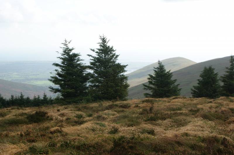
The fun and games that is Crenville's summit
The next section leads north down the forest edge on the left...this is trackless and wet and deeply annoying. You aim for a track running SW to NE at the bottom of the slope...this can be located by either accurate navigation to the gaps in the forest (which aren't so much gaps as thinnings), or by brute force and ignorance. This track then meets another running E to W; head towards the latter. Soon pick up a mountain bike track slanting across the slopes of Slievemeel, and when it enters the forest head straight up the slope to the summit.
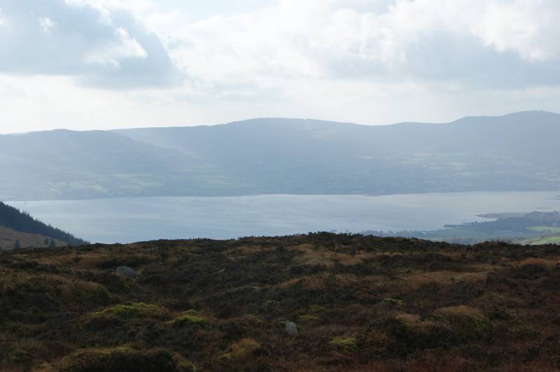
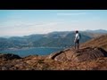
Carlingford Lough from Slievemeel
Once back at the forest edge I chose to return down the track before picking up the E-W track again (said forest edge can be followed down to cut a corner). The track leads all the way back to the car park with one hanging left at a junction required. This might just be the easiest way up Crenville...
Editing Details for track/2714
NOTE: ALL information such as Ascent, Length and Creator time taken etc should be regarded as approximate. The creator's comments are opinions and may not be accurate or still correct.
Your time to complete will depend on the speed of the slowest plus break time and your mode of transport.
NOTE: It is up to you to ensure that your route is appropriate for you and your party to follow bearing in mind all factors such as safety, weather conditions, experience and access permission.
Uploaded on: Sun, 2 Nov 2014 (19:29:05), Linkback: https://mountainviews.ie/track/2714/
* Note: A GPS Height in the elevation profile is sourced from the device that recorded the track. An "SRTM" height is derived from a model of elevations for parts of the earth. More detail
Use of MountainViews is governed by conditions and a privacy policy.
Read general information about the site. Opinions in material here are not necessarily endorsed by MountainViews.
Hillwalking is a risk sport. Information in comments, walks, shared GPS tracks or about starting places may
not be accurate for example as regards safety or access permission. You are responsible for your safety and your permission to walk.
See the credits and list definitions.


 Our Facebook page.