Members and Supporters, the MountainViews Committee requests your help to meet the costs of the website and of other activities such as insured events or publications.
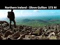
simoburn: Track/2437 in area near Anglesey Mountain, Cooley/Gullion (Ireland)
PMG Walk 16 - A walk in the Cooley Mountains!
Ascent: 1357m,
Length: 23.8km,
Creator time taken: 6h
Descent: 1367m,
Time predicted from Naismith's rule: 7h 2m + breaks
Click here to rate track
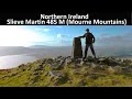
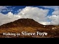
PlacesStart at Corna Mucklagh House (CorMuc H) J12050 19107, Anglesey Mountain, Clermont, Clermont Carn NE Top, Clermont Carn, Carnavaddy, The Foxes Rock, The Ravens Rock, The Eagles Rock, Slieve Foye North-West Top, Slieve Foye, end at J15486 15127, 5.3km SE from Start
Track Rating ..
[RWD version 1 ]
PMG Walk 16 - A walk in the Cooley Mountains!
See the blog post here: http://www.adventureburn.com/pmg-walk-16-17-18-keepin-cooley-trilogy-day/
Editing Details for track/2437
NOTE: ALL information such as Ascent, Length and Creator time taken etc should be regarded as approximate. The creator's comments are opinions and may not be accurate or still correct.
Your time to complete will depend on the speed of the slowest plus break time and your mode of transport.
NOTE: It is up to you to ensure that your route is appropriate for you and your party to follow bearing in mind all factors such as safety, weather conditions, experience and access permission.
Uploaded on: Mon, 31 Mar 2014 (23:00:02), Linkback: https://mountainviews.ie/track/2437/
* Note: A GPS Height in the elevation profile is sourced from the device that recorded the track. An "SRTM" height is derived from a model of elevations for parts of the earth. More detail
Use of MountainViews is governed by conditions and a privacy policy.
Read general information about the site. Opinions in material here are not necessarily endorsed by MountainViews.
Hillwalking is a risk sport. Information in comments, walks, shared GPS tracks or about starting places may
not be accurate for example as regards safety or access permission. You are responsible for your safety and your permission to walk.
See the credits and list definitions.


 Our Facebook page.