This website uses cookies, which are small text files that the website puts on your device to facilitate operation. Cookies help us provide a better service to you. They are used to track general user traffic information and to help the website function properly.
march-fixer: Track/2350 in area near Church Mountain, Dublin/Wicklow (Ireland)
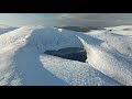
Church Mountain K.A.R.E. Charity Walk
Ascent: 429m,
Length: 14.5km,
Creator time taken: 3h18m
Descent: 430m,
Time predicted from Naismith's rule: 3h 37m + breaks
Click here to rate track
PlacesStart at St Kevins Chair (KevinsCh) N93951 05253, Church Mountain, end at Start
Track Rating ..
[RWD version 1 ]
A beautiful area, a magnificent day and an opportunity to tone up after consuming too much over the Christmas period. This was a non-technical brisk walk along with about 120 other generous patrons of the K.A.R.E. Charity.
The walk starts in the lovely Hollywood village, heads south and crosses the main road to follow St. Kevin's Way down along the western slope of Dragoon Hill (starting in Hollywood provides a nice secure place to leave your car and it affords excellent food and drink on your return). It continues on down into Hollywood Glen and switches east into the forest access track.
We all followed the easier 'long path' along the forest track rather than take the steeper direct short cuts ... on the way up anyway. The track leads steadily up and around Drumreagh until it meets the start of the direct access narrow track (on righ-hand side on the bend) to the summit. We decided to extend the walk by continuing along the main access track heading due south-east towards the eastern side of Church mountain in the direction of Corriebracks.
At the track junction we switched back west for about 100m and found the narrow track on the right-hand side through a red 5-bar gate. This rough track leads up west-north-west onto Church Mountain. As the track finally levelled out we switched back south on to the summit where there is a fine cairn of stones topped by a trig point. This at least provides some shelter for a quick munch and a drop of hot coffee!
We then descended by the prominent north-west route and crossed our previous route to take the short-cut back down to the forest entrance. It was then just a case of retracing our steps back to Hollywood.
Editing Details for track/2350
NOTE: ALL information such as Ascent, Length and Creator time taken etc should be regarded as approximate. The creator's comments are opinions and may not be accurate or still correct.
Your time to complete will depend on the speed of the slowest plus break time and your mode of transport.
NOTE: It is up to you to ensure that your route is appropriate for you and your party to follow bearing in mind all factors such as safety, weather conditions, experience and access permission.
Uploaded on: Sat, 28 Dec 2013 (13:57:27), Linkback: https://mountainviews.ie/track/2350/
* Note: A GPS Height in the elevation profile is sourced from the device that recorded the track. An "SRTM" height is derived from a model of elevations for parts of the earth. More detail
Use of MountainViews is governed by conditions and a privacy policy.
Read general information about the site. Opinions in material here are not necessarily endorsed by MountainViews.
Hillwalking is a risk sport. Information in comments, walks, shared GPS tracks or about starting places may
not be accurate for example as regards safety or access permission. You are responsible for your safety and your permission to walk.
See the credits and list definitions.


 Our Facebook page.