- Home
- Main Display
- Main Display (Old)
- Find a Walk
- Display INTRODUCTION
- DONATE
- Click below for your
profile & contributions
guestuser- New
- Tracks, Walks
- Challenge
- Community
- Lists & Logs
- Popular Lists:
- County Highpoints
- Range & Area Highpoints
- Local 100
- Highest Hundred
- Vandeleur-Lynams
- Arderins
- Carns
- Best rated
- Irish 900 up
- Irish Island
- Munros
- All Lists
- Shorter Irish
- County Highpoints
- Range & Area Highpoints
- Highest Hundred
- Local 100
- Local 100 (pre2014)
- Local Historical Cultural
- Best rated
- Irish 900 up
- Larger Irish
- Arderins
- Arderin Begs
- Arderins + Arderin Begs
- Vandeleur-Lynams
- Vandeleur-Lynams + Arderins
- Carns
- Binnions
- Highest 50 per Province
- Island Features
- Irish Island
- Coastal Hills
- Irish 600 up
- Irish 500 up
- British
- Munros
- British 600 up
- British 500-600
- British Marilyns
- Comprehensive
- All Irish summits
- All Irish features
- All British summits
- All Britain+ Ireland
- Special
- Analysis List
- Simple Irish Listings
- Simple Irish & British Listings
-
- More
- Motley Views
Welcome to MountainViews
If you want to use the website often please enrol (quick and free) at top right.OverviewFor more map options click on any overview map area or any detail map feature.Detail Map FeaturesShowing 19 items:
Oughtmore 569m, Spelhoagh 568m, Mullaghmore 550m, White Mountain 537m, Crockbrack 526.1m, Bohilbreaga 478m, Craigagh Hill 460m, Corick Mountain 430m, Coolnasillagh Mountain 423m, Crockalougha 407m,Tracks:2448, 19km 2143, 13km 2155, 13km 2095, 13km 2103, 12km 2119, 10km 2351, 7km 2724, 6km 2786, 5km Find Suggested Walks
Find hill, mountain, island, coastal feature.Videos
Conditions and Info
Use of MountainViews is governed by conditions and a privacy policy.
Read general information about the site.
Opinions in material here are not necessarily endorsed by MountainViews.
Hillwalking is a risk sport. Information in comments, walks, shared GPS tracks or about starting places may not be accurate for example as regards safety or access permission. You are responsible for your safety and your permission to walk.
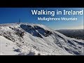
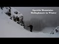
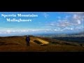
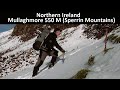
See the credits and list definitions.Video displaygerrym: Track 2119 in area near Mullaghmore, Sperrin Mountains (Ireland)Moydamlaght to Mullaghmore Length: 9.9km, Creator time taken: 5h12m, Ascent: 434m,
Descent: 434m
Places: Start at H7405698642, Mullaghmore, end at Start
Logged as completed by 1
 http://youtu.be/o-WQrExuZM4
A winter walk over Mullaghmore, one of my favourite hills in the Sperrins for its accessibility, views and great walking. Captured on video and at Youtube link above.
Starting point was at the foot of the mountain at Moydamlaght Forest, with easy parking for a number of cars.
A wonderful place to walk in any season, through mature beech and then pine. Grey skies laden with snow and 15cm on the ground confirmed that winter was indeed a good time. The dark trunks of the beech tried their best to stand out against the relentless whiteness, succeeding better than the pine which were swamped with the weight and quantity of snow.
Good forest tracks reach high through the forest, passing numerous blue barrels with seed hoppers at the bottom, which were a welcome place for birds today. A fenced off area in the forest, just of the track contains various structures and almost looks like some survivalist camp.
An area of clearfell was entered and this gave views to trees higher up the hillside and glimpses of other hills before they entered into the low cloud. The going was pretty good as high winds had swept lying snow off the forest tracks into drifts.
The end of the forest was reached and a stile crossed at the cliffs of Craig-na-Shoke. These rose up into the mist and were plastered in snow and in the lee of the cliffs it was strangely still, with snow falling quietly and steadily. Big snow drifts abounded and a lone rabbit tried to get at the greenness below, standing out a mile against the snow.
There were fantastic opportunities to walk up the steep ground to the side of the cliffs, were gullies had been levelled off with snow 2-3ft deep. Great fun kicking and plodding through this to the top of the cliffs. Mist and wind made thier presence felt up here and it was a walk of over a kilometre to the summit. Deep snow drifts abounded and all was froze solid.
Near the summit heavily iced powerlines appeared, with one pole looking like it had lost the battle to stand against the elements. These looked really impressive but the snow falling and spindrift blowing meant getting the camera out was not a good idea :( At the comms station the smell of diesel confirmed that the generator was going and the power was down. The icing of the chainlink fence created a solid barrier behind which i tried to get some shelter from the blowing snow, unsuccessfully. The comms mast looked amazingly impressive with several inches of ice coating every surface.
Heading down was by way of the summit access road, which was just distinguishable from the snow filled ditches at either side.This was a lovely walk through untrodden snow to the high pass and road below. The road was snow covered, though previous ploughing kept the depth down. A walk of some 3 km along this road brought the starting point.COMMENTSNo comments uploaded yet.NOTE: ALL information such as Ascent, Length and Creator time taken etc should be regarded as approximate. The creator's comments are opinions and may not be accurate or still correct.
Your time to complete will depend on your speed plus break time and your mode of transport. For walkers: Naismith's rule, an approximate though often inaccurate estimate, suggests a time of 2h 43m + time stopped for breaks
NOTE: It is up to you to ensure that your route is appropriate for you and your party to follow bearing in mind all factors such as safety, weather conditions, experience and access permission.
* Note: A GPS Height in the elevation profile is sourced from the device that recorded the track. An "SRTM" height is derived from a model of elevations for parts of the earth. More detail Height layer: © MapTiler

MountainViews.ie, a Hill-walking Website for the island of Ireland. 2500 Summiteers, 1480 Contributors, maintainer of lists such as: Arderins, Vandeleur-Lynams, Highest Hundred, County Highpoints etc

 Get Notifications
 Visit our Facebook page.