This website uses cookies, which are small text files that the website puts on your device to facilitate operation. Cookies help us provide a better service to you. They are used to track general user traffic information and to help the website function properly.
Dolgellau to MachynllethArea, Cadair Idris
Subarea
Feature count in area: 53, all in ,
Highest Place: Cadair Idris - Penygadair 893m
Starting Places in area Dolgellau to Machynlleth:
None for this area
Summits & other features in area Dolgellau to Machynlleth: Craig y Gamell 424m, Fedw-lwyd 424m, Foel Pandy 454m, Moel Heulen 403m, Mynydd Rhyd-galed East Top 475m, Mynydd Tri Arglwydd 442m, Pen y Garn 460m Cadair Idris: Braich Ddu [Craig Cwm-llwyd] 546m, Cadair Idris - Penygadair 893m, Ceiswyn 545m, Corlan Fraith 406m, Craig Cwm Amarch 791m, Craig Lwyd 690m, Craig Portas 605m, Craig Portas East Top 587m, Craig y Castell 321m, Craig-las [Tyrrau Mawr] 661m, Craig-y-llyn 622m, Cribin Fawr 659m, Cyfrwy 811m, Esgair Berfa 507m, Ffridd Cocyn 313m, Foel Cae'rberllan 380m, Foel Ddu 448m, Foel Dinas 478m, Foel y Geifr 515m, Gamallt 288m, Gau Graig 683m, Godre Fynydd 508m, Graig Goch 586m, Llechwedd Melyn 196m, Maesglase 676m, Maesglase (old GR) - Maen Du 674m, Mynydd Braich-goch 597m, Mynydd Ceiswyn 605m, Mynydd Cwmcelli 469m, Mynydd Cwmeiddew 507m, Mynydd Dolgoed 576m, Mynydd Fron-fraith 514m, Mynydd Gwerngraig 686m, Mynydd Moel 863m, Mynydd Pencoed 766m, Mynydd Rhyd-galed [Tarrenhendre East Top] 502m, Mynydd Tan-y-coed 491m, Pared y Cefn-hir 383m, Pen Trum-gwr 512m, Tal y Gareg 189m, Tarren Cwm-ffernol 551m, Tarren y Gesail 667m, Tarrenhendre 634m, Trawsfynydd 493m, Tyddynbriddell Hill 280m, Waun-oer 670m
Note: this list of places may include island features such as summits, but not
islands as such.
Cyfrwy, 811mMountain
Place Rating ..
, in British over 600m Lists Grid Reference SH70300 13300,
OS 1:50k mapsheet 124 Place visited by: 12members, recently by: rhw, oakesave, Alanjm, skyehigh, IainT, scapania, Fergalh, Onzy, MichaelE, chalky, jimbloomer, Peter Walker
I visited this place: NO (You need to be a logged-in member for this.)
This is a straight forward detour off the main Minddffordd track or indeed you will cross this if you climb the pony or foxs path routes Linkback: mountainviews.ie/summit/B2139/comment/22346/
Read Less
Read More
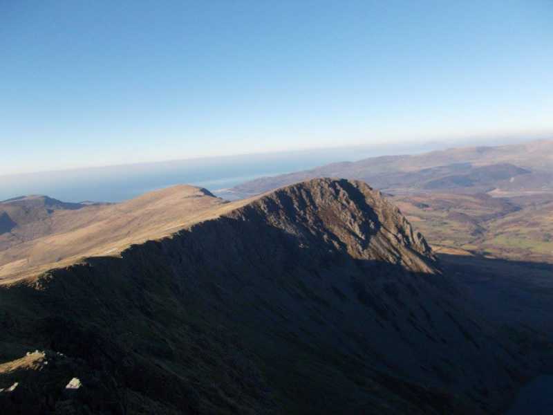
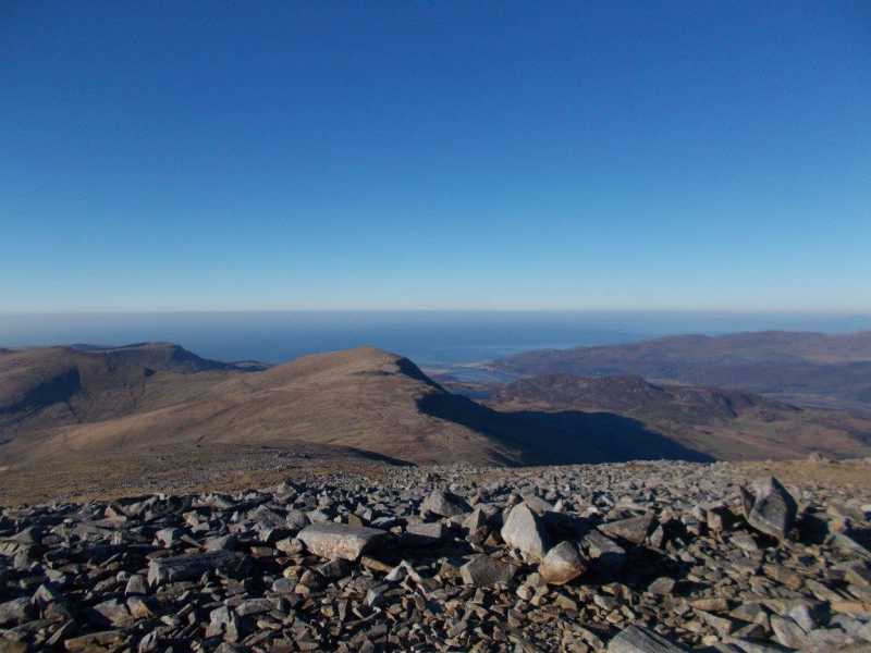
Picture: View from summit towards the sea
Well worth the detour from the Minddfford track
by Fergalh
11 Feb 2021
On a previous visit to Cadair Idris we skipped this summit as it was snow, ice and very cold. On this visit it was very cold again but after leaving Craig Cwm Amarch and heading towards the main summit of Cadair Idris a dog leg to the north west is needed. A small descent and a small ascent leads you to summit marked by a large cairn and unlike my previous visit it was blue skies in January and a wonderful view Linkback: mountainviews.ie/summit/B2139/comment/22345/
Use of MountainViews is governed by conditions and a privacy policy.
Read general information about the site. Opinions in material here are not necessarily endorsed by MountainViews.
Hillwalking is a risk sport. Information in comments, walks, shared GPS tracks or about starting places may
not be accurate for example as regards safety or access permission. You are responsible for your safety and your permission to walk.
See the credits and list definitions.

 Add a Place Comment for Cyfrwy


 Our Facebook page.