Donation Request 2024

DONATE
Members and Supporters, the MountainViews Committee requests your help to meet the costs of the website and of other activities such as insured events or publications.
You do not have to be logged in to donate.
Features
Nearby features appear when you click the map.
Declutter tracks on map.
Place Search
Video
X
Pub: by
Dunkerron Mountains Area , SW: Sneem Subarea
Feature count in area: 65, all in Kerry, OSI/LPS Maps: 78, 83, 84, 85, EW-KNP, EW-R
Highest Place: Stumpa Dúloigh 784m

Starting Places (66) in area Dunkerron Mountains:
Ballaghasheen Coilte, Ballaghasheen Pass Viewpoint, Ballaghbeama Gap, Bohacullia, Bridia Valley End, Cahersavane Road, Cahersavane Schoolhouse, Cloon Lough NE, Cloon Lough SE, Coad Cemetery, Coad Road End, Com an Chiste, Coomaclarig Bridge, Coomnahorna River, Coomyanna Bridge, Dereenavurrig, Derreendarragh Church, Derrynane Quay, Dunkerron Mid, Eagles Lough Access Trailhead, Esknaloughoge Forest Trailhead, Fermoyle Farm, Foot Stick Ford Road, Gap of Dunloe Head of, Glashaknockbrassel Stream, Glasheenoultagh Stream, Gortaclohane Lane End, Gortaclohane Lane NE Branch, Gortagowan Wood, Gowlane School Ruin, Gowlanes Wood, Graces Landing, Inchimore West, Isknagahinney Lough E, Kenmare Bridge, Knockanamadane, Knockanaskill N, Knocknasullig, Knocknsallagh Bridge, Laghtacallow, Lissatinnig Bridge Boreen, Looscaunagh Lough W, Lough Barfinnihy CP, Lough Brin S, Lough Coomeen SE, Lough Dromtine NE, Lough Dromtine SE, Lough Fada N, Lough Iskanamacteery N, Lough Iskanamacteery NW, Lough Reagh N, Maghanlawaun Bridia Valley, Molls Gap, Ochtiabh Road, Poulacapple, River Owroe Source, River Sneem Fermoyle Loop, Rossacoosane Mid, Sahaleen Bridge, Scarriff Island, Shamrock Farmhouse B&B, Sneem, Tooreenboy Lough, Tooreennafersha Mid, Tooreennafersha South, Waterville Promenade

Summits & other features in area Dunkerron Mountains:
Knocknagantee Near West Top 628m
Cen: An Bheann Mhór: An Bheann Mhór 674.7m, An Bhinn Láir 514m, Coomcallee 648.9m, Beann na Stiocairí 673.1m, Coomnahorna 590m, Glanbeg 485.8m, Slievenashaska 578m, Slievenashaska South Top 565.4m
Cen: Knocknagantee: Knockmoyle 682.1m, Finnararagh 667m, Cnoc Breasail 591m, Knocknagantee 674.3m, Knocknagantee West Top 553m, Coomnacronia 636m, Coomura Mountain 666m
Cen: Mullaghanattin: An Cnoc Riabhach 534m, Beann 752m, Beann Far SW Top 636.2m, Beann NE Top 692m, Beann South Top 639m, Beann SW Top 657m, Sallagh 570m, Mullaghanattin 773m, Mullaghanattin East Top 594m, Sallagh South-West Top 543m
E: Kenmare: Gortamullin 205m, Knockanaskill 356m, Letter South 362m
N: Knocknacusha: Knocknacusha 547m
NE: Knocknabreeda Ridge: Crossderry 489m, Knocknabreeda 569m, Mothaillín 506m
NE: Knocknagapple: Bascadh 595m, Bascadh West Top 569m, Boughil 631m, Cnoc na gCapall 639m, Knocklomena 641m
NE: Stumpa Dúloigh: Broaghnabinnia 745m, Knockaunanattin 569m, Knockaunanattin West Top 466.1m, Stumpa Dúloigh 784m, Stumpa Dúloigh SE Top 780m, Stumpa Dúloigh SW Top 663m
SW: Caherdaniel: Farraniaragh Mountain 468m, Eagle Hill 155m, Reenearagh 162m, Beenarourke 304m, Knocknasullig 117m, Cahernageeha Mountain 498.7m
SW: Coad ( Castle Cove ): Beenrour 418m, Eagles Hill 549m, Mullaghbeg 509m
SW: Coomduff: Coomduff 244m
SW: Deenish: Deenish Island (2) 144m
SW: Esknaloughoge: Esknaloughoge 416m, Esknaloughoge North Top 420m
SW: Scarriff: Scarriff Island 252m
SW: Sneem: An Bheann Mhór 309.3m, Dereenavurrig Hill 261m, Knockanamadane 270m, Knocknafreaghane 316.5m, Knocknagullion 413m
SW: Staigue: Staigue Top 459m, Staigue NE Top 435m

Note: this list of places may include island features such as summits, but not islands as such.
Rating graphic.
An Bheann Mhór, 309.3m Hill
Place Rating ..
(Ir. An Bheann Mhór [TH], 'the big peak'), Kerry County in Munster province, in Binnion Lists, An Bheann Mhór is the 1144th highest place in Ireland.
Grid Reference V65537 64645, OS 1:50k mapsheet 83,84
Place visited by: 13 members, recently by: chelman7, eamonoc, nickywood, simon4, simon3, Fergalh, daitho9, chalky, ciarraioch, mickosullivan, trekker, Conor74, three5four0
I visited this place: NO (You need to be a logged-in member for this.)
Longitude: -9.950723, Latitude: 51.818433, Easting: 65538, Northing: 64645, Prominence: 183m,  Isolation: 1.2km
ITM: 465517 564709
Bedrock type: Green sandstone & purple siltstone, (Glenflesk Chloritic Sandstone Formation)
Notes on name: This peak is unnamed on OS maps. It is recorded as An Bheann Mhór in Toponomia Hiberniae by Breandán Ó Cíobháin.
  Short or GPS IDs, 6 char: AnB309, 10 char: AnBhnMh309

Linkback: https://mountainviews.ie/summit/951/
Gallery for An Bheann Mhór and surrounds
Summary for An Bheann Mhór : Beautiful summit of great views but extremely difficult terrain.
Summary created by simon3 2021-09-17 19:17:47
            MountainViews.ie picture about <em>An Bheann Mhór</em>
Picture: Picture taken from Sneem to the NE.
Gorgeous to look at, An Bheann Mhór also is a superb viewpoint at the top with extensive views over Kenmare River, coast, islands, the Caha Mountains and then much of the southern Dunkerrons on Iveragh.

One place to start is from the west at the forestry entrance EsknaTrailhd (V63607 65227) (Esknaloughoge Forest Trailhead) from where you can walk onto the ridge via mobile phone masts.

Although the linear distance is not very great the land along the ridge to the summit is extremely rough with large slabs of rock which are hidden until you reach them requiring detours followed by crossings of wet boggy land.

Allow 2.5 hours for a return trip.
Linkback: mountainviews.ie/summit/951/comment/5710/
Member Comments for An Bheann Mhór
Comment create / edit display placeholder

            MountainViews.ie picture about <em>An Bheann Mhór</em>
Picture: An Bheann Mhor from Sneem
Its more awkward than it looks.
by three5four0 17 Sep 2021
Park at around EsknaTrailhd (V635 651), at the start of forestry tracks on the N70. The tracks marked on OSI Sheet 84 4th Edition are pretty accurate, for once. So follow the one from where you have parked all the way to A (V643 647). Here there is a small transmitter, go round the side, cross a fence and you are on the ridge of An Bheinn Mhor, between pt222 and pt207.

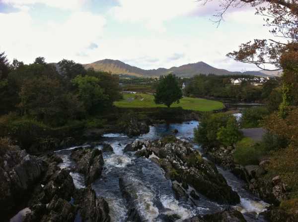
Now that was the easy part, the next section is just plain awkward in anything but good weather. Follow the fence for a while, along this ridge, with the usual heather, deep grass and furze you encounter on lower hills. Soon you encounter some mild benching, which requires a bit of negotiating (after pt222) and again after this. This made for slow progress, as the rain showers had left the rock wet and greasy. If you look at the photo I took at Sneem from the bridge, it gives a hint at what the ground is like.

This was the last hill of a day of 3 MV tops, and I just made the summit in time for the arrival of more rain and wind, magic! (there is a short steeper section just before the summit) Made sure of the visiting the spot height, but marked a possible higher point at B (V65509 64627), would the next visiter care to check this out?

The views were splendid, though I didn't hang around long as I wanted to get back past the rough bits before I was enveloped in the advancing gloom. Nothing like the thought of sprockiling about on wet greasy rock in the dark with wind driven rain to focus the mind and spur you on to that first tasty pint in Sneem! Linkback: mountainviews.ie/summit/951/comment/6559/
Read Less
Read More

            MountainViews.ie picture about <em>An Bheann Mhór</em>
Picture: View to Dereenavurrig
A challenging Kerry Binnion
by eamonoc 10 Feb 2023
A cautionary me set out for this hill after reading previous comments. walk to masts no problem, from mast on a clear
day summit visible about 2km distant, the initial ground met after leaving the mast was a bit unsavoury with many pitfalls for
weary hikers, after about 300mts the difficulties abate and some rough ground leads to the top. Fine views abound here, retraced
upward route back to masts, took just short of 2hrs to complete. Worth a try if you must . Linkback: mountainviews.ie/summit/951/comment/23835/
Read Less
Read More
EDIT Point of Interest
text
Videos


Recent Contributions
x
Conditions and Info
Use of MountainViews is governed by conditions and a privacy policy.
Read general information about the site.
Opinions in material here are not necessarily endorsed by MountainViews.
Hillwalking is a risk sport. Information in comments, walks, shared GPS tracks or about starting places may not be accurate for example as regards safety or access permission. You are responsible for your safety and your permission to walk.
See the credits and list definitions.

OSi logo
OSNI/LPS logo
Open Street Map
(Various variations used.)
British summit data courtesy:
Database of British & Irish Hills