Members and Supporters, the MountainViews Committee requests your help to meet the costs of the website and of other activities such as insured events or publications.
Feature count in area: 62, by county: Cork: 45, Kerry: 24, of which 7 are in both Cork and Kerry,
OSI/LPS Maps: 78, 79, 85, 86, 88, 89
Highest Place: Knockboy 704.8m
Starting Places (47) in area West Cork Mountains: Barley Lake North, Barrboy, Caha Pass, Carranmore, Carrigacappeen, Carriganass Castle, Castle Donovan Car Park, Clearagh House, Coolkellure House, Coomhola Bridge, Corrigatirra, Cousane Gap, Cummer Lough East Road, Derreencollig Wood, Esk Boreen, Fuhiry Wood, Garinish Island Pier, Glasagarav River Bridge, Glasnacummeen Stream, Glengarriff, Glengarriff Nature Reserve CP, Gorteeniher Drimoleague Heritage Walk CP, Gortloughra River Road, Gougane Barra Oratory, Gougane Barra Park CP, Grousemount Wind Farm, Kealkill Village, Knockanuha, Knockbrack South, Lough Atooreen N, Lough Nambrackderg North, Lough Nambrackderg Wood, Lough Nambreacdearg, Mealagh Bridge, Molly Gallivan's Visitor Centre, Nowen Hill West Road, Owvane River Bridge, Pookeen North Top Road, Pooleen Wood Car Park, Priests Leap, Reenroe Bridge, River Roughty, Shandrum Concrete Silo, Sillahertane Stream, Slaheny River Horseshoe, Top of Coom, Turner's Rock Tunnel
Summits & other features in area West Cork Mountains: Cen: Maughanaclea: Maughanaclea Hills East Top 470m, Maughanaclea Hills West Top 452m Cen: Shehy More: Shehy More 545.6m, Shehy More SW Top 446m E: Clearagh: Clearagh Hill 287m E: Currane: Currane Hill 228m N Cen: Douce: Douce Mountain 476m, Doughill Mountain 471m N: Carran: Barnastooka 497m, Bealick 537m, Carran 604m, Carran Far NE Top 561m, Carran Far North Top 506m, Carran NE Top 555m, Carran South Top 567m, Knockantooreen 450m N: Conigar: Conigar 566m, Conigar SW Top 566m, Foilastookeen 540m N: Coomataggart: Carrigalougha 423m, Coomataggart 530m, Coomataggart SW Top 509m, Derrineanig 304m, Lackabaun 472m, Mweelin 487m NE Cen: Carrigarierk: Carrigarierk 343m NW: Barraboy: Barraboy Mountain 460m, Barraboy Mountain Far East Top 456m, Barraboy Mountain SE Top 409m, Derroograne 468m, Turners Rock 420m NW: Knockboy: Caoinkeen 692.8m, Caoinkeen South-East Top 553.5m, Coomhola Mountain 472m, Knockboy 704.8m, Knockboy North Top 651.2m, Knockboy South Top 533.3m, The Priest's Leap 519m NW: Knocknamanagh: Bird Hill 412m, Coomclogherane Top 449m, Gullaba Hill 603m, Knockbrack 440m, Knockbrack South Top 458m, Knocknamanagh 637m, Knocknamanagh NE Top 625m S Cen: Dunmanway Hills: Cashloura 296.8m, Coolsnaghtig 295.8m, Inchanadreen 310m S Cen: Nowen: Milane Hill 354.4m, Mullaghmesha 494.3m, Nowen Hill 535.2m, Nowen Hill Far West Top 405.2m, Nowen Hill SW Top 509m, Pookeen North Top 319m S: Leap Hills: Carrigfadda 311.7m, Killeigh Hill 229m, Knockarudane Hill 169m, Knockscagh 195m S: Skibbereen: Barryroe Hill 156m, Lick Hill 158m W Cen: Knockbreteen: Knockbreteen 239m W: Bantry: Knocknaveagh 282m
Note: this list of places may include island features such as summits, but not
islands as such.
Turners Rock, 420mHill
Place Rating ..
, Cork County in Munster province, in Carn Lists, Turners Rock is the 854th highest place in Ireland. Turners Rock is the most westerly summit in the West Cork Mountains area.
Grid Reference V91022 60192,
OS 1:50k mapsheet 85 Place visited by: 57members, recently by: maoris, Superterence, Colin Murphy, bryanjbarry, jlk, Geo, JohnRea, frostie89, chelman7, Taisce, JohnFinn, annem, jackos, Pepe, Oscar-mckinney
I visited this place: NO (You need to be a logged-in member for this.)
Longitude: -9.57985, Latitude: 51.784192, Easting: 91022, Northing: 60192,
Prominence: 95m, Isolation: 2.6km ITM: 491000 560280 Bedrock type: Cross-bedded sandstone & siltstone, (Slaheny Sandstone Formation) Notes on name: Turners Rock is immediately east of the tunnel at the summit of the Caha Mountain Pass. The rocks hereabouts are grooved due to the passage of ice according to T.J. Barrington (Discovering Kerry).
Short or GPS IDs, 6 char: TrnrRc, 10 char: TrnrsRock Linkback: https://mountainviews.ie/summit/732/
Gallery for Turners Rock and surrounds
Summary
for Turners Rock :
A short run after the pass
Summary created by Colin Murphy, jackill
2023-10-31 15:35:46
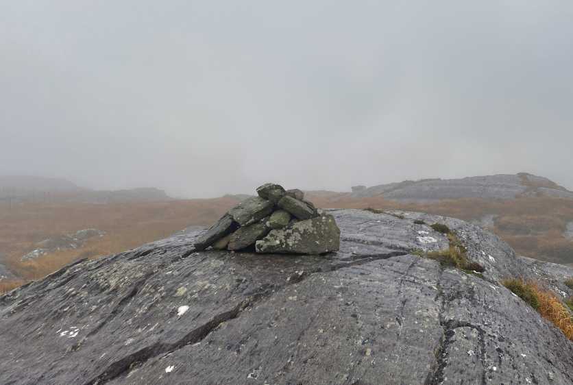
Picture: High point
Park at TR Tunnel (V9056 6011) on the N71, theres plenty of room on the Kerry side of the tunnel.
A path around the side points the way and then stay as close as you can to the sheepwire fence crossing to the Cork side of it as you reach the summit area.
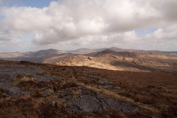
Picture: View from Turner's rock over Barraboy to Knockboy and its attendant summits
scapania on Turners Rock
by scapania
5 Apr 2010
An easy, quick climb from the layby next to the 'welcome to Co. Cork' sign just after going through the main tunnel on the N71 Caha Pass road (TR Tunnel (V9056 6011)), just follow the rough paths and then fence up over wet, rocky typical Beara ground. There is a cairn on a rock outcrop in the summit area, but outcrop just to the east seems to be a couple of feet higher. Nice enough view from the summit, especially across the shapely summit of Barraboy towards Knockboy. Linkback: mountainviews.ie/summit/732/comment/4590/
Read Less
Read More
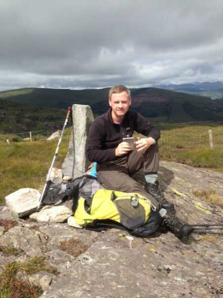
Picture: Single Malt Celebrations
Not the worst spot to celebrate 100 local peaks
by thomas_g
27 Aug 2013
Came across the top of the tunnel from Baurearagh (watch for the hole that goes through to the road) and after a quick steep climb gained the top. Lovely views over Glengarriff and a bit of sun made for a very pleasant spot to spend a few minutes. Linkback: mountainviews.ie/summit/732/comment/15160/
Use of MountainViews is governed by conditions and a privacy policy.
Read general information about the site. Opinions in material here are not necessarily endorsed by MountainViews.
Hillwalking is a risk sport. Information in comments, walks, shared GPS tracks or about starting places may
not be accurate for example as regards safety or access permission. You are responsible for your safety and your permission to walk.
See the credits and list definitions.


 Our Facebook page.