This website uses cookies, which are small text files that the website puts on your device to facilitate operation. Cookies help us provide a better service to you. They are used to track general user traffic information and to help the website function properly.
Feature count in area: 29, all in Kerry,
OSI/LPS Maps: 78, EW-KNP, EW-R
Highest Place: Carrauntoohil 1038.6m
Starting Places (19) in area MacGillycuddy's Reeks: Ballaghbeama Gap, Bridia Valley End, Cronins Yard, Gap of Dunloe Head of, Gap of Dunloe Kate K, Glashaknockbrassel Stream, Glasheenoultagh Stream, Hydro Road CP, Knocknsallagh Bridge, Lisleibane Trail Head, Lough Acoose North, Lough Acoose West, Lough Cappanlea OEC, Lough Caragh SW, Lough Fada N, Lough Reagh N, Maghanlawaun Bridia Valley, Shamrock Farmhouse B&B, Tomies Lough Leane NW
Summits & other features in area MacGillycuddy's Reeks: Cen: Reeks West: Beenkeragh 1008.2m, Caher 1000m, Caher West Top 973.4m, Carrauntoohil 1038.6m, Cnoc Íochtair 746.3m, Hag's Tooth 662m, Knockbrinnea East Top 845.4m, Knockbrinnea West Top 852.2m, The Bones Peak 956.5m, Skregmore 847.7m, Stumpa Bharr na hAbhann 852.1m E: Cnoc an Bhráca: Cnoc an Bhráca 728m, Cnoc na dTarbh 655m, Strickeen 440m N: Reeks North: Knockbrack 425m, Knocknabrone Hill 353m, Skregbeg 573m NW: Gortnagan: Gortnagan Beg 298m SE: Reeks East: Brassel Mountain 575m, Cnoc an Chuillinn 954.6m, Cnoc an Chuillinn East Top 922.9m, Knocknapeasta 985.1m, Cnoc na Toinne 844.1m, Cruach Mhór 930.8m, Maolán Buí 968.9m, The Big Gun 939.9m SW: Bridia: Beann Bhán 459.5m, Beendarrig 449.7m, Beann Dubh 450.5m
Note: this list of places may include island features such as summits, but not
islands as such.
Beann Bhán, 459.5mHill
Place Rating ..
, Binn Bhán, Kerry County in Munster province, in Carn Lists, Beann Bhán is the 701st highest place in Ireland.
Grid Reference V75640 82855,
OS 1:50k mapsheet 78 Place visited by: 27members, recently by: Colin Murphy, madfrankie, annem, Grumbler, eamonoc, simon3, liz50, Wilderness, Fergalh, daitho9, conormcbandon, chelman7, Wildrover, shaunkelly, markmjcampion
I visited this place: NO (You need to be a logged-in member for this.)
Short or GPS IDs, 6 char: BnBhán, 10 char: Beann Bhán Linkback: https://mountainviews.ie/summit/577/
Gallery for Beann Bhán and surrounds
Summary
for Beann Bhán :
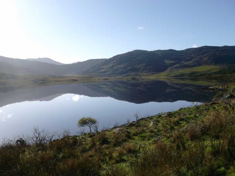
Heathery summit on broad ridge overlooking Lough Acoose.
Summary created by simon3
2022-01-17 19:32:30
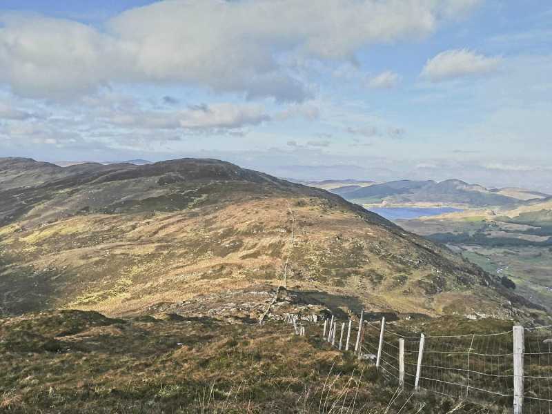
Picture: View from the south.
To the north: It is possible to start from around Glasheen (V76112 83996), which is on a road going past Lough Acoose.
From the south, start at around A (V77919 81491) in the Bridia Valley using the Kerry Way via Beendarrig to gain higher ground.
Expect heathery rough ground on all sides.
The views here are much the same as with nearby Beann Dubh with which it will usually be walked.
Beann Bhan is best taken in along with its colorful neighbours the Binn Dearg (Red Peak) and Beann Dubh (Black Peak) on excursion from Kerry Way from the top of the Bridia path.. Nice views in all directions. Linkback: mountainviews.ie/summit/577/comment/17741/
Read Less
Read More
Passage tomb?
by Colin Murphy
21 May 2024
Descending Beann Bhán in Kerry recently, came across this structure, which appears (to my untrained eye) be a megalithic tomb, although it isn't marked on any map I could find. Perhaps it's of more recent origin, but perhaps a member might be able to shed some light on it. Linkback: mountainviews.ie/summit/577/comment/24215/
Use of MountainViews is governed by conditions and a privacy policy.
Read general information about the site. Opinions in material here are not necessarily endorsed by MountainViews.
Hillwalking is a risk sport. Information in comments, walks, shared GPS tracks or about starting places may
not be accurate for example as regards safety or access permission. You are responsible for your safety and your permission to walk.
See the credits and list definitions.


 Add a Place Comment for Beann Bhán


 Our Facebook page.