Cookies. This website uses cookies, which are small text files that the website puts on your device to facilitate operation. Cookies help us provide a better service to you. They are used to track general user traffic information and to help the website function properly.

Click to hide this notice for 30 days.
Welcome to MountainViews
If you want to use the website often please enrol (quick and free) at top right.
Overview
Detail
Zoom: ??
For more map options click on any overview map area or any detail map feature.
Detail Map Features
Find Suggested Walks
Find hill, mountain, island, coastal feature.
Videos

Recent Contributions
Get Notifications

Ballaghnabehy Top: Easily reached Dartry with great views

Donnell's Hill: Great views of the Comeraghs

Letterettrin - a perspective on the N Connemara peaks

Knocklettercuss: Ascend via the spur

Kilbrony Park Ramble

Dún Briste: You must be joking

Doonvinalla E Top: Portacloy Cliff Walk

Knocknakilton & Cummeen, Dingle Penninsula

Burren: Black Head Loop

Silvermines Hydro Project

Erris Head Hill: Fantastic loop

Croaghnageer and Croghanirwore

Conditions and Info
Use of MountainViews is governed by conditions and a privacy policy.
Read general information about the site.
Opinions in material here are not necessarily endorsed by MountainViews.
Hillwalking is a risk sport. Information in comments, walks, shared GPS tracks or about starting places may not be accurate for example as regards safety or access permission. You are responsible for your safety and your permission to walk.
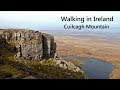
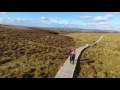
See the credits and list definitions.
Video display
Breifne Area   SW: Iron Mountains Subarea
Place count in area: 14, OSI/LPS Maps: 26, 27, 27A 
Highest place:
Cuilcagh, 666m
Maximum height for area: 666 metres,     Maximum prominence for area: 570 metres,

Note: this list of places includes island features such as summits, but not islands as such.
Rating graphic.
Knockacullion Mountain Cnoc an Chuilinn A name in Irish, also Knockabell an extra name in English Hill of the Holly Leitrim County in Connacht Province, in Arderin List, Black shale, silty shale, ironstone beds Bedrock

Height: 562m OS 1:50k Mapsheet: 26 Grid Reference: H03059 17791
Place visited by 78 members. Recently by: markwallace, abeach, ToughSoles, andalucia, Carolyn105, TipsyDempy, MickM45, conormcbandon, abcd, Grumbler, Hyperstorm, Hillwalker65, srr45, AlanReid, annem
I have visited this place: NO (You need to be a logged-in member to change this.)

Longitude: -7.953986, Latitude: 54.109333 , Easting: 203059, Northing: 317791 Prominence: 57m,  Isolation: 2km
ITM: 603008 817808,   GPS IDs, 6 char: Knckcl, 10 char: Knckcln
Bedrock type: Black shale, silty shale, ironstone beds, (Bencroy Shale Formation)

Previously Knockabell in MV.   Knockacullion is the third highest mountain in the Breifne area and the 388th highest in Ireland. Knockacullion is the second most southerly summit and also the second most westerly in the Breifne area.

Linkback: https://mountainviews.ie/summit/337/
COMMENTS for Knockacullion (Cnoc an Chuilinn) 1 of 1  
Follow this place's comments
MountainViews.ie Picture about mountain Knockacullion (<i>Cnoc an Chuilinn</i>) in area Breifne, Ireland
Picture: From the NE, showing untracked and wearying bog.
 
Flattish scarp with cliffs to east and fatiguing terrain.
Short Summary created by simon3  23 Aug 2020
The most likely access to Knockacullion is from Bencroy or Slieve Anierin. We don't have information on reaching it from the west, Lough Allen side or the East side where there is a substantial cliff.
The summit is fairly flat on all sides except to the east and is covered in more or less unbroken blanket bog. The top has a distinct well established pond.
Please note that approaching from north or south you are walking on trackless moorland which many commentators have noted as sapping energy and taking an unexpected amount of energy. Linkback: https://mountainviews.ie/summit/337/comment/5097/
 
MountainViews.ie Picture about mountain Knockacullion (<i>Cnoc an Chuilinn</i>) in area Breifne, Ireland
Picture: Knockacullion seen from Slieve Anierin
gerrym on Knockacullion, 2006
by gerrym  10 Jun 2006
Knockacullion, in keeping with most of the hills in the area, has a dull summit area but more than makes up for this with the impressive cliffs stretching along the SE of the hill. Walking along the tops of the cliffs and those of Slieve Anierin is a fantastic experience for over 3 km. I approached the hill from Bencroy (a natural route which shows three hills in thier best light), descending to the col over quite a wet area, past a pool of water and making for a long low ridge with a rocky side lifting it above the ground below. This ridge can be followed to the summit area and then the line of cliffs can be followed towards Slieve Anierin, as contour around the hill Lough Nabellbeg comes into view, nestled perfectly below the start of the cliffs to Slieve Anierin and glistening in the sunlight very invitingly. There are cracking views S & E over the lowlands with numerous loughs. There is a slight drop down to the col before the ascent of Slieve Anierin. On the return from S Anierin I dropped down steeply at this col to the base of the cliffs and walked along the bottom back towards Bencroy. There has been a very substancial landslide in the not too distant past - can be clearly seen in the photo and has swept all before it for a considerable distance - are some more minor slides further along. A really nice hill which plays it part perfectly in the round of this walk. No one else up top on this trip. Linkback: https://mountainviews.ie/summit/337/comment/2392/
Your Score: Very useful <<  >>Average
 
MountainViews.ie Picture about mountain Knockacullion (<i>Cnoc an Chuilinn</i>) in area Breifne, Ireland
Picture: Loch Nabellbeg nestling snugly beneath Knockacullion
 
eflanaga on Knockacullion, 2006
by eflanaga  5 Jun 2006
Climbed February 20th 06. Accessed from Slieve Aneirin (first part of walk). From summit of Slieve Aneirin I took a bearing of 48 degrees NE to take me safely onto the col (H028169 starA) south of Knockacullion. Thankfully, the mist cleared as I approached the col, providing me with a clear view of my target. The col between Aneirin is, once again, quite marshy with fairly long trussock grass and gorse to negotiate making the going tougher than it might first appear (or maybe my early morning start was catching up with me). In any event I reached the relatively flat and featureless summit, (that is featureless apart from it’s locheen), in brilliant sunshine. The early morning mist had all but burned away, lingering only (as it did all day on Cuilcagh to the north-east) but haze hindering long distance views/photography. Nevertheless there are lovely views north over a fertile valley to Slievenakilla and west towards Lough Allen. I was intending to take a break on the summit but due to the lack of suitable ‘dry’ seating and the nearness of Bencroy I decided to postpone the break making do with a Mars bar 'on the hoof' as I descended the northern slope of Knockacullion. (See Bencroy for final part of walk). Linkback: https://mountainviews.ie/summit/337/comment/2193/
Your Score: Very useful <<  >>Average
 
walker_hollick on Knockacullion, 2005
by walker_hollick  30 Jan 2005
See comment on Bencroy on how to get to start. From Bencroy Knockabell is in a roughly
southeasterly direction. Its main distinguishing feature is a small lake at the summit.

The area of moorland from here north to the Bellavally Gap has a wonderfully bleak and remote
feel, even though the terrain can be wet and arduous. Linkback: https://mountainviews.ie/summit/337/comment/1452/
Your Score: Very useful <<  >>Average
 
MountainViews.ie Picture about mountain Knockacullion (<i>Cnoc an Chuilinn</i>) in area Breifne, Ireland
Description of the top.
by Jaak  23 Aug 2020
Climbed from Bencroy. Best route is to get onto the higher edge of Bencroy, via the path that leads to the old quarry (right fork off the main path) and head for the obvious ridge that leads to Knockacullion. By coincidence I followed the same whitish, rushy "path" mentioned by eflanaga, even though I had not read his comments before I climbed. While this is a bit wet and soft in places, it is a much better alternative to the high heather and wet bog that lie in the more direct route, which should be avoided except you are in the mood for hardship. The top is featureless except for a small lake - see photo, with Slieve Anierin in the background. There are great views of all the surrounding hills and you can clearly see well into Sligo on a good day - Knocknarea was visible when I was on top. The highest point is about 30 metres West of the lake. Linkback: https://mountainviews.ie/summit/337/comment/3138/
Your Score: Very useful <<  >>Average
 
MountainViews.ie Picture about mountain Knockacullion (<i>Cnoc an Chuilinn</i>) in area Breifne, Ireland
Picture: Knocknarea viewed from the top.
 
Views towards west and north-west
by simon3  23 Aug 2020
The day we were there it happened that rain was receding north and there were views to the west. The picture shows Knocknarea and Queen Maeve's Tomb at around 290 degrees bearing on the skyline and 47.2km distant. To the left and on the skyline is Slieve Daeane and the rising ground to the right is Killerry Mtn. Also partially visible was Nephin Linkback: https://mountainviews.ie/summit/337/comment/20864/
Your Score: Very useful <<  >>Average
 
(End of comment section for Knockacullion (Cnoc an Chuilinn).)

Main mapping:
Open Street Map
(Main supplier OpenTopoMap)
Height layer: © MapTiler
MapTiler Logo
British summit data courtesy:
Database of British & Irish Hills
(Creative Commons Licence)
MountainViews.ie, a Hill-walking Website for the island of Ireland. 2500 Summiteers, 1480 Contributors, maintainer of lists such as: Arderins, Vandeleur-Lynams, Highest Hundred, County Highpoints etc