Guestuser: Login or enrol?
- Home
- Main Display
- Main Display (Old)
- Find a Walk
- Display INTRODUCTION
- DONATE
- Click below for your
profile & contributions
guestuser- New
- Tracks, Walks
- Challenge
- Community
- Lists & Logs
- Popular Lists:
- County Highpoints
- Range & Area Highpoints
- Local 100
- Highest Hundred
- Vandeleur-Lynams
- Arderins
- Carns
- Best rated
- Irish 900 up
- Irish Island
- Munros
- All Lists
- Shorter Irish
- County Highpoints
- Range & Area Highpoints
- Highest Hundred
- Local 100
- Local 100 (pre2014)
- Local Historical Cultural
- Best rated
- Irish 900 up
- Larger Irish
- Arderins
- Arderin Begs
- Arderins + Arderin Begs
- Vandeleur-Lynams
- Vandeleur-Lynams + Arderins
- Carns
- Binnions
- Highest 50 per Province
- Island Features
- Irish Island
- Coastal Hills
- Irish 600 up
- Irish 500 up
- British
- Munros
- British 600 up
- British 500-600
- British Marilyns
- Comprehensive
- All Irish summits
- All Irish features
- All British summits
- All Britain+ Ireland
- Special
- Analysis List
- Simple Irish Listings
- Simple Irish & British Listings
-
- More
- Motley Views
Welcome to MountainViews
If you want to use the website often please enrol (quick and free) at top right.OverviewFor more map options click on any overview map area or any detail map feature.Detail Map FeaturesShowing 6 items:
Slieve Anierin 585m, Knockacullion 562m,Tracks:2167, 15km 4391, 15km 4357, 15km 1400, 10km Find Suggested Walks
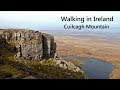
Find hill, mountain, island, coastal feature.Videos
 Recent Contributions
 Get Notifications
So, so simple....
Drumlongfield: Not such an easy climb to summit by hedgerow
Good, easily navigable climb up two Carns
Mullaghanish: Save it for sunset
Knockree: Wicklow Way Easy Access
Very tough and long trek over rough terrain.
Sheep Island: My Left Foot
Way up Cloghnagaune from the SE.
White Hill: Summit of the Wicklow Way
Robber's Pass Hill: 3 candidate high points
Tonlagee via Stoney Top.
Carrickashane Mountain: Now has clear views, but its a short messy walk
Conditions and Info
Use of MountainViews is governed by conditions and a privacy policy.
Read general information about the site.
Opinions in material here are not necessarily endorsed by MountainViews.
Hillwalking is a risk sport. Information in comments, walks, shared GPS tracks or about starting places may not be accurate for example as regards safety or access permission. You are responsible for your safety and your permission to walk.
See the credits and list definitions.Video displayBreifne Area SW: Iron Mountains SubareaPlace count in area: 14, OSI/LPS Maps: 26, 27, 27A
Highest place: Cuilcagh, 666m
Maximum height for area: 666 metres, Maximum prominence for area: 570 metres,
Places in area Breifne:
N: Cuilcagh Mountains:Benaughlin 370mBenbeg 539mCuilcagh 666mMullaleam 424m
NE: Derrylin:Knockninny Hill 191mSlieve Rushen 404m
SW: Iron Mountains:Bencroy 518mKnockacullion 562mSlieve Anierin 585m
W: Benbrack:Bartonny Top 411mBenbrack 502mBenbrack NE Top 496mBenbrack West Top 463mThe Playbank 542m
Note: this list of places includes island features such as summits, but not islands as such.
(Ir. Sliabh an Iarainn [OSI], 'mountain of the iron') Leitrim County in Connacht Province, in Arderin List, Sandstone, sandy shale & shale Bedrock
Height: 585m OS 1:50k Mapsheet: 26 Grid Reference: H01878 15930
Place visited by 133 members. Recently by: ryanguinness10, Helgabee, Tuigamala, bowler, marymac, markwallace, eimirmaguire, ToughSoles, andalucia, TipsyDempy, Carolyn105, MickM45, conormcbandon, Joshua3, srr45I have visited this place: NO (You need to be a logged-in member to change this.)Longitude: -7.972069, Latitude: 54.092539 , Easting: 201878, Northing: 315930 Prominence: 245m, Isolation: 2.2km, Has trig pillar
ITM: 601827 815938 , GPS IDs, 6 char: SlvAnr, 10 char: SlvAnrn
Bedrock type: Sandstone, sandy shale & shale, (Bencroy Sandstone Member)
This area is area is known for its mineral resources, particularly the coal which was mined in the vicinity of Arigna. There were also iron workings beside Lough Allen at the base of this mountain, still operating in the late 19th century. A local legend holds that they were worked by Goibnenn, the smith-god of the Tuatha Dé Danann. Slieve Anierin is the second highest mountain in the Breifne area and the 329th highest in Ireland. Slieve Anierin is the most southerly summit and also the most westerly in the Breifne area. Slieve Anierin is the third highest point in county Leitrim.
Linkback: https://mountainviews.ie/summit/305/COMMENTS for Slieve Anierin (Sliabh an Iarainn) 1 2 3 Next page >>  Follow this place's comments
 Height layer: © MapTiler

MountainViews.ie, a Hill-walking Website for the island of Ireland. 2500 Summiteers, 1480 Contributors, maintainer of lists such as: Arderins, Vandeleur-Lynams, Highest Hundred, County Highpoints etc

 Colin Murphy
 Fergalh
 Colin Murphy
 Leatra
 Collaborative entry
 Colin Murphy
 Pepe
Pepe
 hibby
hibby
 simon3
 Collaborative entry
 Visit our Facebook page.