This website uses cookies, which are small text files that the website puts on your device to facilitate operation. Cookies help us provide a better service to you. They are used to track general user traffic information and to help the website function properly.
Starting Places (16) in area South East Midlands: Ballinvarry West, Clodiagh Church, Coolnahau, Coppanagh Wood South, Freney's Well, Glynn, Gorlough Wood, Hill of Allen, Inistioge, Killamery Wood East, Kylebeg Wood, Lingaun River, Mount Alto Wood, Mullenbeg Wood South, Newtown Upper School, Slievenamon Walk Head
Summits & other features in area South East Midlands: E: Barrow: Clogrennan Hill 336m, Newtown Hill 208m N Cen: Timahoe Hills: Ballaghmore Hill 268m, Cullenagh Mountain 317m, Fossy Mountain 332m, Hewson Hill 261m N: Croghan: Croghan Hill 234m N: Newbridge Hills: Dunmurry Hill 233m, Hill of Allen 219m S: Mullinavat: Coolnahau Hill 265m, Corbally Hill 285m, Mount Alto 276m, Tory Hill 292m S: Slievenamon: Knockahunna 502.8m, Sheegouna 553.5m, Slievenamon 720.2m, Slievenamon North-West Top 564m S: Windgap: Carricktriss Gorse 314m, Carrigadoon Hill 296.9m, Faranaree Hill 283m SE: Brandon Hill: Brandon Hill 515m, Coppanagh 365m, Croghan 365m W Cen: Durrow: Ballynalacken Hill 314m, Caponellan Hill 253m, Knockmannon Hill 315m W Cen: Slieveardagh: Clomantagh Hill 349m, Knocknamuck 340m, Monabrogue 284m W: Horse & Jockey: Kill Hill 241m, Killough 235m
Note: this list of places may include island features such as summits, but not
islands as such.
Slievenamon North-West Top, 564.0mMountain Sliabh na mBan barr thiar thuaidh A name in Irish,
Place Rating ..
, Tipperary County in Munster province, in no lists, Slievenamon North-West Top is the second highest mountain in the South East Midlands area and the 383rd highest in Ireland.
Grid Reference S28831 31526,
OS 1:50k mapsheet 67 Place visited by: 80members, recently by: childminder05, DeirdreM, Moirabourke, Cunn2000, westside, dregish, conorjob, Liamob, jollyrog, pinchy, Timmy.Mullen, deirdre007, helenw7, garrettd, jackos
I visited this place: NO (You need to be a logged-in member for this.)
Short or GPS IDs, 6 char: SlvnNr, 10 char: SlvnmnNrth Linkback: https://mountainviews.ie/summit/1427/
Gallery for Slievenamon North-West Top (Sliabh na mBan barr thiar thuaidh) and surrounds
Summary
for Slievenamon North-West Top (Sliabh na mBan barr thiar thuaidh):
Almost a summit.
Summary created by jackill
2015-07-08 05:30:51
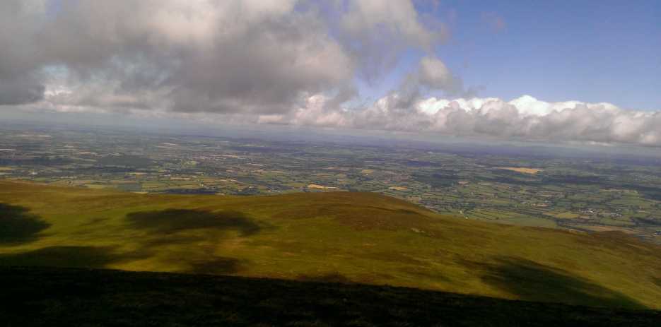
Picture: As seen from the summit of Slievenamon
Start from the roadside north of Kilcash at A (S317 288) just in front of a farmyard.Park on the roadside, which is narrow, as best you can room for 7-8 cars . Be careful not to obstruct the farm entrances. A rough signposted track leads off to the west, up to the summit of Slievenamon. The route up the mountain is on a substantial track so you can't really go wrong, just follow it uphill with the forestry on your right.
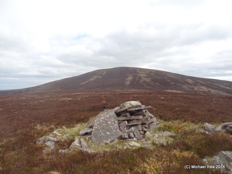
At the top of this track is a concrete building with bits of decaying aerial near it. Go past this uphill to the north on a gradual slope to the summit area of Slievenamon. Head downhill north on steep ground before a gradual rise to the summit of Slievenamon North-West Top which is marked by a cairn of flat stones and what appears to be an excavated cist grave. At this point is well worth continuing to Knockahunna and Slievenamon North-East Top making a good circuit in an isolated mountain area.
Add a Place Comment for Slievenamon North-West Top, Sliabh na mBan barr thiar thuaidh (1427) in Area: South East Midlands, S: Slievenamon, County: Tipperary, S: Slievenamon
Member Comments for
Slievenamon North-West Top (Sliabh na mBan barr thiar thuaidh)
Use of MountainViews is governed by conditions and a privacy policy.
Read general information about the site. Opinions in material here are not necessarily endorsed by MountainViews.
Hillwalking is a risk sport. Information in comments, walks, shared GPS tracks or about starting places may
not be accurate for example as regards safety or access permission. You are responsible for your safety and your permission to walk.
See the credits and list definitions.


 Add a Place Comment for Slievenamon North-West Top, Sliabh na mBan barr thiar thuaidh


 Our Facebook page.